Enable Location

We need your location to show you interesting places around you

Discover nearby places

Find interesting locations and hidden gems around you

Precise directions

Get accurate directions and distances to places

Your location is never shared with other users. It's only used when you tap the location button.

Wekiva River

Log in to your account

Start exploring — it's free

Trusted by 68,293 travelers worldwide

Continue with Google
Continue with Apple
or

We will send you a code to connect

By continuing, you accept our Terms and Conditions and our Privacy Policy

Check your inbox

We've sent a pincode in your inbox. Please enter the code below.

Wekiva River
Discussion Reviews 1 Photos
9.3k Popularity

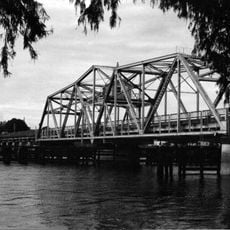
Wekiva River, Protected river north of Orlando, Florida

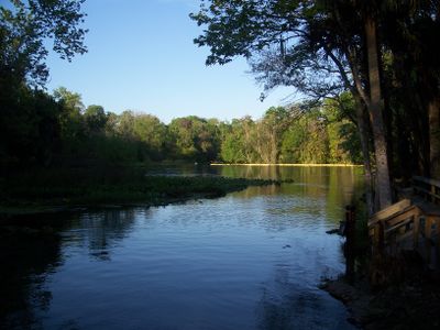
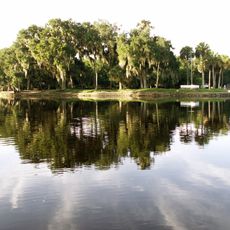
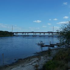
The Wekiva River is a spring-fed waterway in central Florida, flowing north of Orlando through swamp forests and past sandy banks before joining the St. Johns River. The water stays cool and clear year-round, fed by underground springs that maintain a steady flow even in dry seasons.

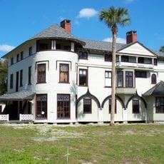
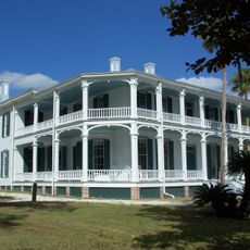
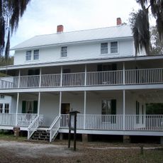
The name Wekiva comes from the Timucua language, spoken by indigenous people who lived in this part of Florida before European contact. The area was later used for logging and citrus farming in the 1800s, and it shifted toward conservation in the 20th century as development spread around Orlando.

The river draws people who come by canoe or kayak to watch turtles sunning on logs and birds wading along the banks. The spring-fed water stays clear enough to see the sandy bottom, which adds to the experience of moving through a natural corridor.

Canoe and kayak rentals are available near the main access points, making it easy to get on the water without your own gear. The heat and insects can be intense, especially in summer, so wear light long sleeves and bring plenty of drinking water.

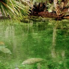
The springs that feed the river keep the water at a nearly constant 68 degrees Fahrenheit (20 degrees Celsius) throughout the year, which is noticeably cooler than the surrounding air in summer. This steady temperature draws manatees into the river during winter, when they seek warmer spring water to escape the colder ocean.

The community of curious travelers

AroundUs brings together thousands of curated places, local tips, and hidden gems, enriched daily by 60,000 contributors worldwide.

Start exploring
Location
GPS coordinates
28.87760,-81.36700
Latest update
March 3, 2026 10:13
Around this place
Blue Spring State Park
United States of America

Blue Spring State Park

8.3 km
Central Florida Zoo and Botanical Gardens
United States of America

Central Florida Zoo and Botanical Gardens

7.4 km
Spec Martin Stadium
United States of America

Spec Martin Stadium

17.2 km
Hontoon Island State Park
United States of America

Hontoon Island State Park

9.9 km
John B. Stetson House
United States of America

John B. Stetson House

16.8 km
DeBary Hall
United States of America

DeBary Hall

6.8 km
Louis P. Thursby House
United States of America

Louis P. Thursby House

7.8 km
St. Johns River Veterans Memorial Bridge
United States of America

St. Johns River Veterans Memorial Bridge

6.6 km
Wayne Densch Performing Arts Center
United States of America

Wayne Densch Performing Arts Center

12.3 km
Southern Cassadaga Spiritualist Camp Historic District
United States of America

Southern Cassadaga Spiritualist Camp Historic District

15.9 km
Francis P. Whitehair Bridge
United States of America

Francis P. Whitehair Bridge

14.7 km
Lake Monroe Bridge
United States of America

Lake Monroe Bridge

6.2 km
Sanford Grammar School
United States of America

Sanford Grammar School

12.3 km
St. James A. M. E. Church
United States of America

St. James A. M. E. Church

12.9 km
Orange City Historic District
United States of America

Orange City Historic District

10.3 km
African American Museum of the Arts
United States of America

African American Museum of the Arts

17.3 km
Ann Stevens House
United States of America

Ann Stevens House

16.6 km
Stockton-Lindquist House
United States of America

Stockton-Lindquist House

16.5 km
Alexander Haynes House
United States of America

Alexander Haynes House

17.6 km
Orange City Town Hall
United States of America

Orange City Town Hall

10.4 km
Family Fun
United States of America

Family Fun

10 km
Lake Mary Chamber of Commerce Building
United States of America

Lake Mary Chamber of Commerce Building

14 km
Old Fernald-Laughton Memorial Hospital
United States of America

Old Fernald-Laughton Memorial Hospital

12.3 km
Hopper Academy
United States of America

Hopper Academy

13.2 km
Kilkoff House
United States of America

Kilkoff House

17.3 km
Seth French House
United States of America

Seth French House

10.8 km
Sanford Residential Historic District
United States of America

Sanford Residential Historic District

12.5 km
Seminole County Home
United States of America

Seminole County Home

16.4 km
Show the full map
Reviews
Share your experience

No review yet

Discussions
Start a discussion...

No discussion yet

« Wekiva River - Protected river north of Orlando, Florida » is provided by Around Us (aroundus.com). Images and texts are derived from Wikimedia project under a Creative Commons license. You are allowed to copy, distribute, and modify copies of this page, under the conditions set by the license, as long as this note is clearly visible.

Discover hidden gems everywhere you go!

From secret cafés to breathtaking viewpoints, skip the crowded tourist spots and find places that match your style. Our app makes it easy with voice search, smart filtering, route optimization, and insider tips from travelers worldwide. Download now for the complete mobile experience.

Around Us App Screenshot

A unique approach to discovering new places

Le Figaro

All the places worth exploring

France Info

A tailor-made excursion in just a few clicks

20 Minutes

Around Us
Travel Guide & Maps
Download

Send to your phone

QR Code
1

Open the camera app on your mobile.

2

Point at the QR code with your camera. A notification will appear.

3

Tap the notification to open the link.