·

Enable Location

We need your location to show you interesting places around you

Discover nearby places

Find interesting locations and hidden gems around you

Precise directions

Get accurate directions and distances to places

Your location is never shared with other users. It's only used when you tap the location button.

Floyd County

Log in to your account

Start exploring — it's free

Trusted by 62,661 travelers worldwide

Continue with Google
Continue with Apple
or

We will send you a code to connect

By continuing, you accept our Terms and Conditions and our Privacy Policy

Check your inbox

We've sent a pincode in your inbox. Please enter the code below.

Floyd County, Administrative division in Northwest Georgia, United States.

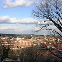
Floyd County is a county in Northwest Georgia that encompasses rivers, lakes, and urban areas centered on Rome. The landscape combines rural terrain with developed communities that together form this administrative region.

The county was established in 1832 by the Georgia General Assembly and named after United States Congressman John Floyd. This founding marked an important step in the region's administrative development.

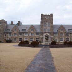
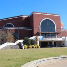
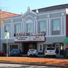
Three colleges shape the educational and community life here, drawing students from across the region and hosting cultural events throughout the year. These institutions have become central gathering places where residents engage in learning and local activities.

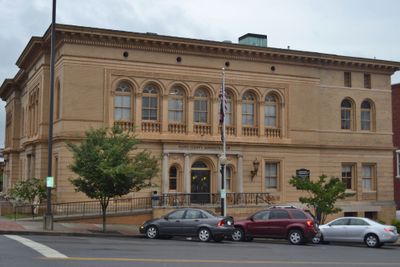
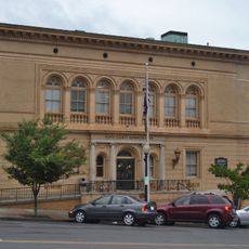
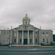
The Floyd County Administration Building in Rome serves as the main center for government services including property management, elections, and public safety. This is where residents and visitors can conduct official business and access local government information.

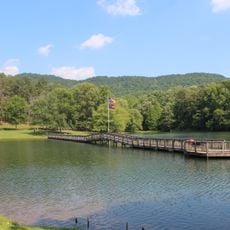
The county contains three major river systems: the Oostanaula River, Etowah River, and Upper Coosa River that create a diverse water network across the landscape. These waterways shape the terrain and offer different routes through the region.

The community of curious travelers

AroundUs brings together thousands of curated places, local tips, and hidden gems, enriched daily by 60,000 contributors worldwide.

Start exploring
Location
Inception
December 3, 1832
Capital city
Rome
Shares border with
Walker County, Gordon County, Bartow County, Polk County, Cherokee County, Chattooga County
GPS coordinates
34.26000,-85.22000
Latest update
December 20, 2025 00:18
Around this place
Berry College
United States of America

Berry College

5.3 km
James H. Floyd State Park
United States of America

James H. Floyd State Park

22.7 km
United States of America

Paradise Garden

29.5 km
Oak Hill & The Martha Berry Museum
United States of America

Oak Hill & The Martha Berry Museum

4.1 km
King Archaeological Site
United States of America

King Archaeological Site

18 km
Chieftains Museum
United States of America

Chieftains Museum

5 km
Marshall Forest
United States of America

Marshall Forest

2.5 km
Clock Tower
United States of America

Clock Tower

4.7 km
United States of America

Lake Marvin

36.4 km
United States of America

William S. Simmons Plantation

21.1 km
Forum Civic Center
United States of America

Forum Civic Center

4.4 km
United States of America

Jackson Hill

5.3 km
Lumpkin Hill
United States of America

Lumpkin Hill

4.9 km
DeSoto Theatre
United States of America

DeSoto Theatre

4.7 km
United States Post Office and Courthouse
United States of America

United States Post Office and Courthouse

4.6 km
Old Shorter Hill
United States of America

Old Shorter Hill

4.8 km
Blossom Hill
United States of America

Blossom Hill

5.5 km
United States of America

Lake Conasauga

3.6 km
Sardis Presbyterian Church and Cemetery
United States of America

Sardis Presbyterian Church and Cemetery

14.6 km
Between the Rivers Historic District
United States of America

Between the Rivers Historic District

4.6 km
United States of America

DeSoto Lake

5.2 km
Chattooga County Courthouse
United States of America

Chattooga County Courthouse

27.2 km
Wesley O. Conner House
United States of America

Wesley O. Conner House

20.5 km
United States of America

Penn Place

29.6 km
United States of America

East Rome Historic District

5.2 km
Summerville Commercial Historic District
United States of America

Summerville Commercial Historic District

27.2 km
United States of America

South Broad Street Historic District

4.1 km
John M. Carroll House
United States of America

John M. Carroll House

20.7 km
Show the full map
Administrative divisions
« Floyd County - Administrative division in Northwest Georgia, United States » is provided by Around Us (aroundus.com). Images and texts are derived from Wikimedia project under a Creative Commons license. You are allowed to copy, distribute, and modify copies of this page, under the conditions set by the license, as long as this note is clearly visible.

Discover hidden gems everywhere you go!

From secret cafés to breathtaking viewpoints, skip the crowded tourist spots and find places that match your style. Our app makes it easy with voice search, smart filtering, route optimization, and insider tips from travelers worldwide. Download now for the complete mobile experience.

Around Us App Screenshot

A unique approach to discovering new places

Le Figaro

All the places worth exploring

France Info

A tailor-made excursion in just a few clicks

20 Minutes

Around Us
Travel Guide & Maps
Download

Send to your phone

QR Code
1

Open the camera app on your mobile.

2

Point at the QR code with your camera. A notification will appear.

3

Tap the notification to open the link.