Abbeville County

Log in to your account

AroundUs is a community-driven map of interesting places, built by curious explorers like you. It grows with every review, story, and photo you share.
Connect to save your favorite spots, contribute locations, and create personalized routes.
By continuing, you accept our Terms and Conditions and our Privacy Policy
Add to collection
Map
Suggest a change
Share

Abbeville County, Administrative division in South Carolina, United States.

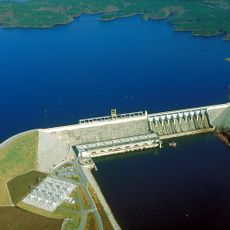
Abbeville County is an administrative division in South Carolina featuring rolling hills, forests, and waterways in the Savannah River basin. The land varies between wooded areas and open spaces across several hundred square miles.

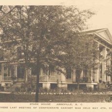
The county was established in 1785, created from the Ninety-Six District during early settlement of the region. It became strategically significant during the Civil War period as conflict shaped its communities.

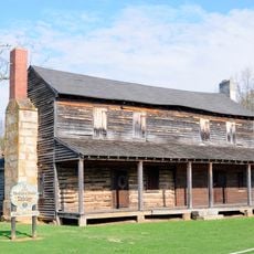
The area reflects Scottish, Irish, and French Huguenot roots in its local customs and community celebrations. These heritage influences shape the traditions and gatherings people participate in today.

Visitors can explore the hilly and forested landscape along various roads, though infrastructure and services vary across different areas. A personal vehicle is helpful for traveling between locations and accessing the countryside.

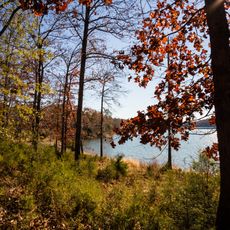
The area contains portions of Sumter National Forest, a vast woodland where visitors can hike and explore trails through undeveloped terrain. Calhoun Falls State Park sits within this forest setting and features cascading waterfalls along scenic water routes.

Location: South Carolina

Inception: March 12, 1785

Capital city: Abbeville

Shares border with: Greenville County, Anderson County, Laurens County, Greenwood County, McCormick County, Elbert County

Website: http://abbevillecountysc.com

GPS coordinates: 34.23000,-82.45000

Latest update: December 7, 2025 10:08

Photos
Around this place
Show the full map
Richard B. Russell Lake
United States of America

Richard B. Russell Lake

22.6 km
Richard B. Russell Dam
United States of America

Richard B. Russell Dam

26.4 km
Burt-Stark Mansion
United States of America

Burt-Stark Mansion

8.2 km
Richard B. Russell State Park
United States of America

Richard B. Russell State Park

28.5 km
Belton Standpipe
United States of America

Belton Standpipe

32.8 km
Abbeville Opera House
United States of America

Abbeville Opera House

8.8 km
Cedar Springs Historic District
United States of America

Cedar Springs Historic District

21.5 km
Lander College Old Main Building
United States of America

Lander College Old Main Building

26.5 km
Abbeville Historic District
United States of America

Abbeville Historic District

8.8 km
Abbeville County Courthouse
United States of America

Abbeville County Courthouse

8.8 km
Obediah Shirley House
United States of America

Obediah Shirley House

24.9 km
Vance-Maxwell House
United States of America

Vance-Maxwell House

27.1 km
Calhoun Mill
United States of America

Calhoun Mill

21.9 km
Calhoun-Gibert House
United States of America

Calhoun-Gibert House

28.8 km
Harbison College President's Home
United States of America

Harbison College President's Home

7.1 km
James C. Self House
United States of America

James C. Self House

25 km
Masonic Female College and Cokesbury Conference School
United States of America

Masonic Female College and Cokesbury Conference School

22 km
Lower Long Cane Associate Reformed Presbyterian Church
United States of America

Lower Long Cane Associate Reformed Presbyterian Church

25.6 km
Chamberlain-Kay House
United States of America

Chamberlain-Kay House

32.9 km
Kennedy Street School
United States of America

Kennedy Street School

34.7 km
Young Place
United States of America

Young Place

12.4 km
Mount Carmel Historic District
United States of America

Mount Carmel Historic District

25.2 km
Donalds Grange No. 497
United States of America

Donalds Grange No. 497

17.8 km
Erskine College-Due West Historic District
United States of America

Erskine College-Due West Historic District

12.3 km
Belton Area Museum Association
United States of America

Belton Area Museum Association

32.8 km
Greenwood Museum
United States of America

Greenwood Museum

26.9 km
Confederate Monument (Abbeville)
United States of America

Confederate Monument (Abbeville)

8.8 km
Smith-McGee Bridge
United States of America

Smith-McGee Bridge

33.1 km
Show the full map
Reviews

Visited this place? Tap the stars to rate it and share your experience / photos with the community! Try now! You can cancel it anytime.

Administrative divisions
« Abbeville County - Administrative division in South Carolina, United States » is provided by Around Us (aroundus.com). Images and texts are derived from Wikimedia project under a Creative Commons license. You are allowed to copy, distribute, and modify copies of this page, under the conditions set by the license, as long as this note is clearly visible.

Discover hidden gems everywhere you go!

From secret cafés to breathtaking viewpoints, skip the crowded tourist spots and find places that match your style. Our app makes it easy with voice search, smart filtering, route optimization, and insider tips from travelers worldwide. Download now for the complete mobile experience.

Around Us App Screenshot

A unique approach to discovering new places

Le Figaro

All the places worth exploring

France Info

A tailor-made excursion in just a few clicks

20 Minutes