·

Enable Location

We need your location to show you interesting places around you

Discover nearby places

Find interesting locations and hidden gems around you

Precise directions

Get accurate directions and distances to places

Your location is never shared with other users. It's only used when you tap the location button.

Fort Sumter Range Lights

Log in to your account

Start exploring — it's free

Trusted by 62,634 travelers worldwide

Continue with Google
Continue with Apple
or

We will send you a code to connect

By continuing, you accept our Terms and Conditions and our Privacy Policy

Check your inbox

We've sent a pincode in your inbox. Please enter the code below.

Fort Sumter Range Lights

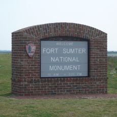
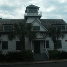
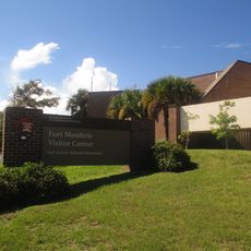
Fort Sumter Range Lights, Range lights system in Charleston Harbor, United States.

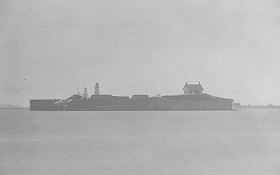
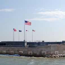
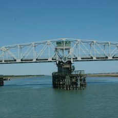
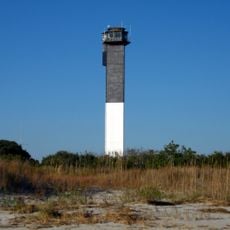
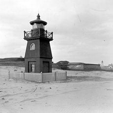
Fort Sumter Range Lights are two separate beacons positioned to guide ships through the main channel of Charleston Harbor. The front beacon stands at Fort Sumter while the rear beacon operated from a church steeple for much of its service.

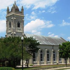
The front light was built at Fort Sumter in 1857 to support navigation in this important harbor. The rear light used the church steeple of St. Philip's for decades before moving to a different location in 1915.

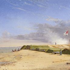
The range lights system shows how ships once navigated Charleston Harbor safely without electronic aids. These beacons were essential to the region's maritime life and connected different parts of the city through their practical function.

Ships align the two lights vertically to ensure safe passage through the main channel. The visibility of these beacons depends on weather conditions and time of day, so experienced sailors combined them with other navigation methods.

The rear light used the church steeple of St. Philip's Church for over a century, combining religious architecture with practical maritime engineering in an unusual way. This blend of sacred and functional spaces was rarely seen in navigation systems.

The community of curious travelers

AroundUs brings together thousands of curated places, local tips, and hidden gems, enriched daily by 60,000 contributors worldwide.

Start exploring
Inception
1855
GPS coordinates
32.75222,-79.87472
Latest update
December 14, 2025 16:42
Around this place
Fort Sumter
United States of America

Fort Sumter

40 m
Fort Moultrie
United States of America

Fort Moultrie

1.8 km
Castle Pinckney
United States of America

Castle Pinckney

4.2 km
Fort Sumter and Fort Moultrie National Historical Park
United States of America

Fort Sumter and Fort Moultrie National Historical Park

1.5 km
Ben Sawyer Bridge
United States of America

Ben Sawyer Bridge

3.8 km
Charleston Light
United States of America

Charleston Light

3 km
Fort Johnson
United States of America

Fort Johnson

2.2 km
Mount Pleasant Historic District
United States of America

Mount Pleasant Historic District

3.8 km
Battery Thomson
United States of America

Battery Thomson

3.2 km
Marshlands Plantation House
United States of America

Marshlands Plantation House

2.5 km
Battery Gadsden
United States of America

Battery Gadsden

3.4 km
U.S. Coast Guard Historic District
United States of America

U.S. Coast Guard Historic District

3.1 km
Old Berkeley County Courthouse
United States of America

Old Berkeley County Courthouse

3.8 km
Battery Jasper
United States of America

Battery Jasper

2 km
Moultrieville Historic District
United States of America

Moultrieville Historic District

1.7 km
Sullivan's Island Range Lights
United States of America

Sullivan's Island Range Lights

2.2 km
Dr. John B. Patrick House
United States of America

Dr. John B. Patrick House

3.1 km
Sullivan's Island Historic District
United States of America

Sullivan's Island Historic District

2.8 km
Osceola's tomb
United States of America

Osceola's tomb

1.8 km
Battery Huger
United States of America

Battery Huger

20 m
Fort Moultrie Visitor Center
United States of America

Fort Moultrie Visitor Center

1.8 km
Flagpole Monument
United States of America

Flagpole Monument

23 m
Garrison Monument
United States of America

Garrison Monument

22 m
Fort Moultrie Quartermaster and Support Facilities Historic District
United States of America

Fort Moultrie Quartermaster and Support Facilities Historic District

2.2 km
Stella Maris Catholic Church
United States of America

Stella Maris Catholic Church

1.8 km
1809 Powder Magazine
United States of America

1809 Powder Magazine

1.8 km
Patapsco Monument
United States of America

Patapsco Monument

1.8 km
Sullivan's Island Beach
United States of America

Sullivan's Island Beach

3.1 km
Show the full map
« Fort Sumter Range Lights - Range lights system in Charleston Harbor, United States » is provided by Around Us (aroundus.com). Images and texts are derived from Wikimedia project under a Creative Commons license. You are allowed to copy, distribute, and modify copies of this page, under the conditions set by the license, as long as this note is clearly visible.

Discover hidden gems everywhere you go!

From secret cafés to breathtaking viewpoints, skip the crowded tourist spots and find places that match your style. Our app makes it easy with voice search, smart filtering, route optimization, and insider tips from travelers worldwide. Download now for the complete mobile experience.

Around Us App Screenshot

A unique approach to discovering new places

Le Figaro

All the places worth exploring

France Info

A tailor-made excursion in just a few clicks

20 Minutes

Around Us
Travel Guide & Maps
Download

Send to your phone

QR Code
1

Open the camera app on your mobile.

2

Point at the QR code with your camera. A notification will appear.

3

Tap the notification to open the link.