Enable Location

We need your location to show you interesting places around you

Discover nearby places

Find interesting locations and hidden gems around you

Precise directions

Get accurate directions and distances to places

Your location is never shared with other users. It's only used when you tap the location button.

Buena Vista Park

Log in to your account

Start exploring — it's free

Trusted by 61,423 travelers worldwide

Continue with Google
Continue with Apple
or

We will send you a code to connect

By continuing, you accept our Terms and Conditions and our Privacy Policy

Check your inbox

We've sent a pincode in your inbox. Please enter the code below.

Buena Vista Park

Buena Vista Park, Public park with oak groves in Haight district, San Francisco, United States

Description

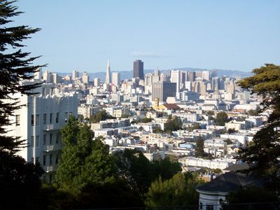
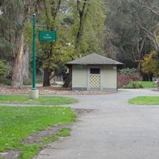
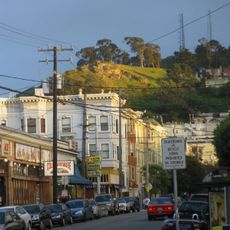
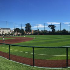
Buena Vista Park is a hilltop green space of about 37 acres in the Haight district, crisscrossed by winding paths through dense forests of oak, cypress, eucalyptus, and redwood trees. The summit offers views across the city, and the park includes tennis courts, restrooms, and water fountains throughout.

History

The park was established in 1867 as San Francisco's first public park on natural hilltop terrain. Over the decades, the land was developed with tennis courts, walking paths, and landscaping to create a recreational space for the growing city.

Culture

The park connects different neighborhoods and carries traces of the city's past through repurposed cemetery headstones placed in its gutters from 1914, when the city relocated its burial grounds. These stones tell the story of a significant urban transformation.

Practical

The park is accessible from multiple entry points, with the main stairs beginning at Haight Street where most visitors enter. The trails are well-maintained throughout, but climbing to the summit requires effort due to the hilly terrain.

Did you know?

The northern slopes preserve one of San Francisco's last remaining groves of coast live oak trees, where native plants and wildlife find shelter in a rare patch of original landscape. This forest remnant is a precious piece of the city's natural heritage.

Location
GPS coordinates
37.76830,-122.44100
Latest update
December 7, 2025 20:47

AroundUs brings together thousands of curated places, local tips, and hidden gems, enriched daily by 60,000 contributors worldwide. Discover all places nearby (San Francisco).

Around this place
Painted Ladies
United States of America

Painted Ladies

1.1 km
San Francisco Mint
United States of America

San Francisco Mint

1.2 km
William Westerfeld House
United States of America

William Westerfeld House

1.1 km
GLBT Historical Society
United States of America

GLBT Historical Society

964 m
Panhandle
United States of America

Panhandle

893 m
War Memorial Gymnasium
United States of America

War Memorial Gymnasium

1.2 km
Randall Museum
United States of America

Randall Museum

492 m
Alfred E. Clarke Mansion
United States of America

Alfred E. Clarke Mansion

972 m
Twin Peaks Tavern
United States of America

Twin Peaks Tavern

788 m
Alvord Lake Bridge
United States of America

Alvord Lake Bridge

1.2 km
Tank Hill
United States of America

Tank Hill

1.1 km
St. Joseph's Hospital
United States of America

St. Joseph's Hospital

228 m
Dante Benedetti Diamond at Max Ulrich Field
United States of America

Dante Benedetti Diamond at Max Ulrich Field

1.1 km
Abner Phelps House
United States of America

Abner Phelps House

562 m
Cafe Du Nord
United States of America

Cafe Du Nord

984 m
United States of America

Third Baptist Church

1.3 km
William McKinley Memorial (San Francisco)
United States of America

William McKinley Memorial (San Francisco)

536 m
California Volunteers
United States of America

California Volunteers

1.3 km
Mish House
United States of America

Mish House

564 m
First United Lutheran Church
United States of America

First United Lutheran Church

1.2 km
Theodore Green Apothecary
United States of America

Theodore Green Apothecary

732 m
Mini Bar SF
United States of America

Mini Bar SF

1 km
Cafe Flore
United States of America

Cafe Flore

794 m
Eureka Valley - Harvey Milk Memorial Branch Library
United States of America

Eureka Valley - Harvey Milk Memorial Branch Library

935 m
Southern Pacific Company Hospital Historic District
United States of America

Southern Pacific Company Hospital Historic District

658 m
Seward Street Slides
United States of America

Seward Street Slides

1.2 km
Castro Street Theatre
United States of America

Castro Street Theatre

827 m
Vulcan Stairs
United States of America

Vulcan Stairs

536 m
Show the full map
« Buena Vista Park - Public park with oak groves in Haight district, San Francisco, United States » is provided by Around Us (aroundus.com). Images and texts are derived from Wikimedia project under a Creative Commons license. You are allowed to copy, distribute, and modify copies of this page, under the conditions set by the license, as long as this note is clearly visible.

Discover hidden gems everywhere you go!

From secret cafés to breathtaking viewpoints, skip the crowded tourist spots and find places that match your style. Our app makes it easy with voice search, smart filtering, route optimization, and insider tips from travelers worldwide. Download now for the complete mobile experience.

Around Us App Screenshot

A unique approach to discovering new places

Le Figaro

All the places worth exploring

France Info

A tailor-made excursion in just a few clicks

20 Minutes

Around Us
Travel Guide & Maps
Download

Send to your phone

QR Code
1

Open the camera app on your mobile.

2

Point at the QR code with your camera. A notification will appear.

3

Tap the notification to open the link.