Panhandle

Log in to your account

AroundUs is a community-driven map of interesting places, built by curious explorers like you. It grows with every review, story, and photo you share.
Connect to save your favorite spots, contribute locations, and create personalized routes.
Continue with Google
Continue with Apple
Continue with X
Continue with Facebook
Continue with email
By continuing, you accept our Terms and Conditions and our Privacy Policy
Create an account
Add to collection
Map
Suggest a change
Share

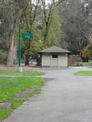
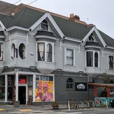
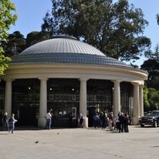
Panhandle, Municipal park between Haight-Ashbury and Western Addition, San Francisco, US.

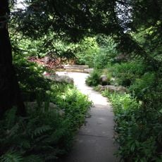
The Panhandle is an elongated city park between the Haight-Ashbury and Western Addition neighborhoods, stretching approximately three-quarters of a mile. It features parallel paved paths, basketball courts, and an outdoor fitness area positioned between Fell and Oak Streets.

The park began in 1870 as an experimental site for stabilizing sand dunes through planting barley, beach grass, and lupines. These botanical trials later informed the development of the nearby Golden Gate Park.

The park emerged from community resistance to a freeway project in the 1960s and became a place for bicycle routes and outdoor gathering instead. This outcome shaped the neighborhood's character and reflects the area's values to this day.

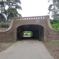
The park is open daily from 6 AM to 10 PM and features public restrooms and drinking fountains throughout the grounds. The well-paved paths are easy to navigate and provide straightforward access to all areas of the park.

Many of the trees here rank among San Francisco's oldest specimens and were originally planted as part of experiments to green barren sand areas. Visitors often overlook that they are walking through living evidence of over 150 years of urban gardening history.

Location: San Francisco

Inception: 1870

GPS coordinates: 37.77200,-122.45000

Latest update: December 7, 2025 20:47

Photos
Around this place
William Westerfeld House
United States of America

William Westerfeld House

1.3 km
Conservatory of Flowers
United States of America

Conservatory of Flowers

880 m
Buena Vista Park
United States of America

Buena Vista Park

893 m
Lone Mountain
United States of America

Lone Mountain

808 m
San Francisco Columbarium
United States of America

San Francisco Columbarium

1.1 km
War Memorial Gymnasium
United States of America

War Memorial Gymnasium

553 m
Randall Museum
United States of America

Randall Museum

1.3 km
AIDS Memorial Grove
United States of America

AIDS Memorial Grove

1.1 km
Alvord Lake Bridge
United States of America

Alvord Lake Bridge

552 m
Negoesco Stadium
United States of America

Negoesco Stadium

612 m
Tank Hill
United States of America

Tank Hill

1.4 km
St. Joseph's Hospital
United States of America

St. Joseph's Hospital

1.1 km
Dante Benedetti Diamond at Max Ulrich Field
United States of America

Dante Benedetti Diamond at Max Ulrich Field

550 m
Abner Phelps House
United States of America

Abner Phelps House

1.1 km
Yugantar Ashram
United States of America

Yugantar Ashram

1.3 km
Fromm Institute for Lifelong Learning
United States of America

Fromm Institute for Lifelong Learning

842 m
William McKinley Memorial (San Francisco)
United States of America

William McKinley Memorial (San Francisco)

759 m
Mish House
United States of America

Mish House

1 km
First United Lutheran Church
United States of America

First United Lutheran Church

963 m
Theodore Green Apothecary
United States of America

Theodore Green Apothecary

1.1 km
Garfield Monument (San Francisco)
United States of America

Garfield Monument (San Francisco)

777 m
Statue of Robert Burns
United States of America

Statue of Robert Burns

1.4 km
General Pershing
United States of America

General Pershing

1.4 km
Mini Bar SF
United States of America

Mini Bar SF

1.2 km
Southern Pacific Company Hospital Historic District
United States of America

Southern Pacific Company Hospital Historic District

749 m
Bridge Theatre
United States of America

Bridge Theatre

1.1 km
Vulcan Stairs
United States of America

Vulcan Stairs

1.2 km
Golden Gate Park Carousel
United States of America

Golden Gate Park Carousel

845 m
Show the full map
Reviews

Visited this place? Tap the stars to rate it and share your experience / photos with the community! Try now! You can cancel it anytime.

« Panhandle - Municipal park between Haight-Ashbury and Western Addition, San Francisco, US » is provided by Around Us (aroundus.com). Images and texts are derived from Wikimedia project under a Creative Commons license. You are allowed to copy, distribute, and modify copies of this page, under the conditions set by the license, as long as this note is clearly visible.

Discover hidden gems everywhere you go!

From secret cafés to breathtaking viewpoints, skip the crowded tourist spots and find places that match your style. Our app makes it easy with voice search, smart filtering, route optimization, and insider tips from travelers worldwide. Download now for the complete mobile experience.

Around Us App Screenshot

A unique approach to discovering new places

Le Figaro

All the places worth exploring

France Info

A tailor-made excursion in just a few clicks

20 Minutes