Chest opened
+${chestReward.xp} XP
Explorer
NOUVEAU ×${chestReward.collectible.quantity}
tapez pour fermer
Chest locked

Open chests in the app

Around Us is built for your phone — chests unlock when you walk, explore and capture nearby places.

Enable Location

We need your location to show you interesting places around you

Discover nearby places

Find interesting locations and hidden gems around you

Precise directions

Get accurate directions and distances to places

Your location is never shared with other users. It's only used when you tap the location button.

Treasure Island

Log in to your account

Start exploring — it's free

Trusted by 72,884 travelers worldwide

Continue with Google
Continue with Apple
or

We will send you a code to connect

By continuing, you accept our Terms and Conditions and our Privacy Policy

Check your inbox

We've sent a pincode in your inbox. Please enter the code below.

Discussion Reviews 1 Photos
12.3k Popularity

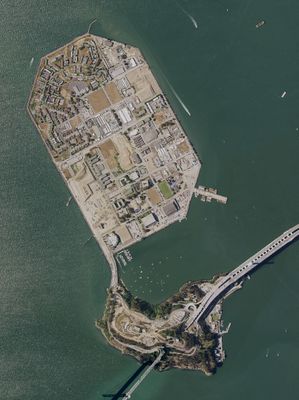
Treasure Island, Artificial island and neighborhood in San Francisco Bay, United States.

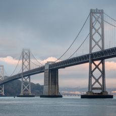
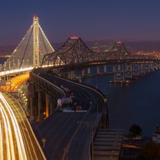
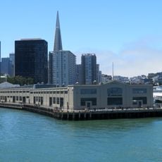
Treasure Island is an engineered landmass in San Francisco Bay situated between San Francisco and Oakland. The 393-acre area provides open views of the San Francisco skyline and the Bay Bridge.

The island was engineered for the 1939 Golden Gate International Exposition to showcase innovations and technological advances from multiple nations. The U.S. Navy then took control and operated it as a significant military training and processing facility until 1997.

The name comes from Robert Louis Stevenson's novel of the same title, and this literary connection shapes how the place is remembered. Residents and visitors often reference the story when discussing the island's identity.

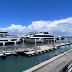
Reach the island via Interstate 80 on the Bay Bridge or by taking the MUNI-108 bus from the Transbay Terminal. Visit on clear days to enjoy the best views across the water.

During World War II, the island functioned as a processing center for Navy personnel and remained off-limits to the public for decades. Only after its decommissioning in the late 1990s did it gradually open to residents and visitors.

The community of curious travelers

AroundUs brings together thousands of curated places, local tips, and hidden gems, enriched daily by 60,000 contributors worldwide.

Start exploring
Location
Inception
1936
GPS coordinates
37.82417,-122.37111
Latest update
March 5, 2026 18:58
Around this place
San Francisco–Oakland Bay Bridge
United States of America

San Francisco–Oakland Bay Bridge

2.3 km
Eastern span replacement of the San Francisco–Oakland Bay Bridge
United States of America

Eastern span replacement of the San Francisco–Oakland Bay Bridge

1.9 km
Embarcadero
United States of America

Embarcadero

3.5 km
Exploratorium
United States of America

Exploratorium

3.5 km
San Francisco Ferry Building
United States of America

San Francisco Ferry Building

3.7 km
SS Jeremiah O'Brien
United States of America

SS Jeremiah O'Brien

3.6 km
Aquarium of the Bay
United States of America

Aquarium of the Bay

3.7 km
Vaillancourt Fountain
United States of America

Vaillancourt Fountain

3.8 km
Levi's Plaza
United States of America

Levi's Plaza

3.6 km
Mohandas K. Gandhi
United States of America

Mohandas K. Gandhi

3.7 km
Malloch Building
United States of America

Malloch Building

3.8 km
Administration Building, Treasure Island
United States of America

Administration Building, Treasure Island

807 m
Piers in San Francisco
United States of America

Piers in San Francisco

3.6 km
Pier 35
United States of America

Pier 35

3.6 km
Pier 23
United States of America

Pier 23

3.5 km
Ferry Station Post Office Building
United States of America

Ferry Station Post Office Building

3.8 km
Yerba Buena Light
United States of America

Yerba Buena Light

2.1 km
Ferryboat Santa Rosa
United States of America

Ferryboat Santa Rosa

3.6 km
Armour & Co. Building
United States of America

Armour & Co. Building

3.6 km
Skygate
United States of America

Skygate

3.7 km
Hall of Transportation, Treasure Island
United States of America

Hall of Transportation, Treasure Island

761 m
Palace of Fine and Decorative Arts, Treasure Island
United States of America

Palace of Fine and Decorative Arts, Treasure Island

791 m
House at 1254–1256 Montgomery Street
United States of America

House at 1254–1256 Montgomery Street

3.8 km
Pier 1
United States of America

Pier 1

3.7 km
Light Cannons
United States of America

Light Cannons

3.8 km
Pier 1
United States of America

Pier 1

3.6 km
Treasure Island Museum
United States of America

Treasure Island Museum

782 m
Basilone Theater
United States of America

Basilone Theater

491 m
Show the full map
Reviews
Share your experience

No review yet

Discussions
Start a discussion...

No discussion yet

« Treasure Island - Artificial island and neighborhood in San Francisco Bay, United States » is provided by Around Us (aroundus.com). Images and texts are derived from Wikimedia project under a Creative Commons license. You are allowed to copy, distribute, and modify copies of this page, under the conditions set by the license, as long as this note is clearly visible.

Discover hidden gems everywhere you go!

From secret cafés to breathtaking viewpoints, skip the crowded tourist spots and find places that match your style. Our app makes it easy with voice search, smart filtering, route optimization, and insider tips from travelers worldwide. Download now for the complete mobile experience.

Around Us App Screenshot

A unique approach to discovering new places

Le Figaro

All the places worth exploring

France Info

A tailor-made excursion in just a few clicks

20 Minutes

Around Us
Travel Guide & Maps
Download

Send to your phone

QR Code
1

Open the camera app on your mobile.

2

Point at the QR code with your camera. A notification will appear.

3

Tap the notification to open the link.