Chest opened
+${chestReward.xp} XP
Explorer
NOUVEAU ×${chestReward.collectible.quantity}
tapez pour fermer
Chest locked

Open chests in the app

Around Us is built for your phone — chests unlock when you walk, explore and capture nearby places.

Enable Location

We need your location to show you interesting places around you

Discover nearby places

Find interesting locations and hidden gems around you

Precise directions

Get accurate directions and distances to places

Your location is never shared with other users. It's only used when you tap the location button.

Suisun Bay

Log in to your account

Start exploring — it's free

Trusted by 72,886 travelers worldwide

Continue with Google
Continue with Apple
or

We will send you a code to connect

By continuing, you accept our Terms and Conditions and our Privacy Policy

Check your inbox

We've sent a pincode in your inbox. Please enter the code below.

Suisun Bay
Discussion Reviews 1 Photos
32.6k Popularity

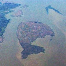
Suisun Bay, Tidal estuary in Northern California, United States

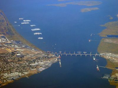
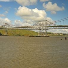
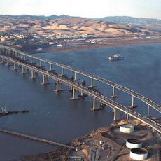
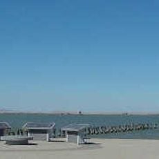
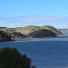
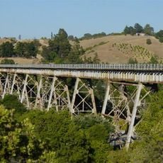
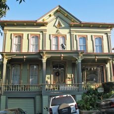
Suisun Bay is a tidal estuary stretching between Contra Costa and Solano County, where freshwater from inland rivers meets ocean tides. The Benicia-Martinez and Antioch bridges cross the water, linking communities along both shores.

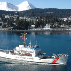
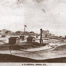
After World War II, the US Navy created a reserve fleet here to store decommissioned military and merchant ships. This collection of inactive vessels shaped how people viewed the bay for many decades.

The name comes from the Suisunes, a Native American people who lived in this region before European arrival. Their heritage shapes how locals understand and relate to the water today.

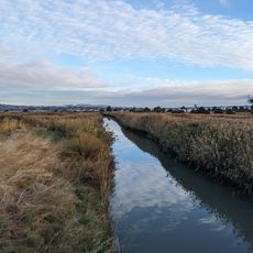
The bay is best viewed from shore areas where small parks and public overlooks offer water views along both sides. Tidal cycles significantly affect water levels and conditions, so planning a visit around tide changes offers the most rewarding experience.

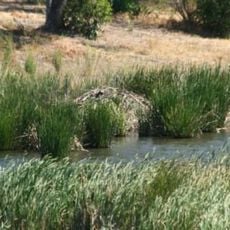
Along the northern edge sits Suisun Marsh, California's largest tidal wetland with extensive habitats where birds and other wildlife thrive. Few visitors realize how important these shallow waters are to the survival of species that depend on this ecosystem.

The community of curious travelers

AroundUs brings together thousands of curated places, local tips, and hidden gems, enriched daily by 60,000 contributors worldwide.

Start exploring
Location
GPS coordinates
38.07000,-122.07000
Latest update
December 20, 2025 00:21
Around this place
Carquinez Bridge
United States of America

Carquinez Bridge

13.7 km
Benicia–Martinez Bridge
United States of America

Benicia–Martinez Bridge

5.7 km
Six Flags Hurricane Harbor Concord
United States of America

Six Flags Hurricane Harbor Concord

11.1 km
John Muir National Historic Site
United States of America

John Muir National Historic Site

10.3 km
Port Chicago Naval Magazine National Memorial
United States of America

Port Chicago Naval Magazine National Memorial

3.8 km
USCGC Storis
United States of America

USCGC Storis

2.1 km
Benicia Arsenal
United States of America

Benicia Arsenal

6 km
Benicia State Recreation Area
United States of America

Benicia State Recreation Area

10.8 km
Don Francisco Galindo House
United States of America

Don Francisco Galindo House

11.2 km
Carquinez Strait Regional Shoreline
United States of America

Carquinez Strait Regional Shoreline

11 km
Muir Trestle
United States of America

Muir Trestle

10.2 km
Carquinez Strait Light
United States of America

Carquinez Strait Light

12.5 km
Don Salvio Pacheco Adobe
United States of America

Don Salvio Pacheco Adobe

10.8 km
Roe Island Light
United States of America

Roe Island Light

3.7 km
Tucker House
United States of America

Tucker House

8.7 km
Ryer Island
United States of America

Ryer Island

5.1 km
Port Costa School
United States of America

Port Costa School

10.8 km
Radke Martinez Regional Shoreline
United States of America

Radke Martinez Regional Shoreline

8.1 km
Vicente Martinez Adobe
United States of America

Vicente Martinez Adobe

10.4 km
Martinez Library
United States of America

Martinez Library

8.1 km
Markham Regional Arboretum
United States of America

Markham Regional Arboretum

13.7 km
Episcopal Church of the Resurrection – Pleasant Hill, CA
United States of America

Episcopal Church of the Resurrection – Pleasant Hill, CA

13.5 km
Old Masonic Hall
United States of America

Old Masonic Hall

7.8 km
Don Fernando Pacheco Adobe
United States of America

Don Fernando Pacheco Adobe

8.6 km
Rainforest Flora
United States of America

Rainforest Flora

13.7 km
Pixieland Amusement Park
United States of America

Pixieland Amusement Park

9.9 km
William T. Hendrick House
United States of America

William T. Hendrick House

9.6 km
Jardín Botánico de Plantas Nativas Forrest Deaner
United States of America

Jardín Botánico de Plantas Nativas Forrest Deaner

7.6 km
Show the full map
Reviews
Share your experience

No review yet

Discussions
Start a discussion...

No discussion yet

« Suisun Bay - Tidal estuary in Northern California, United States » is provided by Around Us (aroundus.com). Images and texts are derived from Wikimedia project under a Creative Commons license. You are allowed to copy, distribute, and modify copies of this page, under the conditions set by the license, as long as this note is clearly visible.

Discover hidden gems everywhere you go!

From secret cafés to breathtaking viewpoints, skip the crowded tourist spots and find places that match your style. Our app makes it easy with voice search, smart filtering, route optimization, and insider tips from travelers worldwide. Download now for the complete mobile experience.

Around Us App Screenshot

A unique approach to discovering new places

Le Figaro

All the places worth exploring

France Info

A tailor-made excursion in just a few clicks

20 Minutes

Around Us
Travel Guide & Maps
Download

Send to your phone

QR Code
1

Open the camera app on your mobile.

2

Point at the QR code with your camera. A notification will appear.

3

Tap the notification to open the link.