Colusa County

Log in to your account

AroundUs is a community-driven map of interesting places, built by curious explorers like you. It grows with every review, story, and photo you share.
Connect to save your favorite spots, contribute locations, and create personalized routes.
Continue with Google
Continue with Apple
Continue with X
Continue with Facebook
Continue with email
By continuing, you accept our Terms and Conditions and our Privacy Policy
Create an account
Add to collection
Map
Suggest a change
Share

Colusa County, Administrative division in northern California, US

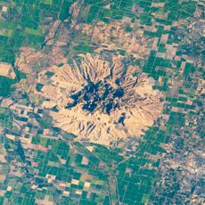
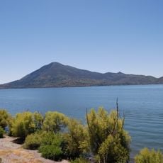
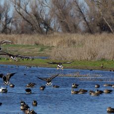
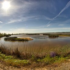
Colusa County is an administrative division in northern California covering about 1,156 square miles in the Sacramento Valley, with the Sacramento River forming its eastern boundary. The area contains several towns and is dominated by rural landscapes used primarily for farming.

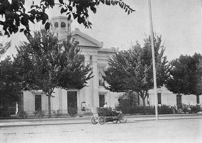
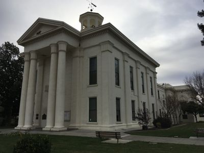
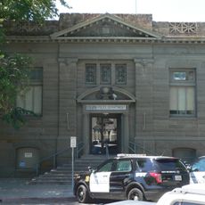
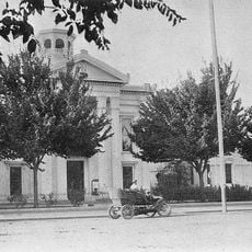
The county was established in 1850 as one of California's original 27 counties and took its name from Rancho Colus, a Mexican land grant given to John Bidwell. This early settlement formed the foundation for its current role as an agricultural region.

The Patwin band of the Wintun people were the original inhabitants here, speaking two dialects of the Southern Wintuan language along the Sacramento River. These ancestral connections continue to shape local identity and place names in the region.

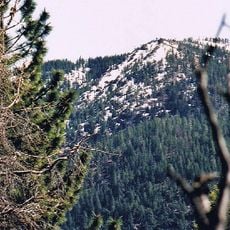
Exploring the region on foot works best during cooler morning or evening hours, as summers can become quite hot. Public transit offers a good option for traveling longer distances between towns.

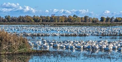
The area is a major rice producer in the United States, using sophisticated irrigation systems to transform the dry valley into productive fields. Rice cultivation landscapes shape the visual character of the region, especially during growing season.

Location: California

Inception: 1850

Capital city: Colusa

Part of: Sacramento Valley

Shares border with: Glenn County, Yolo County, Butte County, Sutter County, Lake County

Website: http://countyofcolusa.org

GPS coordinates: 39.18000,-122.24000

Latest update: December 14, 2025 20:10

Photos
Around this place
Sutter Buttes
United States of America

Sutter Buttes

37.4 km
Mount Konocti
United States of America

Mount Konocti

51 km
Berryessa Snow Mountain National Monument
United States of America

Berryessa Snow Mountain National Monument

28.5 km
Anderson Marsh State Historic Park
United States of America

Anderson Marsh State Historic Park

44.3 km
Delevan National Wildlife Refuge
United States of America

Delevan National Wildlife Refuge

19.4 km
Colusa National Wildlife Refuge
United States of America

Colusa National Wildlife Refuge

17.2 km
Snow Mountain East
United States of America

Snow Mountain East

49.6 km
East Park Dam
United States of America

East Park Dam

31 km
Sacramento Valley Museum
United States of America

Sacramento Valley Museum

7.4 km
Grand Island Shrine
United States of America

Grand Island Shrine

27.2 km
Colusa Carnegie Library
United States of America

Colusa Carnegie Library

20.3 km
Colusa County Courthouse
United States of America

Colusa County Courthouse

20.3 km
United States of America

Cecil Ranch

30.9 km
West Butte Schoolhouse
United States of America

West Butte Schoolhouse

31.2 km
United States of America

Pine Needle Point

35.2 km
United States of America

Sutter Buttes State Park

39 km
United States of America

Indian Beach

45.4 km
United States of America

Windy Point

13.9 km
United States of America

Blodgett Canyon

33.6 km
United States of America

Buckingham Bluffs

49.7 km
United States of America

East Park Reservoir

29.3 km
United States of America

Upper Letts Lake

43.1 km
Sacramento National Wildlife Refuge
United States of America

Sacramento National Wildlife Refuge

26.4 km
United States of America

Arbuckle Golf Course

20.9 km
United States of America

Colusa Golf and Country Course

20.7 km
United States of America

Buckingham Golf & Country Club

48.8 km
United States of America

The Riviera Hills Restaurant, Lounge and Recreation Club

48 km
United States of America

The Falls

35.5 km
Show the full map
Reviews

Visited this place? Tap the stars to rate it and share your experience / photos with the community! Try now! You can cancel it anytime.

Administrative divisions
« Colusa County - Administrative division in northern California, US » is provided by Around Us (aroundus.com). Images and texts are derived from Wikimedia project under a Creative Commons license. You are allowed to copy, distribute, and modify copies of this page, under the conditions set by the license, as long as this note is clearly visible.

Discover hidden gems everywhere you go!

From secret cafés to breathtaking viewpoints, skip the crowded tourist spots and find places that match your style. Our app makes it easy with voice search, smart filtering, route optimization, and insider tips from travelers worldwide. Download now for the complete mobile experience.

Around Us App Screenshot

A unique approach to discovering new places

Le Figaro

All the places worth exploring

France Info

A tailor-made excursion in just a few clicks

20 Minutes