Chest opened
+${chestReward.xp} XP
Explorer
NOUVEAU ×${chestReward.collectible.quantity}
tapez pour fermer
Chest locked

Open chests in the app

Around Us is built for your phone — chests unlock when you walk, explore and capture nearby places.

Enable Location

We need your location to show you interesting places around you

Discover nearby places

Find interesting locations and hidden gems around you

Precise directions

Get accurate directions and distances to places

Your location is never shared with other users. It's only used when you tap the location button.

Log in to your account

Start exploring — it's free

Trusted by 72,886 travelers worldwide

Continue with Google
Continue with Apple
or

We will send you a code to connect

By continuing, you accept our Terms and Conditions and our Privacy Policy

Check your inbox

We've sent a pincode in your inbox. Please enter the code below.

Discussion Reviews Photo
19k Popularity

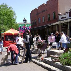
Orangevale, Census-designated place in Sacramento County, United States.

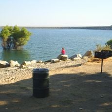
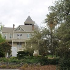
Orangevale is a residential community in Sacramento County, California, situated across rolling terrain. The landscape features gentle hills that offer views toward the Sierra Nevada mountains, creating a setting where neighborhoods blend with natural geography.

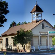
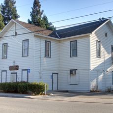
The area began as Orange Vale Colony, established on land from the 1844 Rancho San Juan Mexican land grant. Over time, the settlement evolved from its original agricultural vision into today's residential community.

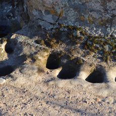
The territory shows connections to ancient Maidu Native American pathways, with numerous oak trees in the local park marking these historic routes. The landscape with its established trees tells a story of people living alongside nature over generations.

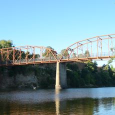
The community connects to Sacramento through Interstate 80 and US Route 50, with regular bus service available. The area consists of spread-out residential neighborhoods, so having a vehicle is helpful for getting around.

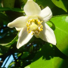
Several residential properties have special zoning that allows residents to keep horses and maintain fruit orchards on their land. This rural permission preserves a connection to the area's agricultural roots while letting people live in a semi-rural setting.

The community of curious travelers

AroundUs brings together thousands of curated places, local tips, and hidden gems, enriched daily by 60,000 contributors worldwide.

Start exploring
Elevation above the sea
73 m
Shares border with
Placer County
GPS coordinates
38.68194,-121.21389
Latest update
December 7, 2025 10:08
Around this place
American River
United States of America

American River

5.8 km
Mather Air Force Base
United States of America

Mather Air Force Base

16 km
Folsom Lake
United States of America

Folsom Lake

8.2 km
U.S. Route 50 in California
United States of America

U.S. Route 50 in California

7.2 km
Folsom Dam
United States of America

Folsom Dam

5.7 km
United States of America

Mormon Island

8.7 km
Aerospace Museum of California
United States of America

Aerospace Museum of California

15.4 km
Folsom Powerhouse State Historic Park
United States of America

Folsom Powerhouse State Historic Park

3.3 km
Folsom Lake State Recreation Area
United States of America

Folsom Lake State Recreation Area

8.9 km
SeaQuest Folsom
United States of America

SeaQuest Folsom

8.8 km
United States of America

Folsom City Zoo Sanctuary

4.2 km
Roseville Golfland Sunsplash
United States of America

Roseville Golfland Sunsplash

9.6 km
Fair Oaks Bridge
United States of America

Fair Oaks Bridge

6.8 km
All-American Speedway
United States of America

All-American Speedway

10.7 km
Scandia Fun Center
United States of America

Scandia Fun Center

13.3 km
United States of America

Carpenter Hill

10.6 km
Brighton School
United States of America

Brighton School

17.1 km
Maidu Museum & Historic Site
United States of America

Maidu Museum & Historic Site

6.9 km
Jensen Botanical Gardens
United States of America

Jensen Botanical Gardens

10.4 km
American River Grange Hall No. 172
United States of America

American River Grange Hall No. 172

10.5 km
Cohn House
United States of America

Cohn House

3.4 km
Faith Episcopal Church
United States of America

Faith Episcopal Church

17.9 km
Rusch Botanical Gardens
United States of America

Rusch Botanical Gardens

8 km
Sacramento Children's Museum
United States of America

Sacramento Children's Museum

12 km
Alden Memorial Bridge
United States of America

Alden Memorial Bridge

3.4 km
Scandia Family Fun Center
United States of America

Scandia Family Fun Center

13.3 km
Historic Opera House
United States of America

Historic Opera House

3.3 km
Rainbow Bridge
United States of America

Rainbow Bridge

3.3 km
Show the full map
Reviews
Share your experience

No review yet

Discussions
Start a discussion...

No discussion yet

« Orangevale - Census-designated place in Sacramento County, United States » is provided by Around Us (aroundus.com). Images and texts are derived from Wikimedia project under a Creative Commons license. You are allowed to copy, distribute, and modify copies of this page, under the conditions set by the license, as long as this note is clearly visible.

Discover hidden gems everywhere you go!

From secret cafés to breathtaking viewpoints, skip the crowded tourist spots and find places that match your style. Our app makes it easy with voice search, smart filtering, route optimization, and insider tips from travelers worldwide. Download now for the complete mobile experience.

Around Us App Screenshot

A unique approach to discovering new places

Le Figaro

All the places worth exploring

France Info

A tailor-made excursion in just a few clicks

20 Minutes

Around Us
Travel Guide & Maps
Download

Send to your phone

QR Code
1

Open the camera app on your mobile.

2

Point at the QR code with your camera. A notification will appear.

3

Tap the notification to open the link.