Chest opened
+${chestReward.xp} XP
Explorer
NOUVEAU ×${chestReward.collectible.quantity}
tapez pour fermer
Chest locked

Open chests in the app

Around Us is built for your phone — chests unlock when you walk, explore and capture nearby places.

Enable Location

We need your location to show you interesting places around you

Discover nearby places

Find interesting locations and hidden gems around you

Precise directions

Get accurate directions and distances to places

Your location is never shared with other users. It's only used when you tap the location button.

Rio Linda

Log in to your account

Start exploring — it's free

Trusted by 72,877 travelers worldwide

Continue with Google
Continue with Apple
or

We will send you a code to connect

By continuing, you accept our Terms and Conditions and our Privacy Policy

Check your inbox

We've sent a pincode in your inbox. Please enter the code below.

Discussion Reviews 1 Photos
18.5k Popularity

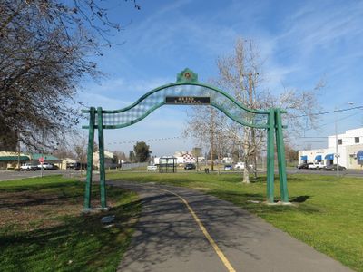
Rio Linda, Census-designated place in Sacramento County, California.

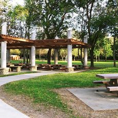
Rio Linda is a community in northern Sacramento County that spans several square miles of relatively flat land. The area features residential neighborhoods and several schools serving the local population.

The area traces its roots to the Rancho Del Paso Mexican land grant of 1844, before settlers developed it in the early 1900s. Systematic settlement began when developers acquired and subdivided land for residential and agricultural use.

The community maintains a seed library at the local branch, established over a century ago, supporting local gardening traditions and knowledge sharing. This reflects residents' commitment to sustainable farming and preserving heirloom plant varieties.

The area is best explored by car, as the community is spread across multiple locations and public transportation may be limited. Visitors should check opening hours before visiting local attractions like the racetrack or seed library.

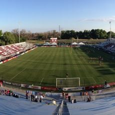
The Roy Hayer Memorial Racetrack in the community was where NASCAR champion Jeff Gordon began his racing career. This local track played a crucial role in launching one of modern motorsport's most successful drivers.

The community of curious travelers

AroundUs brings together thousands of curated places, local tips, and hidden gems, enriched daily by 60,000 contributors worldwide.

Start exploring
Elevation above the sea
17 m
Shares border with
Sutter County, Sacramento
GPS coordinates
38.69028,-121.45389
Latest update
December 7, 2025 19:22
Around this place
Governor's Mansion State Historic Park
United States of America

Governor's Mansion State Historic Park

12.6 km
Railyards Stadium
United States of America

Railyards Stadium

11.6 km
California State Railroad Museum
United States of America

California State Railroad Museum

12.5 km
Heart Health Park
United States of America

Heart Health Park

11.1 km
Old Sacramento State Historic Park
United States of America

Old Sacramento State Historic Park

12.6 km
I Street Bridge
United States of America

I Street Bridge

12.4 km
Aerospace Museum of California
United States of America

Aerospace Museum of California

5.7 km
Wells Fargo Pavilion
United States of America

Wells Fargo Pavilion

12.4 km
Robert T. Matsui United States Courthouse
United States of America

Robert T. Matsui United States Courthouse

12.5 km
Sacramento History Museum
United States of America

Sacramento History Museum

12.5 km
Scandia Fun Center
United States of America

Scandia Fun Center

8.6 km
Sacramento Masonic Temple
United States of America

Sacramento Masonic Temple

12.5 km
Discovery Park
United States of America

Discovery Park

10.3 km
Jibboom Street Bridge
United States of America

Jibboom Street Bridge

11.1 km
Cal/EPA Building
United States of America

Cal/EPA Building

12.6 km
Federal Building
United States of America

Federal Building

12.5 km
J. Neely Johnson House
United States of America

J. Neely Johnson House

12.2 km
Mesick House
United States of America

Mesick House

12.1 km
United States of America

Saint Andrews African Methodist Episcopal Church

12.4 km
Theodore Judah School
United States of America

Theodore Judah School

12.6 km
Cranston-Geary House
United States of America

Cranston-Geary House

12.5 km
Wake Island Water Park
United States of America

Wake Island Water Park

7.6 km
Raging Waters Sacramento
United States of America

Raging Waters Sacramento

11.2 km
Scandia Family Fun Center
United States of America

Scandia Family Fun Center

8.6 km
Deterding Park
United States of America

Deterding Park

12.3 km
Alkali Flat North Historic District
United States of America

Alkali Flat North Historic District

11.9 km
Alkali Flat Central Historic District
United States of America

Alkali Flat Central Historic District

12.2 km
Alkali Flat West Historic District
United States of America

Alkali Flat West Historic District

12.1 km
Show the full map
Reviews
Share your experience

No review yet

Discussions
Start a discussion...

No discussion yet

« Rio Linda - Census-designated place in Sacramento County, California » is provided by Around Us (aroundus.com). Images and texts are derived from Wikimedia project under a Creative Commons license. You are allowed to copy, distribute, and modify copies of this page, under the conditions set by the license, as long as this note is clearly visible.

Discover hidden gems everywhere you go!

From secret cafés to breathtaking viewpoints, skip the crowded tourist spots and find places that match your style. Our app makes it easy with voice search, smart filtering, route optimization, and insider tips from travelers worldwide. Download now for the complete mobile experience.

Around Us App Screenshot

A unique approach to discovering new places

Le Figaro

All the places worth exploring

France Info

A tailor-made excursion in just a few clicks

20 Minutes

Around Us
Travel Guide & Maps
Download

Send to your phone

QR Code
1

Open the camera app on your mobile.

2

Point at the QR code with your camera. A notification will appear.

3

Tap the notification to open the link.