Chest opened
+${chestReward.xp} XP
Explorer
NOUVEAU ×${chestReward.collectible.quantity}
tapez pour fermer
Chest locked

Open chests in the app

Around Us is built for your phone — chests unlock when you walk, explore and capture nearby places.

Enable Location

We need your location to show you interesting places around you

Discover nearby places

Find interesting locations and hidden gems around you

Precise directions

Get accurate directions and distances to places

Your location is never shared with other users. It's only used when you tap the location button.

Log in to your account

Start exploring — it's free

Trusted by 72,884 travelers worldwide

Continue with Google
Continue with Apple
or

We will send you a code to connect

By continuing, you accept our Terms and Conditions and our Privacy Policy

Check your inbox

We've sent a pincode in your inbox. Please enter the code below.

Fort Gaston
Discussion Reviews Photo
2k Popularity

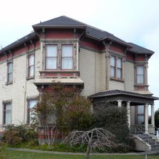
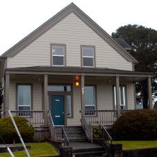
Fort Gaston, 19th century military fortification in Hoopa Valley, California.

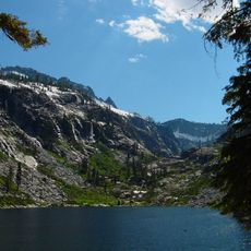
Fort Gaston is a military fortification from the 1800s positioned on the west bank of the Trinity River in Humboldt County. The site stands roughly 14 miles upstream from where this river meets the Klamath River.

The facility was established on December 4, 1859, and named after Lieutenant William Gaston, who died during military conflict in the Pacific Northwest. Following its founding, the site served in regional military operations until its closure in 1892.

The site served as a point where military operations and the local Hoopa community intersected during the 1800s. For the Hoopa people, this location remains part of their reservation's history and identity.

The grounds sit in a river valley and are easily reached from nearby roads running through the region. Visitors should prepare for changing weather and take note of the natural setting with its wetlands and forested areas.

From 1889 to 1898, the site operated a salmon hatchery, an unusual conversion of the military structure for environmental purposes. This shift shows how the location adapted after its primary military role ended.

The community of curious travelers

AroundUs brings together thousands of curated places, local tips, and hidden gems, enriched daily by 60,000 contributors worldwide.

Start exploring
Location
GPS coordinates
41.05030,-123.67400
Latest update
December 14, 2025 11:05
Around this place
Hyperion
United States of America

Hyperion

33.4 km
Redwood National and State Parks
United States of America

Redwood National and State Parks

45.1 km
Carson Mansion
United States of America

Carson Mansion

49 km
Six Rivers National Forest
United States of America

Six Rivers National Forest

11.4 km
Trinity Alps Wilderness
United States of America

Trinity Alps Wilderness

49.5 km
Arcata Wastewater Treatment Plant and Wildlife Sanctuary
United States of America

Arcata Wastewater Treatment Plant and Wildlife Sanctuary

41.1 km
Trinidad State Beach
United States of America

Trinidad State Beach

40 km
Coast Guard Air Station Humboldt Bay
United States of America

Coast Guard Air Station Humboldt Bay

37.6 km
Humboldt Lagoons State Park
United States of America

Humboldt Lagoons State Park

41.2 km
Azalea State Natural Reserve
United States of America

Azalea State Natural Reserve

37.1 km
Little River State Beach
United States of America

Little River State Beach

36.8 km
Arcata Community Forest
United States of America

Arcata Community Forest

37.8 km
Trinidad Head Light
United States of America

Trinidad Head Light

40 km
Pythian Castle
United States of America

Pythian Castle

39.9 km
William McKinley statue
United States of America

William McKinley statue

40.2 km
Hotel Arcata
United States of America

Hotel Arcata

40.1 km
Salmon Mountain
United States of America

Salmon Mountain

26.5 km
Humboldt Bay Maritime Museum
United States of America

Humboldt Bay Maritime Museum

48.9 km
United States Post Office and Courthouse
United States of America

United States Post Office and Courthouse

49.6 km
HSU First Street Gallery
United States of America

HSU First Street Gallery

49.6 km
E. Janssen Building
United States of America

E. Janssen Building

49.6 km
Humboldt County Superior Court
United States of America

Humboldt County Superior Court

49.4 km
Humboldt State University Natural History Museum
United States of America

Humboldt State University Natural History Museum

39.8 km
The Old Arrow Tree, California
United States of America

The Old Arrow Tree, California

30.9 km
Old Jacoby Creek School
United States of America

Old Jacoby Creek School

40 km
Odd Fellows Hall
United States of America

Odd Fellows Hall

49.5 km
Thomas F. Ricks House
United States of America

Thomas F. Ricks House

49.6 km
George McFarlan House
United States of America

George McFarlan House

48.8 km
Show the full map
Reviews
Share your experience

No review yet

Discussions
Start a discussion...

No discussion yet

« Fort Gaston - 19th century military fortification in Hoopa Valley, California » is provided by Around Us (aroundus.com). Images and texts are derived from Wikimedia project under a Creative Commons license. You are allowed to copy, distribute, and modify copies of this page, under the conditions set by the license, as long as this note is clearly visible.

Discover hidden gems everywhere you go!

From secret cafés to breathtaking viewpoints, skip the crowded tourist spots and find places that match your style. Our app makes it easy with voice search, smart filtering, route optimization, and insider tips from travelers worldwide. Download now for the complete mobile experience.

Around Us App Screenshot

A unique approach to discovering new places

Le Figaro

All the places worth exploring

France Info

A tailor-made excursion in just a few clicks

20 Minutes

Around Us
Travel Guide & Maps
Download

Send to your phone

QR Code
1

Open the camera app on your mobile.

2

Point at the QR code with your camera. A notification will appear.

3

Tap the notification to open the link.