Enable Location

We need your location to show you interesting places around you

Discover nearby places

Find interesting locations and hidden gems around you

Precise directions

Get accurate directions and distances to places

Your location is never shared with other users. It's only used when you tap the location button.

Munson Valley Historic District

Log in to your account

Start exploring — it's free

Trusted by 61,977 travelers worldwide

Continue with Google
Continue with Apple
or

We will send you a code to connect

By continuing, you accept our Terms and Conditions and our Privacy Policy

Check your inbox

We've sent a pincode in your inbox. Please enter the code below.

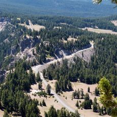
Munson Valley Historic District, Historic district in Klamath County, Oregon.

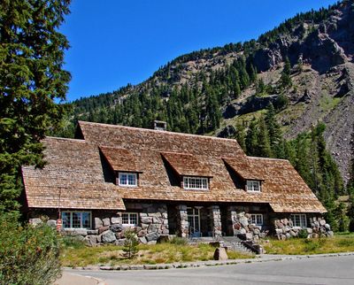
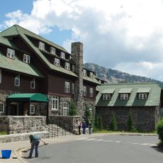
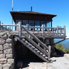
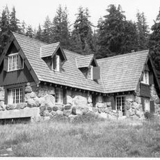
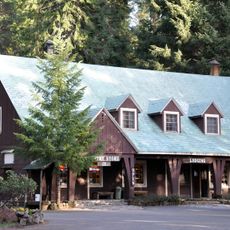
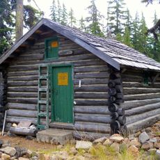
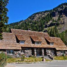
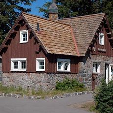
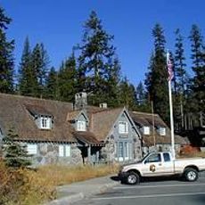
Munson Valley Historic District comprises eighteen primary structures within Crater Lake National Park built in National Park Service rustic style. These buildings formed the park's former administrative center, containing staff quarters and various service facilities arranged throughout the valley.

The site became park headquarters in 1924, which triggered major construction between 1927 and 1930. Most of the administrative buildings and staff housing that shape the place today were built during those three years.

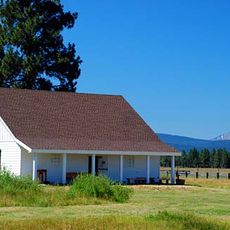
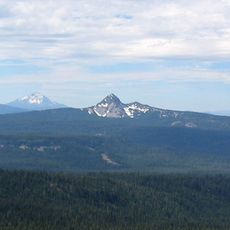
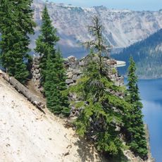
The buildings use local materials and design that fits naturally into the landscape. This approach shapes how the place looks today and how visitors experience it as part of the wider natural setting.

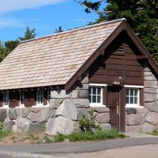
Visitors can explore the former Ranger Dormitory, now serving as an information center where maps and park details are available. The site is best explored on foot, with walkways connecting the buildings in ways that are easy to navigate.

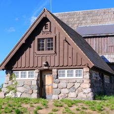
The Superintendent's Residence from 1933 now houses the Science and Learning Center and holds National Historic Landmark status. This building bridges its historical role with a contemporary educational function that visitors can access today.

The community of curious travelers

AroundUs brings together thousands of curated places, local tips, and hidden gems, enriched daily by 60,000 contributors worldwide.

Start exploring
Location
Architects
National Park Service
Architectural style
National Park Service rustic
GPS coordinates
42.89722,-122.13417
Latest update
December 14, 2025 14:27
Around this place
Old Man of the Lake
United States of America

Old Man of the Lake

6.5 km
Mount Mazama
United States of America

Mount Mazama

5.2 km
Crater Lake Lodge
United States of America

Crater Lake Lodge

1.5 km
Mount Scott
United States of America

Mount Scott

10 km
Rim Drive
United States of America

Rim Drive

6 km
Fort Klamath
United States of America

Fort Klamath

26.4 km
Rim Village Historic District
United States of America

Rim Village Historic District

1.6 km
Jackson F. Kimball State Recreation Site
United States of America

Jackson F. Kimball State Recreation Site

21.7 km
Watchman Lookout Station
United States of America

Watchman Lookout Station

6 km
Union Peak
United States of America

Union Peak

10.4 km
Sinnott Memorial Observation Station
United States of America

Sinnott Memorial Observation Station

1.7 km
Comfort Station No. 72
United States of America

Comfort Station No. 72

1.9 km
Crater Lake Superintendent's Residence
United States of America

Crater Lake Superintendent's Residence

424 m
Comfort Station No. 68
United States of America

Comfort Station No. 68

1.8 km
Plaikni Falls
United States of America

Plaikni Falls

7.1 km
Imnaha Guard Station
United States of America

Imnaha Guard Station

26.8 km
Union Creek Historic District
United States of America

Union Creek Historic District

25.5 km
Honeymoon Creek Snow-Survey Cabin
United States of America

Honeymoon Creek Snow-Survey Cabin

26 km
Rim Drive Historic District
United States of America

Rim Drive Historic District

6 km
Castle Crest Wildflower Trail
United States of America

Castle Crest Wildflower Trail

134 m
Administration Building
United States of America

Administration Building

36 m
Rim Visitor Center
United States of America

Rim Visitor Center

1.7 km
Watchman Peak Trail
United States of America

Watchman Peak Trail

6 km
Steel Visitor Center
United States of America

Steel Visitor Center

36 m
Mount Scott Trail
United States of America

Mount Scott Trail

9.3 km
Watchman Overlook
United States of America

Watchman Overlook

6.1 km
Devil's Backbone Viewpoint
United States of America

Devil's Backbone Viewpoint

7.4 km
Discovery Point
United States of America

Discovery Point

3.5 km
Show the full map
« Munson Valley Historic District - Historic district in Klamath County, Oregon » is provided by Around Us (aroundus.com). Images and texts are derived from Wikimedia project under a Creative Commons license. You are allowed to copy, distribute, and modify copies of this page, under the conditions set by the license, as long as this note is clearly visible.

Discover hidden gems everywhere you go!

From secret cafés to breathtaking viewpoints, skip the crowded tourist spots and find places that match your style. Our app makes it easy with voice search, smart filtering, route optimization, and insider tips from travelers worldwide. Download now for the complete mobile experience.

Around Us App Screenshot

A unique approach to discovering new places

Le Figaro

All the places worth exploring

France Info

A tailor-made excursion in just a few clicks

20 Minutes

Around Us
Travel Guide & Maps
Download

Send to your phone

QR Code
1

Open the camera app on your mobile.

2

Point at the QR code with your camera. A notification will appear.

3

Tap the notification to open the link.