Enable Location

We need your location to show you interesting places around you

Discover nearby places

Find interesting locations and hidden gems around you

Precise directions

Get accurate directions and distances to places

Your location is never shared with other users. It's only used when you tap the location button.

Log in to your account

Start exploring — it's free

Trusted by 63,026 travelers worldwide

Continue with Google
Continue with Apple
or

We will send you a code to connect

By continuing, you accept our Terms and Conditions and our Privacy Policy

Check your inbox

We've sent a pincode in your inbox. Please enter the code below.

Fort William
Discussion Reviews Photo
3.2k Popularity

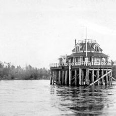
Fort William, Historical fort on Sauvie Island, United States

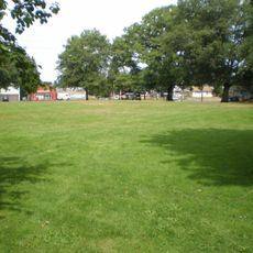
Fort William was a trading post located on Sauvie Island where the Willamette River meets the Columbia River in what is now Oregon. The settlement included structures for storage, housing, and commerce spread across the central area of the island.

A Boston merchant established the post in 1834 as a commercial venture, then transferred it to the Hudson's Bay Company in 1837. This transition marked a shift in how the site operated and its role in the early Oregon region.

The site brought together traders, trappers, and local communities in a place where commerce and daily life intersected. The fort represented a moment when different worlds converged along the rivers for business and exchange.

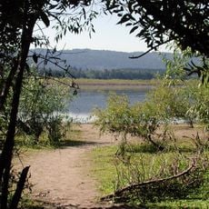
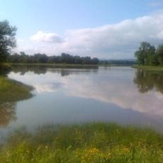
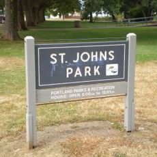
The site is accessible by walking trails that link with other island attractions and feature interpretive signs about the location's past. Plan your visit during drier months since seasonal flooding from the river can affect access during other times of the year.

The settlement relocated from the island's north side to its center to escape flooding from the Columbia River. This move reveals how early traders adapted to the natural conditions of their surroundings.

The community of curious travelers

AroundUs brings together thousands of curated places, local tips, and hidden gems, enriched daily by 60,000 contributors worldwide.

Start exploring
Location
GPS coordinates
45.65390,-122.83000
Latest update
December 12, 2025 09:03
Around this place
St. Johns Bridge
United States of America

St. Johns Bridge

9.2 km
Portland International Raceway
United States of America

Portland International Raceway

12.2 km
Course of the Willamette River
United States of America

Course of the Willamette River

5.1 km
Burlington Northern Railroad Bridge 5.1
United States of America

Burlington Northern Railroad Bridge 5.1

10.7 km
Peace Candle of the World
United States of America

Peace Candle of the World

10.6 km
Burlington Northern Railroad Bridge 9.6
United States of America

Burlington Northern Railroad Bridge 9.6

11.3 km
Kelley Point Park
United States of America

Kelley Point Park

5.2 km
Smith and Bybee Wetlands Natural Area
United States of America

Smith and Bybee Wetlands Natural Area

5.7 km
Holcomb Creek Trestle
United States of America

Holcomb Creek Trestle

8.3 km
Wapato Bridge
United States of America

Wapato Bridge

3.1 km
Cathedral Park
United States of America

Cathedral Park

9.1 km
Sauvie Island Wildlife Area
United States of America

Sauvie Island Wildlife Area

7.7 km
Oregon Slough Railroad Bridge
United States of America

Oregon Slough Railroad Bridge

10.9 km
Pier Park
United States of America

Pier Park

8.1 km
McCoy Park
United States of America

McCoy Park

11.4 km
Bybee–Howell House
United States of America

Bybee–Howell House

1.6 km
St. Johns City Hall
United States of America

St. Johns City Hall

9.2 km
St. Johns Library
United States of America

St. Johns Library

9.4 km
Bell Tower
United States of America

Bell Tower

12.3 km
Five Oaks Museum
United States of America

Five Oaks Museum

10 km
Willamette River Light
United States of America

Willamette River Light

5.2 km
St. Johns Park
United States of America

St. Johns Park

9.1 km
Washington County Jail
United States of America

Washington County Jail

10 km
George Park
United States of America

George Park

9.7 km
Moses and Ida Kline House
United States of America

Moses and Ida Kline House

11.1 km
Clark County Courthouse
United States of America

Clark County Courthouse

12.1 km
Reeder Beach
United States of America

Reeder Beach

8.4 km
Schrunk Riverview Tower
United States of America

Schrunk Riverview Tower

9 km
Show the full map
Reviews
Share your experience

No review yet

Discussions
Start a discussion...

No discussion yet

« Fort William - Historical fort on Sauvie Island, United States » is provided by Around Us (aroundus.com). Images and texts are derived from Wikimedia project under a Creative Commons license. You are allowed to copy, distribute, and modify copies of this page, under the conditions set by the license, as long as this note is clearly visible.

Discover hidden gems everywhere you go!

From secret cafés to breathtaking viewpoints, skip the crowded tourist spots and find places that match your style. Our app makes it easy with voice search, smart filtering, route optimization, and insider tips from travelers worldwide. Download now for the complete mobile experience.

Around Us App Screenshot

A unique approach to discovering new places

Le Figaro

All the places worth exploring

France Info

A tailor-made excursion in just a few clicks

20 Minutes

Around Us
Travel Guide & Maps
Download

Send to your phone

QR Code
1

Open the camera app on your mobile.

2

Point at the QR code with your camera. A notification will appear.

3

Tap the notification to open the link.