Timothy Lake, body of water
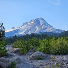
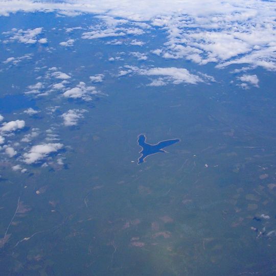
Timothy Lake is a reservoir of deep blue water in the Mount Hood National Forest, about 50 miles southeast of Portland, Oregon. The compacted-earth dam stands 110 feet high and impounds 81,000 acre-feet. The lake measures roughly 3.0 km north to south and 3.2 km east to west, with an irregular, lobed shoreline and no islands. Anvil, Cooper, Dinger and Stone creeks feed it.
Portland General Electric built the compacted-earth Timothy Lake Dam in 1956 to regulate seasonal water flow to Lake Harriet downstream. The dam stands 110 feet high and impounds 81,000 acre-feet, but it does not generate hydroelectric power itself. The resulting reservoir lies on the Oak Grove Fork Clackamas River, about 50 miles southeast of Portland.
The lake's name comes from a meadow where shepherds once grew timothy grass for their flocks. This name preserves a memory of the area's farming past, even though the original meadow now lies beneath the water.
Timothy Lake lies at 985 metres in Clackamas County, about 80 km southeast of Portland. The 5.1-square-kilometre reservoir is reached by forest roads and has a shoreline trail. Camping, boating, hiking, horseback riding and mountain biking are popular in summer. The dam is 110 feet high and impounds 81,000 acre-feet.
The lake overlaps with the Pacific Crest Trail, a famous long-distance hiking route that runs from Mexico to Canada, allowing hikers to experience both the local lake loop and a section of this legendary trail. This connection makes Timothy Lake a unique meeting point for long-distance hikers and local visitors.
The community of curious travelers
AroundUs brings together thousands of curated places, local tips, and hidden gems, enriched daily by 93,913 contributors worldwide.