Celilo Falls

Log in to your account

AroundUs is a community-driven map of interesting places, built by curious explorers like you. It grows with every review, story, and photo you share.
Connect to save your favorite spots, contribute locations, and create personalized routes.
Continue with Google
Continue with Apple
Continue with X
Continue with Facebook
Continue with email
By continuing, you accept our Terms and Conditions and our Privacy Policy
Create an account
Add to collection
Map
Suggest a change
Share

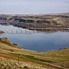
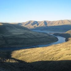
Celilo Falls, Native American fishing area at Columbia River, Oregon, United States

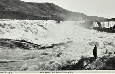
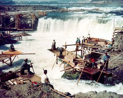
Celilo Falls was a fishing area on the Columbia River in Oregon consisting of three sections: Horseshoe Falls, a deep eddy called Cul-de-Sac, and the main river channel through basalt narrows. People built platforms extending over the water and used ropes for safety while catching salmon, particularly during migration seasons.

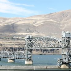
Indigenous communities continuously inhabited this location for approximately 15,000 years until the construction of The Dalles Dam in 1957. The dam's construction flooded the historic fishing grounds and ended one of the longest human settlement traditions in North America.

The site was known as Wyam in native languages and functioned as a major gathering place where people came together to fish for salmon and exchange goods. The rock formations and flowing water created the backbone of this social hub that connected generations of people.

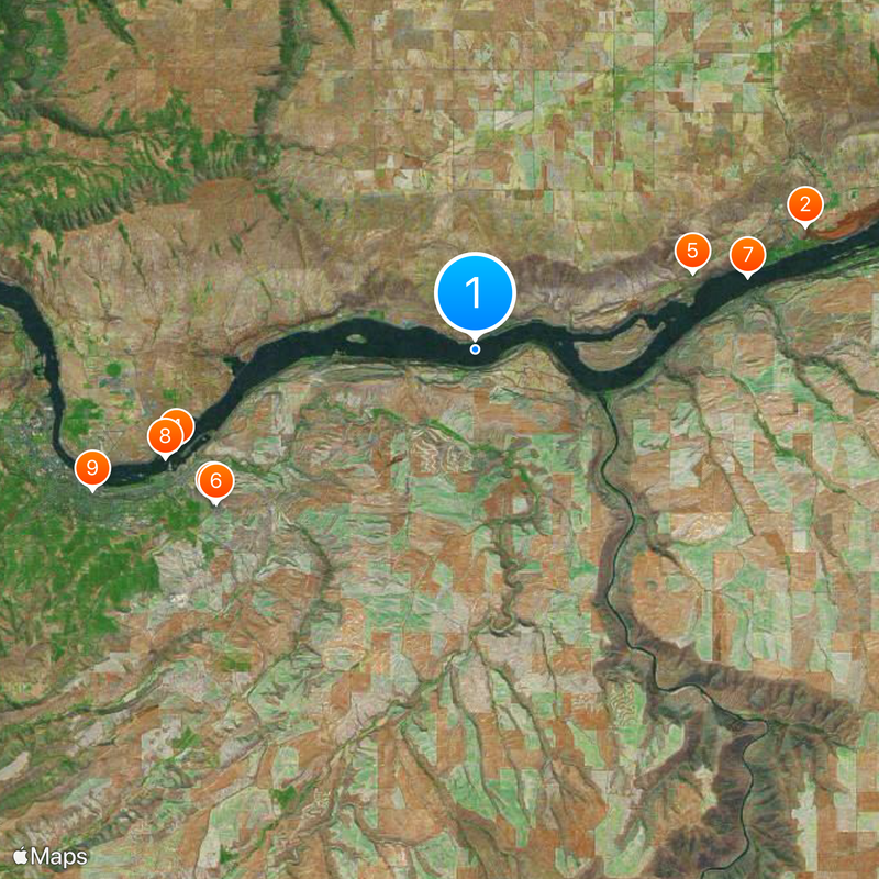
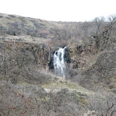
The location sits on the Columbia River where water currents become particularly strong during salmon migration and rock formations limit fishing spots. Visitors should know that the area is now submerged underwater and can only be explored historically, with viewpoints available along the shoreline.

During spring flooding periods, the volume of water flowing through this location exceeded the current flow rate of Niagara Falls. This extraordinary water power made the area one of the most productive salmon fishing grounds on the entire continent.

Location: Oregon

Part of: Columbia River

GPS coordinates: 45.64945,-120.97792

Latest update: December 17, 2025 10:37

Photos
Around this place
Maryhill Stonehenge
United States of America

Maryhill Stonehenge

14.3 km
Pacific DC Intertie
United States of America

Pacific DC Intertie

12.3 km
The Dalles Dam
United States of America

The Dalles Dam

12.7 km
Maryhill Museum of Art
United States of America

Maryhill Museum of Art

9.3 km
Celilo Converter Station
United States of America

Celilo Converter Station

12.2 km
Sam Hill Memorial Bridge
United States of America

Sam Hill Memorial Bridge

11.4 km
The Dalles Bridge
United States of America

The Dalles Bridge

13.3 km
The Dalles Mint
United States of America

The Dalles Mint

16.5 km
Maryhill State Park
United States of America

Maryhill State Park

12.3 km
Deschutes River State Recreation Area
United States of America

Deschutes River State Recreation Area

5.6 km
Oregon Trunk Rail Bridge
United States of America

Oregon Trunk Rail Bridge

323 m
Columbia Hills Historical State Park
United States of America

Columbia Hills Historical State Park

9.7 km
Charles E. Nelson House
United States of America

Charles E. Nelson House

12.5 km
Granada Theater
United States of America

Granada Theater

16.8 km
Dr. J. A. Reuter House
United States of America

Dr. J. A. Reuter House

17 km
Indian Shaker Church and Gulick Homestead
United States of America

Indian Shaker Church and Gulick Homestead

13 km
The Dalles Civic Auditorium
United States of America

The Dalles Civic Auditorium

16.8 km
First Day Advent Christian Church
United States of America

First Day Advent Christian Church

13.5 km
The Dalles Carnegie Library
United States of America

The Dalles Carnegie Library

16.9 km
Joseph D. and Margaret Kelly House
United States of America

Joseph D. and Margaret Kelly House

16.6 km
U.S. Post Office
United States of America

U.S. Post Office

16.9 km
Edward French House
United States of America

Edward French House

17.1 km
John and Murta Van Dellen House
United States of America

John and Murta Van Dellen House

17.1 km
John L. Thompson House
United States of America

John L. Thompson House

17 km
Sharp Family Residential Ensemble
United States of America

Sharp Family Residential Ensemble

16.7 km
Fulton–Taylor House
United States of America

Fulton–Taylor House

17 km
National Neon Sign Museum
United States of America

National Neon Sign Museum

16.9 km
Sunshine Mill
United States of America

Sunshine Mill

16.2 km
Show the full map
Reviews

Visited this place? Tap the stars to rate it and share your experience / photos with the community! Try now! You can cancel it anytime.

« Celilo Falls - Native American fishing area at Columbia River, Oregon, United States » is provided by Around Us (aroundus.com). Images and texts are derived from Wikimedia project under a Creative Commons license. You are allowed to copy, distribute, and modify copies of this page, under the conditions set by the license, as long as this note is clearly visible.

Discover hidden gems everywhere you go!

From secret cafés to breathtaking viewpoints, skip the crowded tourist spots and find places that match your style. Our app makes it easy with voice search, smart filtering, route optimization, and insider tips from travelers worldwide. Download now for the complete mobile experience.

Around Us App Screenshot

A unique approach to discovering new places

Le Figaro

All the places worth exploring

France Info

A tailor-made excursion in just a few clicks

20 Minutes