Enable Location

We need your location to show you interesting places around you

Discover nearby places

Find interesting locations and hidden gems around you

Precise directions

Get accurate directions and distances to places

Your location is never shared with other users. It's only used when you tap the location button.

Sam Hill Memorial Bridge

Log in to your account

Start exploring — it's free

Trusted by 61,818 travelers worldwide

Continue with Google
Continue with Apple
or

We will send you a code to connect

By continuing, you accept our Terms and Conditions and our Privacy Policy

Check your inbox

We've sent a pincode in your inbox. Please enter the code below.

Sam Hill Memorial Bridge

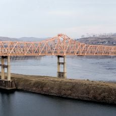
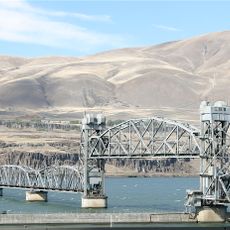
Sam Hill Memorial Bridge, Steel truss road bridge in Biggs Junction, Oregon and Maryhill, Washington, United States.

Description

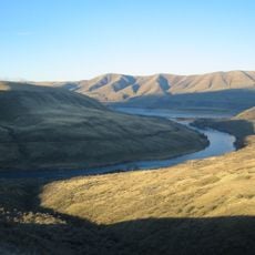
The Sam Hill Memorial Bridge is a steel truss structure that crosses the Columbia River between Oregon and Washington, featuring a distinctive polygonal Warren design that carries traffic across the waterway. The bridge's main span rises prominently above the river, forming a recognizable landmark in this part of the Columbia River Gorge region.

History

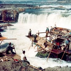
Construction started in 1960 to replace a ferry service that had operated since the 1920s for crossing the river. This transition from ferry to bridge marked a shift in how people and vehicles moved between the two states.

Culture

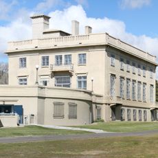
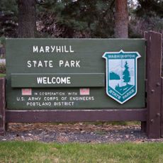
The bridge honors Sam Hill, who contributed to regional infrastructure development and established the nearby Maryhill Museum of Art along the Columbia River.

Practical

The crossing is free to use today, and traffic moves steadily across a modernized deck surface. The structure accommodates standard vehicles and provides a straightforward route for people traveling between the two states.

Did you know?

The bridge originally operated as a toll crossing in its early years but became free to use in the mid-1970s, a change that many travelers today may not realize. This shift reflects how transportation funding priorities changed over time in the region.

Location
Location
Inception
1962
Official opening
November 1, 1962
GPS coordinates
45.67600,-120.83600
Latest update
December 12, 2025 09:02

AroundUs brings together thousands of curated places, local tips, and hidden gems, enriched daily by 60,000 contributors worldwide. Discover all places nearby (Washington).

Around this place
Maryhill Stonehenge
United States of America

Maryhill Stonehenge

3.1 km
Celilo Falls
United States of America

Celilo Falls

11.4 km
John Day Dam
United States of America

John Day Dam

11.9 km
Pacific DC Intertie
United States of America

Pacific DC Intertie

23.5 km
The Dalles Dam
United States of America

The Dalles Dam

24.2 km
Maryhill Museum of Art
United States of America

Maryhill Museum of Art

2.2 km
Goldendale Observatory State Park
United States of America

Goldendale Observatory State Park

18.2 km
Celilo Converter Station
United States of America

Celilo Converter Station

23.4 km
The Dalles Bridge
United States of America

The Dalles Bridge

24.7 km
The Dalles Mint
United States of America

The Dalles Mint

27.9 km
Maryhill State Park
United States of America

Maryhill State Park

1 km
Deschutes River State Recreation Area
United States of America

Deschutes River State Recreation Area

7.5 km
Oregon Trunk Rail Bridge
United States of America

Oregon Trunk Rail Bridge

11.8 km
Columbia Hills Historical State Park
United States of America

Columbia Hills Historical State Park

20.2 km
Charles E. Nelson House
United States of America

Charles E. Nelson House

20.9 km
Columbia Hills
United States of America

Columbia Hills

8.1 km
Granada Theater
United States of America

Granada Theater

28.2 km
Goldendale Free Public Library
United States of America

Goldendale Free Public Library

16.2 km
John and Helen Moore House
United States of America

John and Helen Moore House

26.4 km
Indian Shaker Church and Gulick Homestead
United States of America

Indian Shaker Church and Gulick Homestead

24.4 km
The Dalles Civic Auditorium
United States of America

The Dalles Civic Auditorium

28.2 km
First Day Advent Christian Church
United States of America

First Day Advent Christian Church

2.2 km
The Dalles Carnegie Library
United States of America

The Dalles Carnegie Library

28.3 km
Joseph D. and Margaret Kelly House
United States of America

Joseph D. and Margaret Kelly House

28 km
Sharp Family Residential Ensemble
United States of America

Sharp Family Residential Ensemble

28.2 km
National Neon Sign Museum
United States of America

National Neon Sign Museum

28.3 km
Sunshine Mill
United States of America

Sunshine Mill

27.5 km
Wonderworks Children’s Museum
United States of America

Wonderworks Children’s Museum

27.8 km
Show the full map
« Sam Hill Memorial Bridge - Steel truss road bridge in Biggs Junction, Oregon and Maryhill, Washington, United States » is provided by Around Us (aroundus.com). Images and texts are derived from Wikimedia project under a Creative Commons license. You are allowed to copy, distribute, and modify copies of this page, under the conditions set by the license, as long as this note is clearly visible.

Discover hidden gems everywhere you go!

From secret cafés to breathtaking viewpoints, skip the crowded tourist spots and find places that match your style. Our app makes it easy with voice search, smart filtering, route optimization, and insider tips from travelers worldwide. Download now for the complete mobile experience.

Around Us App Screenshot

A unique approach to discovering new places

Le Figaro

All the places worth exploring

France Info

A tailor-made excursion in just a few clicks

20 Minutes

Around Us
Travel Guide & Maps
Download

Send to your phone

QR Code
1

Open the camera app on your mobile.

2

Point at the QR code with your camera. A notification will appear.

3

Tap the notification to open the link.