Chest opened
+${chestReward.xp} XP
Explorer
NOUVEAU ×${chestReward.collectible.quantity}
tapez pour fermer
Chest locked

Open chests in the app

Around Us is built for your phone — chests unlock when you walk, explore and capture nearby places.

Enable Location

We need your location to show you interesting places around you

Discover nearby places

Find interesting locations and hidden gems around you

Precise directions

Get accurate directions and distances to places

Your location is never shared with other users. It's only used when you tap the location button.

Sol Duc River

Log in to your account

Start exploring — it's free

Trusted by 72,885 travelers worldwide

Continue with Google
Continue with Apple
or

We will send you a code to connect

By continuing, you accept our Terms and Conditions and our Privacy Policy

Check your inbox

We've sent a pincode in your inbox. Please enter the code below.

Sol Duc River
Discussion Reviews 1 Photos
9.8k Popularity

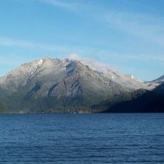
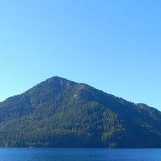
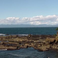
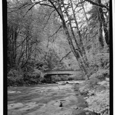
Sol Duc River, River system in Clallam County, Washington, United States.

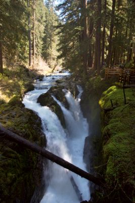
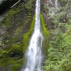
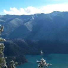
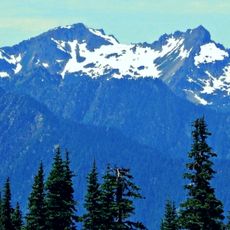
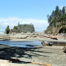
The Sol Duc River is a river system flowing through Olympic National Park with multiple waterfalls and diverse aquatic life along its course. It winds through rocky terrain, creating cascades and multiple channels as it moves toward the Pacific coast.

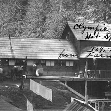
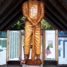
Native American tribes of the Olympic Peninsula relied on the river for fishing and water transportation long before European settlers arrived in the 1800s. The waterway remained central to the region's landscape and indigenous life for generations.

The name Sol Duc comes from the Quillayute language and means 'magic waters', reflecting the Indigenous people's deep connection to this waterway.

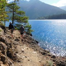
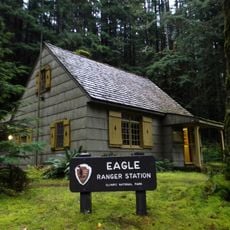
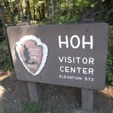
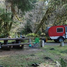
The river is accessible through several hiking trails in Olympic National Park, and visitors should prepare for changing weather conditions. A fishing permit is required if you plan to fish in the waterway.

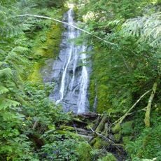
A waterfall about 50 feet high splits into multiple channels before the currents reunite, creating a fascinating pattern through the rocky landscape. This natural occurrence often goes unnoticed by many passing hikers.

The community of curious travelers

AroundUs brings together thousands of curated places, local tips, and hidden gems, enriched daily by 60,000 contributors worldwide.

Start exploring
Location
GPS coordinates
48.05473,-124.18361
Latest update
December 10, 2025 15:56
Around this place
Olympic Mountains
United States of America

Olympic Mountains

35.9 km
Sol Duc Hot Springs
United States of America

Sol Duc Hot Springs

25.7 km
Marymere Falls
United States of America

Marymere Falls

29.4 km
Hall of Mosses Trail
United States of America

Hall of Mosses Trail

28.8 km
Mount Storm King
United States of America

Mount Storm King

33 km
One Square Inch of Silence
United States of America

One Square Inch of Silence

31.4 km
Spruce Railroad Trail
United States of America

Spruce Railroad Trail

28.6 km
Bogachiel State Park
United States of America

Bogachiel State Park

21.9 km
Aurora Peak
United States of America

Aurora Peak

28.2 km
Pyramid Mountain
United States of America

Pyramid Mountain

28.1 km
Tongue Point
United States of America

Tongue Point

37.6 km
Storm King Ranger Station
United States of America

Storm King Ranger Station

29.5 km
Slip Point Light
United States of America

Slip Point Light

23.9 km
East Twin Falls
United States of America

East Twin Falls

22.7 km
Mount Appleton
United States of America

Mount Appleton

35.5 km
Eagle Ranger Station
United States of America

Eagle Ranger Station

25.5 km
Pyramid Peak Aircraft Warning Service Lookout
United States of America

Pyramid Peak Aircraft Warning Service Lookout

28 km
Kloshe Nanitch Lookout
United States of America

Kloshe Nanitch Lookout

8.3 km
Forks Timber Museum
United States of America

Forks Timber Museum

20.5 km
Forks Timber Museum
United States of America

Forks Timber Museum

20.5 km
Pacific coastal area of Olympic National Park
United States of America

Pacific coastal area of Olympic National Park

35.3 km
Hoh Rain Forest Visitor Center
United States of America

Hoh Rain Forest Visitor Center

28.5 km
Forks Loggers Memorial
United States of America

Forks Loggers Memorial

20.4 km
Sol Duc River Bridge
United States of America

Sol Duc River Bridge

7.7 km
Hole-in-the-Wall
United States of America

Hole-in-the-Wall

37 km
Forks Visitor Information Center
United States of America

Forks Visitor Information Center

20.4 km
Fairholme Campground
United States of America

Fairholme Campground

20.2 km
Hoh Campground
United States of America

Hoh Campground

28.7 km
Show the full map
Reviews
Share your experience

No review yet

Discussions
Start a discussion...

No discussion yet

« Sol Duc River - River system in Clallam County, Washington, United States » is provided by Around Us (aroundus.com). Images and texts are derived from Wikimedia project under a Creative Commons license. You are allowed to copy, distribute, and modify copies of this page, under the conditions set by the license, as long as this note is clearly visible.

Discover hidden gems everywhere you go!

From secret cafés to breathtaking viewpoints, skip the crowded tourist spots and find places that match your style. Our app makes it easy with voice search, smart filtering, route optimization, and insider tips from travelers worldwide. Download now for the complete mobile experience.

Around Us App Screenshot

A unique approach to discovering new places

Le Figaro

All the places worth exploring

France Info

A tailor-made excursion in just a few clicks

20 Minutes

Around Us
Travel Guide & Maps
Download

Send to your phone

QR Code
1

Open the camera app on your mobile.

2

Point at the QR code with your camera. A notification will appear.

3

Tap the notification to open the link.