Chest opened
+${chestReward.xp} XP
Explorer
NOUVEAU ×${chestReward.collectible.quantity}
tapez pour fermer
Chest locked

Open chests in the app

Around Us is built for your phone — chests unlock when you walk, explore and capture nearby places.

Enable Location

We need your location to show you interesting places around you

Discover nearby places

Find interesting locations and hidden gems around you

Precise directions

Get accurate directions and distances to places

Your location is never shared with other users. It's only used when you tap the location button.

Log in to your account

Start exploring — it's free

Trusted by 72,876 travelers worldwide

Continue with Google
Continue with Apple
or

We will send you a code to connect

By continuing, you accept our Terms and Conditions and our Privacy Policy

Check your inbox

We've sent a pincode in your inbox. Please enter the code below.

Discussion Reviews Photo
1.6k Popularity

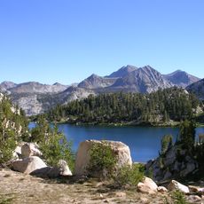
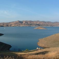
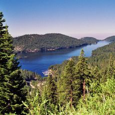
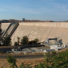
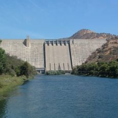
Kerckhoff Dam, Hydroelectric power station and arch dam in Fresno County and Madera County, United States

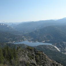
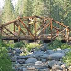
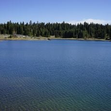
Kerckhoff Dam is a concrete arch structure spanning 155 meters across the San Joaquin River in the Sierra Nevada foothills. The reservoir behind it stores water for both hydroelectric generation and irrigation throughout the surrounding counties.

The dam was constructed in 1920 as the first hydroelectric facility on the San Joaquin River and part of a larger regional development scheme. A second powerhouse was added in 1983 to boost electricity production capacity.

The facility takes its name from William George Kerckhoff, an industrialist whose investments shaped California's power infrastructure in the early 1900s. His vision drove the development of water-based electricity generation in this remote mountain area.

Access to the dam and reservoir is via mountain roads in a remote, steep area, so a reliable vehicle is necessary for visiting. Water release schedules and road conditions can vary seasonally, so it is best to check local access information before making the trip.

The facility operates four Francis turbines split between two separate powerhouses, producing around 193 megawatts of capacity. These turbines were added over several decades, reflecting the evolving technology and engineering methods of their respective eras.

The community of curious travelers

AroundUs brings together thousands of curated places, local tips, and hidden gems, enriched daily by 60,000 contributors worldwide.

Start exploring
Location
Location
Length
155 m
GPS coordinates
37.12810,-119.52500
Latest update
December 14, 2025 13:00
Around this place
Wawona Tree
United States of America

Wawona Tree

43.5 km
Grizzly Giant
United States of America

Grizzly Giant

42.3 km
Shaver Lake
United States of America

Shaver Lake

20.8 km
Save Mart Center
United States of America

Save Mart Center

40.2 km
Sierra National Forest
United States of America

Sierra National Forest

45.1 km
Valley Children's Stadium
United States of America

Valley Children's Stadium

40.6 km
Millerton Lake
United States of America

Millerton Lake

14.9 km
Huntington Lake
United States of America

Huntington Lake

31.4 km
Yosemite Mountain Sugar Pine Railroad
United States of America

Yosemite Mountain Sugar Pine Railroad

37.7 km
Pine Flat Lake
United States of America

Pine Flat Lake

37.4 km
Friant Dam
United States of America

Friant Dam

21.4 km
Bass Lake
United States of America

Bass Lake

20.6 km
Pine Flat Dam
United States of America

Pine Flat Dam

37.4 km
Mammoth Pool Reservoir
United States of America

Mammoth Pool Reservoir

31.6 km
Nelder Grove
United States of America

Nelder Grove

34.4 km
United States of America

Cold Springs Rancheria of Mono Indians of California

24.9 km
Fresno Dome
United States of America

Fresno Dome

36.3 km
Wild Water Adventures
United States of America

Wild Water Adventures

36.3 km
Dinkey Creek Bridge
United States of America

Dinkey Creek Bridge

33.6 km
Balsam Forebay
United States of America

Balsam Forebay

24.4 km
San Joaquin Experimental Range
United States of America

San Joaquin Experimental Range

18.5 km
San Joaquin
United States of America

San Joaquin

12.1 km
Arboreto de la universidad estatal de California campus de Fresno
United States of America

Arboreto de la universidad estatal de California campus de Fresno

40.4 km
Mariposa Grove Museum
United States of America

Mariposa Grove Museum

43.4 km
Clovis Botanical Garden
United States of America

Clovis Botanical Garden

38 km
Woodward Park Regional Library
United States of America

Woodward Park Regional Library

35.7 km
Shuteye Peak Lookout
United States of America

Shuteye Peak Lookout

26.1 km
Clovis Regional Library
United States of America

Clovis Regional Library

37 km
Show the full map
Reviews
Share your experience

No review yet

Discussions
Start a discussion...

No discussion yet

« Kerckhoff Dam - Hydroelectric power station and arch dam in Fresno County and Madera County, United States » is provided by Around Us (aroundus.com). Images and texts are derived from Wikimedia project under a Creative Commons license. You are allowed to copy, distribute, and modify copies of this page, under the conditions set by the license, as long as this note is clearly visible.

Discover hidden gems everywhere you go!

From secret cafés to breathtaking viewpoints, skip the crowded tourist spots and find places that match your style. Our app makes it easy with voice search, smart filtering, route optimization, and insider tips from travelers worldwide. Download now for the complete mobile experience.

Around Us App Screenshot

A unique approach to discovering new places

Le Figaro

All the places worth exploring

France Info

A tailor-made excursion in just a few clicks

20 Minutes

Around Us
Travel Guide & Maps
Download

Send to your phone

QR Code
1

Open the camera app on your mobile.

2

Point at the QR code with your camera. A notification will appear.

3

Tap the notification to open the link.