Chest opened
+${chestReward.xp} XP
Explorer
NOUVEAU ×${chestReward.collectible.quantity}
tapez pour fermer
Chest locked

Open chests in the app

Around Us is built for your phone — chests unlock when you walk, explore and capture nearby places.

Enable Location

We need your location to show you interesting places around you

Discover nearby places

Find interesting locations and hidden gems around you

Precise directions

Get accurate directions and distances to places

Your location is never shared with other users. It's only used when you tap the location button.

Log in to your account

Start exploring — it's free

Trusted by 72,877 travelers worldwide

Continue with Google
Continue with Apple
or

We will send you a code to connect

By continuing, you accept our Terms and Conditions and our Privacy Policy

Check your inbox

We've sent a pincode in your inbox. Please enter the code below.

Redinger Dam
Discussion Reviews Photo
1.7k Popularity

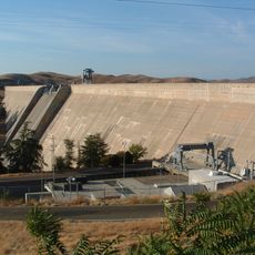
Redinger Dam, Gravity dam in Fresno and Madera Counties, United States.

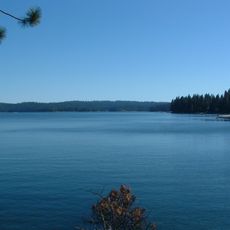
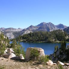
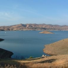
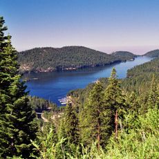
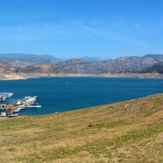
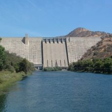
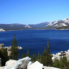
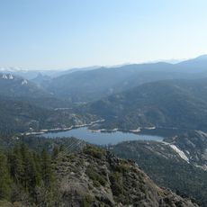
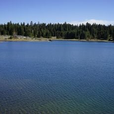
Redinger Dam is a gravity dam that spans across the San Joaquin River and creates the Redinger Lake reservoir. The structure rises 250 feet high with a crest that stretches 875 feet across, and the resulting body of water covers approximately 465 acres.

Southern California Edison built the dam in 1951 as a key part of its Big Creek Hydroelectric Project in the San Joaquin River basin. The facility was developed to provide power to the surrounding region and represented a significant investment in water management infrastructure.

The dam carries the name of David H. Redinger, who led the Big Creek Hydroelectric Project from its start. Visitors can see how the lake's naming honors this figure connected to the project's early years.

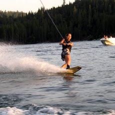
The site offers fishing opportunities and primitive camping facilities for visitors looking to spend time outdoors. The reservoir can be accessed year-round and provides multiple spots to enjoy water-based activities.

The dam functions as one part of a larger hydroelectric network comprising 25 dams, 9 power plants, and multiple tunnels working together. This extensive system manages water and power distribution across California in an interconnected way.

The community of curious travelers

AroundUs brings together thousands of curated places, local tips, and hidden gems, enriched daily by 60,000 contributors worldwide.

Start exploring
Location
Location
GPS coordinates
37.14510,-119.45100
Latest update
December 14, 2025 13:07
Around this place
Wawona Tree
United States of America

Wawona Tree

43.1 km
Grizzly Giant
United States of America

Grizzly Giant

42 km
Shaver Lake
United States of America

Shaver Lake

14.4 km
Save Mart Center
United States of America

Save Mart Center

45.3 km
Sierra National Forest
United States of America

Sierra National Forest

39.3 km
Millerton Lake
United States of America

Millerton Lake

21.4 km
Huntington Lake
United States of America

Huntington Lake

24.6 km
Yosemite Mountain Sugar Pine Railroad
United States of America

Yosemite Mountain Sugar Pine Railroad

38.4 km
Pine Flat Lake
United States of America

Pine Flat Lake

36.5 km
Friant Dam
United States of America

Friant Dam

27.7 km
Bass Lake
United States of America

Bass Lake

20.6 km
Pine Flat Dam
United States of America

Pine Flat Dam

36.6 km
Courtright Reservoir
United States of America

Courtright Reservoir

42.5 km
Mammoth Pool Reservoir
United States of America

Mammoth Pool Reservoir

26.5 km
Nelder Grove
United States of America

Nelder Grove

34.1 km
United States of America

Cold Springs Rancheria of Mono Indians of California

22.4 km
Fresno Dome
United States of America

Fresno Dome

35.2 km
Wild Water Adventures
United States of America

Wild Water Adventures

39.6 km
Dinkey Creek Bridge
United States of America

Dinkey Creek Bridge

27.8 km
Balsam Forebay
United States of America

Balsam Forebay

17.7 km
San Joaquin Experimental Range
United States of America

San Joaquin Experimental Range

25.3 km
San Joaquin
United States of America

San Joaquin

10.7 km
Arboreto de la universidad estatal de California campus de Fresno
United States of America

Arboreto de la universidad estatal de California campus de Fresno

45.5 km
Mariposa Grove Museum
United States of America

Mariposa Grove Museum

43.1 km
Clovis Botanical Garden
United States of America

Clovis Botanical Garden

42.7 km
Woodward Park Regional Library
United States of America

Woodward Park Regional Library

41.4 km
Shuteye Peak Lookout
United States of America

Shuteye Peak Lookout

22.9 km
Clovis Regional Library
United States of America

Clovis Regional Library

41.8 km
Show the full map
Reviews
Share your experience

No review yet

Discussions
Start a discussion...

No discussion yet

« Redinger Dam - Gravity dam in Fresno and Madera Counties, United States » is provided by Around Us (aroundus.com). Images and texts are derived from Wikimedia project under a Creative Commons license. You are allowed to copy, distribute, and modify copies of this page, under the conditions set by the license, as long as this note is clearly visible.

Discover hidden gems everywhere you go!

From secret cafés to breathtaking viewpoints, skip the crowded tourist spots and find places that match your style. Our app makes it easy with voice search, smart filtering, route optimization, and insider tips from travelers worldwide. Download now for the complete mobile experience.

Around Us App Screenshot

A unique approach to discovering new places

Le Figaro

All the places worth exploring

France Info

A tailor-made excursion in just a few clicks

20 Minutes

Around Us
Travel Guide & Maps
Download

Send to your phone

QR Code
1

Open the camera app on your mobile.

2

Point at the QR code with your camera. A notification will appear.

3

Tap the notification to open the link.