Enable Location

We need your location to show you interesting places around you

Discover nearby places

Find interesting locations and hidden gems around you

Precise directions

Get accurate directions and distances to places

Your location is never shared with other users. It's only used when you tap the location button.

Lake Eleanor

Log in to your account

Start exploring — it's free

Trusted by 62,419 travelers worldwide

Continue with Google
Continue with Apple
or

We will send you a code to connect

By continuing, you accept our Terms and Conditions and our Privacy Policy

Check your inbox

We've sent a pincode in your inbox. Please enter the code below.

Lake Eleanor

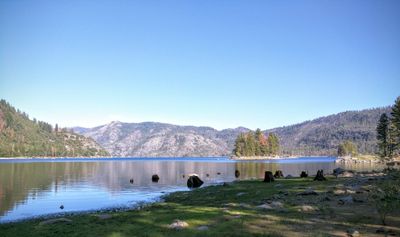
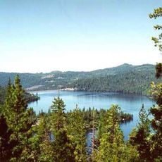
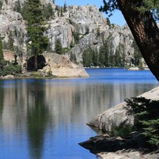
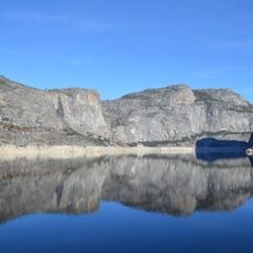
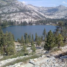
Lake Eleanor, reservoir in Yosemite National Park

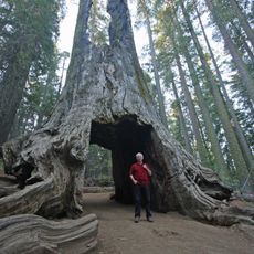
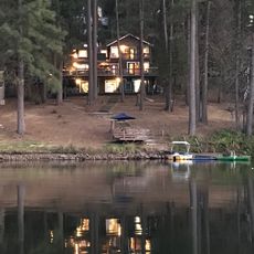
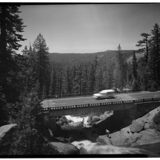
Lake Eleanor is a reservoir in Tuolumne County, California, surrounded by forested hills and rocky terrain. It has a calm water surface that mirrors the sky and trees along its banks, with trails leading around the lake and into the nearby woods.

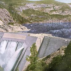
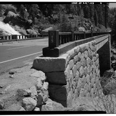
The reservoir was created in 1918 by constructing an arched concrete dam as part of the Hetch Hetchy water system designed to supply San Francisco. This infrastructure was developed following debates about protecting the natural landscape, with conservationists like John Muir expressing concerns about the project.

The lake carries the name of an early settler in the area. Today, visitors use the place mainly for quiet walks and peaceful moments in nature, reflecting a deep connection to the untouched mountain landscape.

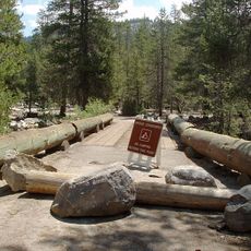
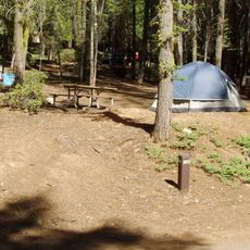
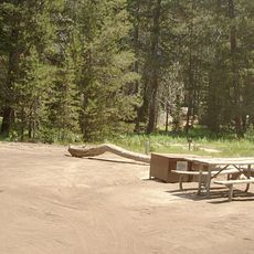
Roads leading to the lake are well maintained and parking is available nearby, making access straightforward for most visitors. Several campgrounds in the area have toilets and picnic spaces, allowing families and groups to spend multiple days outdoors.

The dam features distinctive arched concrete sections standing over 60 feet tall, an impressive engineering example for its era. This design was innovative and remains a rare example of this particular dam construction technique in the region.

The community of curious travelers

AroundUs brings together thousands of curated places, local tips, and hidden gems, enriched daily by 60,000 contributors worldwide.

Start exploring
Location
GPS coordinates
37.97798,-119.87907
Latest update
February 7, 2026 11:40
Around this place
O'Shaughnessy Dam
United States of America

O'Shaughnessy Dam

8.7 km
Stanislaus National Forest
United States of America

Stanislaus National Forest

21.2 km
Emigrant Wilderness
United States of America

Emigrant Wilderness

25.2 km
Hetch Hetchy Reservoir
United States of America

Hetch Hetchy Reservoir

11.6 km
Cherry Lake
United States of America

Cherry Lake

3.4 km
Wapama Falls
United States of America

Wapama Falls

10 km
Grand Canyon of the Tuolumne
United States of America

Grand Canyon of the Tuolumne

25.1 km
Crane Flat Campground
United States of America

Crane Flat Campground

26.5 km
Tueeulala Falls
United States of America

Tueeulala Falls

9.5 km
Yosemite Creek Campground
United States of America

Yosemite Creek Campground

30 km
Crane Flat Fire Lookout
United States of America

Crane Flat Fire Lookout

24.8 km
United States of America

Lyons Dam

28.4 km
Tamarack Flat Campground
United States of America

Tamarack Flat Campground

28.1 km
Hetch Hetchy to Lake Vernon Trail
United States of America

Hetch Hetchy to Lake Vernon Trail

13.5 km
Quaking Aspen Falls
United States of America

Quaking Aspen Falls

30.7 km
Merced Grove Ranger Station
United States of America

Merced Grove Ranger Station

25.7 km
Frog Creek Cabin
United States of America

Frog Creek Cabin

3.2 km
Cooper Cabin
United States of America

Cooper Cabin

28.9 km
Yosemite Wilderness
United States of America

Yosemite Wilderness

24.2 km
Dead Giant Tunnel Tree
United States of America

Dead Giant Tunnel Tree

24.2 km
Crane Flat
United States of America

Crane Flat

24 km
Tamarack Flat
United States of America

Tamarack Flat

28.1 km
South Fork Tuolumne River Bridge
United States of America

South Fork Tuolumne River Bridge

24.8 km
Bower Cave
United States of America

Bower Cave

29.1 km
Lake Lodge Beach
United States of America

Lake Lodge Beach

30.8 km
Groveland Ranger Station
United States of America

Groveland Ranger Station

25.9 km
Rim of the World Vista
United States of America

Rim of the World Vista

22.3 km
South Fork Tuolumne River Bridge
United States of America

South Fork Tuolumne River Bridge

20.9 km
Show the full map
« Lake Eleanor - reservoir in Yosemite National Park » is provided by Around Us (aroundus.com). Images and texts are derived from Wikimedia project under a Creative Commons license. You are allowed to copy, distribute, and modify copies of this page, under the conditions set by the license, as long as this note is clearly visible.

Discover hidden gems everywhere you go!

From secret cafés to breathtaking viewpoints, skip the crowded tourist spots and find places that match your style. Our app makes it easy with voice search, smart filtering, route optimization, and insider tips from travelers worldwide. Download now for the complete mobile experience.

Around Us App Screenshot

A unique approach to discovering new places

Le Figaro

All the places worth exploring

France Info

A tailor-made excursion in just a few clicks

20 Minutes

Around Us
Travel Guide & Maps
Download

Send to your phone

QR Code
1

Open the camera app on your mobile.

2

Point at the QR code with your camera. A notification will appear.

3

Tap the notification to open the link.