Enable Location

We need your location to show you interesting places around you

Discover nearby places

Find interesting locations and hidden gems around you

Precise directions

Get accurate directions and distances to places

Your location is never shared with other users. It's only used when you tap the location button.

Cherry Lake

Log in to your account

Start exploring — it's free

Trusted by 62,419 travelers worldwide

Continue with Google
Continue with Apple
or

We will send you a code to connect

By continuing, you accept our Terms and Conditions and our Privacy Policy

Check your inbox

We've sent a pincode in your inbox. Please enter the code below.

Cherry Lake

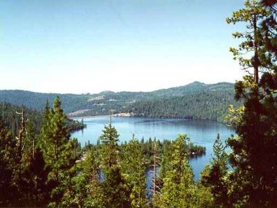
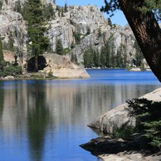
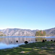
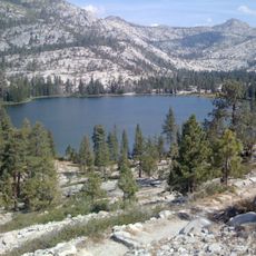
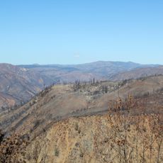
Cherry Lake, reservoir in California

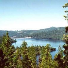
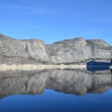
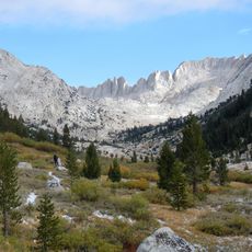
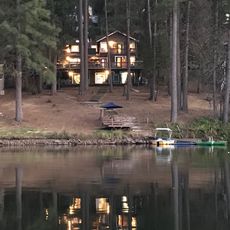
Cherry Lake is a reservoir formed by the Cherry Valley Dam in Stanislaus National Forest, surrounded by tall trees and mountains at an elevation of about 4700 feet (1430 meters). The lake is fed by three forks of Cherry Creek and serves purposes including drinking water supply and hydroelectric generation.

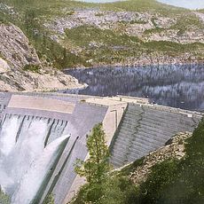
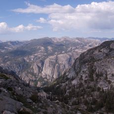
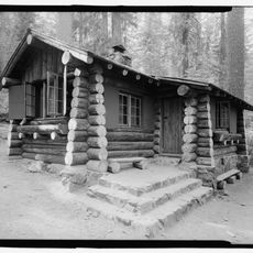
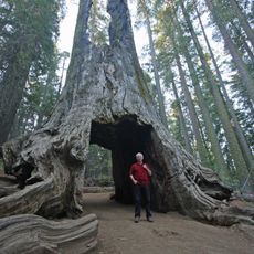
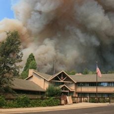
The lake was created in the middle of the 20th century when the Cherry Valley Dam was built to hold water for cities including San Francisco. Earlier uses of the forest by logging and mining workers were later replaced by water management and recreation purposes.

The lake serves as a gathering place where locals and visitors connect with nature through everyday outdoor activities. People use it regularly for fishing, hiking, and relaxing by the water, experiencing simple moments like listening to birds and watching the changing seasons.

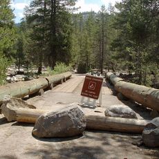
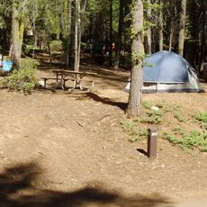
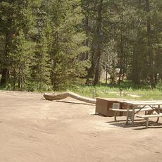
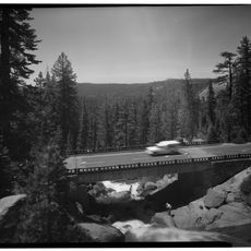
The lake is accessible by paved forest roads from late April through October, after which roads often close due to snow. The west side has a boat ramp and swimming area, while the southwest shore offers a campground with space for over forty tents and RVs.

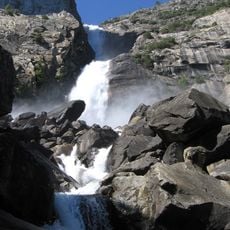
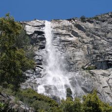
Cherry Creek below the lake offers one of the most challenging whitewater experiences in California with Class V rapids and steep drops. These extremely difficult rapids are accessible only through a few outfitters and are typically run from June to August when snowmelt makes the river safe.

The community of curious travelers

AroundUs brings together thousands of curated places, local tips, and hidden gems, enriched daily by 60,000 contributors worldwide.

Start exploring
Location
Location
Elevation above the sea
1,434 m
GPS coordinates
38.00130,-119.90460
Latest update
February 7, 2026 11:01
Around this place
Hetch Hetchy
United States of America

Hetch Hetchy

11.9 km
O'Shaughnessy Dam
United States of America

O'Shaughnessy Dam

11.8 km
Stanislaus National Forest
United States of America

Stanislaus National Forest

17.7 km
Emigrant Wilderness
United States of America

Emigrant Wilderness

23.9 km
Hetch Hetchy Reservoir
United States of America

Hetch Hetchy Reservoir

14.5 km
Wapama Falls
United States of America

Wapama Falls

12.8 km
Grand Canyon of the Tuolumne
United States of America

Grand Canyon of the Tuolumne

27.9 km
Lake Eleanor
United States of America

Lake Eleanor

3.4 km
Crane Flat Campground
United States of America

Crane Flat Campground

29.6 km
Tueeulala Falls
United States of America

Tueeulala Falls

12.3 km
Yosemite Creek Campground
United States of America

Yosemite Creek Campground

33.3 km
Crane Flat Fire Lookout
United States of America

Crane Flat Fire Lookout

27.9 km
United States of America

Lyons Dam

25.2 km
Tamarack Flat Campground
United States of America

Tamarack Flat Campground

31.4 km
Hetch Hetchy to Lake Vernon Trail
United States of America

Hetch Hetchy to Lake Vernon Trail

15.2 km
Merced Grove Ranger Station
United States of America

Merced Grove Ranger Station

28.6 km
Frog Creek Cabin
United States of America

Frog Creek Cabin

5.7 km
Cooper Cabin
United States of America

Cooper Cabin

26.8 km
Yosemite Wilderness
United States of America

Yosemite Wilderness

26.6 km
Dead Giant Tunnel Tree
United States of America

Dead Giant Tunnel Tree

27.3 km
Crane Flat
United States of America

Crane Flat

26.9 km
Tamarack Flat
United States of America

Tamarack Flat

31.4 km
South Fork Tuolumne River Bridge
United States of America

South Fork Tuolumne River Bridge

28.2 km
Bower Cave
United States of America

Bower Cave

30.5 km
Lake Lodge Beach
United States of America

Lake Lodge Beach

30.2 km
Groveland Ranger Station
United States of America

Groveland Ranger Station

26.1 km
Rim of the World Vista
United States of America

Rim of the World Vista

23.2 km
South Fork Tuolumne River Bridge
United States of America

South Fork Tuolumne River Bridge

22 km
Show the full map
« Cherry Lake - reservoir in California » is provided by Around Us (aroundus.com). Images and texts are derived from Wikimedia project under a Creative Commons license. You are allowed to copy, distribute, and modify copies of this page, under the conditions set by the license, as long as this note is clearly visible.

Discover hidden gems everywhere you go!

From secret cafés to breathtaking viewpoints, skip the crowded tourist spots and find places that match your style. Our app makes it easy with voice search, smart filtering, route optimization, and insider tips from travelers worldwide. Download now for the complete mobile experience.

Around Us App Screenshot

A unique approach to discovering new places

Le Figaro

All the places worth exploring

France Info

A tailor-made excursion in just a few clicks

20 Minutes

Around Us
Travel Guide & Maps
Download

Send to your phone

QR Code
1

Open the camera app on your mobile.

2

Point at the QR code with your camera. A notification will appear.

3

Tap the notification to open the link.