Chest opened
+${chestReward.xp} XP
Explorer
NOUVEAU ×${chestReward.collectible.quantity}
tapez pour fermer
Chest locked

Open chests in the app

Around Us is built for your phone — chests unlock when you walk, explore and capture nearby places.

Enable Location

We need your location to show you interesting places around you

Discover nearby places

Find interesting locations and hidden gems around you

Precise directions

Get accurate directions and distances to places

Your location is never shared with other users. It's only used when you tap the location button.

Log in to your account

Start exploring — it's free

Trusted by 72,928 travelers worldwide

Continue with Google
Continue with Apple
or

We will send you a code to connect

By continuing, you accept our Terms and Conditions and our Privacy Policy

Check your inbox

We've sent a pincode in your inbox. Please enter the code below.

Katherine's Landing
Discussion Reviews Photo
1.2k Popularity

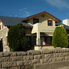
Katherine's Landing, Recreational area at Lake Mohave, Arizona.

Katherine's Landing is a recreational area along the Colorado River at Lake Mohave with numerous beach coves providing access to the water. The site includes a motel, RV facilities, campgrounds, boat rental services, and dining options near Davis Dam.

The area received its name from the Katherine Mine, a gold mining operation that existed in the surrounding region during the late 1800s. It later developed into a recreational destination while preserving the historical name from its mining heritage.

The landing serves as a gathering place for boaters and anglers who come together for fishing competitions and water sports events. People from different backgrounds meet here to share their passion for recreational activities on the water.

The area is best visited during warmer months and offers various lodging and recreational options suited to different lengths of stay. Most activities center around the water, so it helps to check what facilities and rentals are available before arriving.

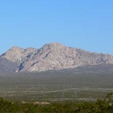
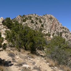
A hiking trail connects the landing to secluded swimming spots and fishing areas along the shoreline. The path allows visitors to venture beyond the developed areas and discover quieter sections of the water and desert landscape.

The community of curious travelers

AroundUs brings together thousands of curated places, local tips, and hidden gems, enriched daily by 60,000 contributors worldwide.

Start exploring
Location
GPS coordinates
35.22000,-114.56500
Latest update
December 14, 2025 18:06
Around this place
Castle Mountains National Monument
United States of America

Castle Mountains National Monument

46.4 km
Atchison, Topeka and Santa Fe Railway 3759
United States of America

Atchison, Topeka and Santa Fe Railway 3759

46.2 km
Grapevine Canyon Petroglyphs
United States of America

Grapevine Canyon Petroglyphs

11 km
Spirit Mountain
United States of America

Spirit Mountain

15.7 km
AT&T Building
United States of America

AT&T Building

46.6 km
Dead Mountains
United States of America

Dead Mountains

29.6 km
Spirit Mountain Wilderness
United States of America

Spirit Mountain Wilderness

8.7 km
Warm Springs Wilderness
United States of America

Warm Springs Wilderness

42.9 km
United States of America

Bridge Canyon Wilderness

12.1 km
Boundary Cone
United States of America

Boundary Cone

29.6 km
Grapevine Canyon
United States of America

Grapevine Canyon

11 km
United States of America

Alexey W. Von Schmidt

24.6 km
Bonelli House
United States of America

Bonelli House

46.9 km
Mohave County Courthouse and Jail
United States of America

Mohave County Courthouse and Jail

46.8 km
Mohave Museum of History and Arts
United States of America

Mohave Museum of History and Arts

45.9 km
Saint Mary's Catholic Church
United States of America

Saint Mary's Catholic Church

46.7 km
Max J. Anderson House
United States of America

Max J. Anderson House

46.8 km
Kingman Commercial Historic District
United States of America

Kingman Commercial Historic District

46.8 km
Tyrell House
United States of America

Tyrell House

46.2 km
G. H. Sullivan Lodging House
United States of America

G. H. Sullivan Lodging House

46.6 km
Masonic Temple
United States of America

Masonic Temple

46.8 km
Hubbs House
United States of America

Hubbs House

46.8 km
House at 105 Spring St.
United States of America

House at 105 Spring St.

46.3 km
Foster S. Dennis House
United States of America

Foster S. Dennis House

46.5 km
Little Red School
United States of America

Little Red School

46.8 km
House at 809 Grand View
United States of America

House at 809 Grand View

45.9 km
J. B. Wright House
United States of America

J. B. Wright House

46.7 km
W. P. Mahoney House
United States of America

W. P. Mahoney House

46.5 km
Show the full map
Reviews
Share your experience

No review yet

Discussions
Start a discussion...

No discussion yet

« Katherine's Landing - Recreational area at Lake Mohave, Arizona » is provided by Around Us (aroundus.com). Images and texts are derived from Wikimedia project under a Creative Commons license. You are allowed to copy, distribute, and modify copies of this page, under the conditions set by the license, as long as this note is clearly visible.

Discover hidden gems everywhere you go!

From secret cafés to breathtaking viewpoints, skip the crowded tourist spots and find places that match your style. Our app makes it easy with voice search, smart filtering, route optimization, and insider tips from travelers worldwide. Download now for the complete mobile experience.

Around Us App Screenshot

A unique approach to discovering new places

Le Figaro

All the places worth exploring

France Info

A tailor-made excursion in just a few clicks

20 Minutes

Around Us
Travel Guide & Maps
Download

Send to your phone

QR Code
1

Open the camera app on your mobile.

2

Point at the QR code with your camera. A notification will appear.

3

Tap the notification to open the link.