Enable Location

We need your location to show you interesting places around you

Discover nearby places

Find interesting locations and hidden gems around you

Precise directions

Get accurate directions and distances to places

Your location is never shared with other users. It's only used when you tap the location button.

Jerome

Log in to your account

Start exploring — it's free

Trusted by 61,551 travelers worldwide

Continue with Google
Continue with Apple
or

We will send you a code to connect

By continuing, you accept our Terms and Conditions and our Privacy Policy

Check your inbox

We've sent a pincode in your inbox. Please enter the code below.

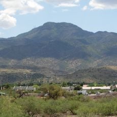
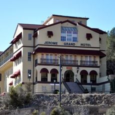
Jerome, Mining town on Cleopatra Hill in Yavapai County, Arizona

Description

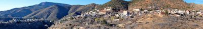
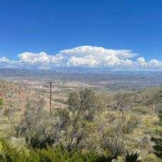
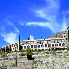
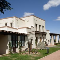
Jerome is a mining town perched on steep hillsides in Yavapai County, Arizona, where buildings are wedged into the mountainside and overlook the Verde Valley below. The structures follow the extreme slopes of the terrain, creating a compact, terraced settlement pattern.

History

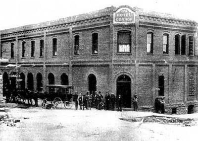
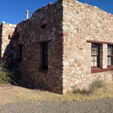
The town grew in the 1800s around copper mining and attracted thousands of workers seeking employment in the growing industry. When the mines closed in 1953, the population shrank sharply and Jerome transformed into a small, quiet place.

Culture

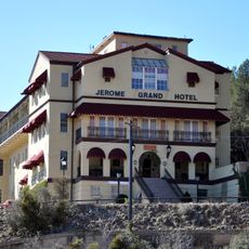
Art galleries and museums throughout Jerome reflect how deeply mining shaped both the community and its sense of place. These spaces show visitors how the copper industry influenced daily life and the identity of everyone who lived here.

Practical

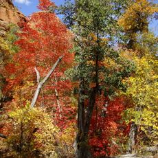
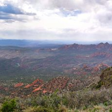
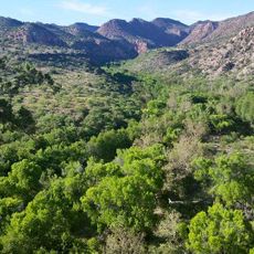
The town sits along State Route 89A, providing access to nearby forests and mountains while remaining easy to reach from larger cities in the region. The streets within the town itself are steep and narrow, so slow driving and careful parking are advisable.

Did you know?

An old school building slid down the hillside during an earthquake in 1907, moving several feet downslope. This dramatic shift and the ground instability beneath the town reveal the extreme challenges miners faced when constructing anything on such steep terrain.

Location
Inception
1899
Elevation above the sea
1,544 m
GPS coordinates
34.74889,-112.11389
Latest update
December 13, 2025 11:41

AroundUs brings together thousands of curated places, local tips, and hidden gems, enriched daily by 60,000 contributors worldwide. Discover all places nearby (Yavapai County).

Around this place
Cathedral Rock
United States of America

Cathedral Rock

30.4 km
Jerome Grand Hotel
United States of America

Jerome Grand Hotel

573 m
Red Rock State Park
United States of America

Red Rock State Park

27.1 km
Tuzigoot National Monument
United States of America

Tuzigoot National Monument

8.4 km
Bell Rock
United States of America

Bell Rock

32.4 km
Mingus Mountain
United States of America

Mingus Mountain

6.2 km
Red Rock-Secret Mountain Wilderness
United States of America

Red Rock-Secret Mountain Wilderness

33.7 km
Dead Horse Ranch State Park
United States of America

Dead Horse Ranch State Park

9.3 km
Out of Africa Wildlife Park
United States of America

Out of Africa Wildlife Park

23.1 km
Jerome State Historic Park
United States of America

Jerome State Historic Park

587 m
Fort Verde State Historic Park
United States of America

Fort Verde State Historic Park

31.5 km
Jerome Historic District
United States of America

Jerome Historic District

573 m
Sycamore Canyon Wilderness
United States of America

Sycamore Canyon Wilderness

29 km
Cathedral Rock Trailhead
United States of America

Cathedral Rock Trailhead

30.9 km
Woodchute Wilderness
United States of America

Woodchute Wilderness

6.1 km
Mingus Lookout Complex
United States of America

Mingus Lookout Complex

6.2 km

Perkinsville Bridge
United States of America

Perkinsville Bridge

18.3 km
Clarkdale Historic District
United States of America

Clarkdale Historic District

5.8 km
Jerome State Historical Mine Park Museum
United States of America

Jerome State Historical Mine Park Museum

582 m
Master Mechanic's House
United States of America

Master Mechanic's House

8.2 km
Willard House
United States of America

Willard House

7.8 km
Tuzigoot Museum
United States of America

Tuzigoot Museum

8.4 km
Audrey Headframe Park
United States of America

Audrey Headframe Park

557 m
Verde Valley Archaeology Center and Museum
United States of America

Verde Valley Archaeology Center and Museum

30.7 km
Clark Memorial Clubhouse
United States of America

Clark Memorial Clubhouse

5.9 km
Douglas Mansion
United States of America

Douglas Mansion

584 m
Sycamore Canyon
United States of America

Sycamore Canyon

13.4 km
Show the full map
« Jerome - Mining town on Cleopatra Hill in Yavapai County, Arizona » is provided by Around Us (aroundus.com). Images and texts are derived from Wikimedia project under a Creative Commons license. You are allowed to copy, distribute, and modify copies of this page, under the conditions set by the license, as long as this note is clearly visible.

Discover hidden gems everywhere you go!

From secret cafés to breathtaking viewpoints, skip the crowded tourist spots and find places that match your style. Our app makes it easy with voice search, smart filtering, route optimization, and insider tips from travelers worldwide. Download now for the complete mobile experience.

Around Us App Screenshot

A unique approach to discovering new places

Le Figaro

All the places worth exploring

France Info

A tailor-made excursion in just a few clicks

20 Minutes

Around Us
Travel Guide & Maps
Download

Send to your phone

QR Code
1

Open the camera app on your mobile.

2

Point at the QR code with your camera. A notification will appear.

3

Tap the notification to open the link.