Interstate 17

Log in to your account

AroundUs is a community-driven map of interesting places, built by curious explorers like you. It grows with every review, story, and photo you share.
Connect to save your favorite spots, contribute locations, and create personalized routes.
By continuing, you accept our Terms and Conditions and our Privacy Policy
Add to collection
Map
Suggest a change
Share

Interstate 17, Major interstate highway in Maricopa County and Yavapai County, United States.

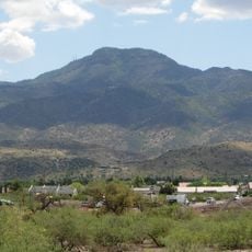
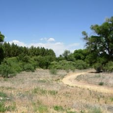
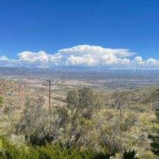
Interstate 17 is a four-lane divided highway that cuts through central Arizona, running from the Phoenix metropolitan area northward toward Flagstaff. The route passes through varying terrain including desert, mountains, and forested regions.

Construction of the highway began in the 1960s as part of the interstate system, connecting previously isolated communities across Arizona. The project opened access to northern regions and mining areas that were difficult to reach before.

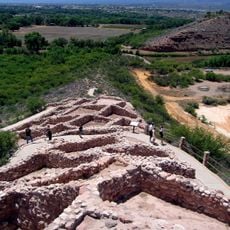
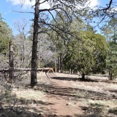
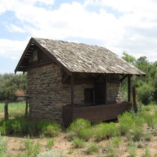
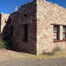
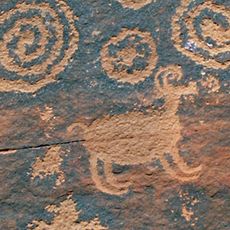
The highway serves as a central route for both local residents and tourists accessing Native American archaeological sites, ranches, and national forests in Arizona.

The highway has rest areas and service stations positioned at regular intervals along its length. Drivers should be aware that mountain sections can be challenging, especially during winter, so checking weather conditions before traveling is wise.

The drive from Phoenix to Flagstaff covers roughly 5000 feet of elevation gain, creating visible shifts from desert to mountain landscape. This dramatic climb allows drivers to experience multiple climate zones and ecosystems in a single trip.

Location: Maricopa County

Location: Yavapai County

Location: Coconino County

Inception: 1957

GPS coordinates: 34.45222,-112.03354

Latest update: December 6, 2025 22:05

Photos
Around this place
Show the full map
Jerome Grand Hotel
United States of America

Jerome Grand Hotel

34.3 km
Tuzigoot National Monument
United States of America

Tuzigoot National Monument

35.5 km
Mingus Mountain
United States of America

Mingus Mountain

28.3 km
Dead Horse Ranch State Park
United States of America

Dead Horse Ranch State Park

33.5 km
Out of Africa Wildlife Park
United States of America

Out of Africa Wildlife Park

20.4 km
Jerome State Historic Park
United States of America

Jerome State Historic Park

34.3 km
Wet Beaver Wilderness
United States of America

Wet Beaver Wilderness

38.2 km
Fort Verde State Historic Park
United States of America

Fort Verde State Historic Park

20.8 km
Childs-Irving Hydroelectric Facilities
United States of America

Childs-Irving Hydroelectric Facilities

32.8 km
V-Bar-V Heritage Site
United States of America

V-Bar-V Heritage Site

37.1 km
Walker Charcoal Kiln
United States of America

Walker Charcoal Kiln

31.4 km
Jerome Historic District
United States of America

Jerome Historic District

34.3 km
Mayer Red Brick Schoolhouse
United States of America

Mayer Red Brick Schoolhouse

19.8 km
Woodchute Wilderness
United States of America

Woodchute Wilderness

36 km
Fossil Creek Bridge
United States of America

Fossil Creek Bridge

37.7 km
Clear Creek Church
United States of America

Clear Creek Church

20.5 km
Mingus Lookout Complex
United States of America

Mingus Lookout Complex

28.3 km
Copper Creek Guard Station
United States of America

Copper Creek Guard Station

27 km
Gold King Mine Ghost Town
United States of America

Gold King Mine Ghost Town

35 km
Clarkdale Historic District
United States of America

Clarkdale Historic District

35.9 km
Jerome State Historical Mine Park Museum
United States of America

Jerome State Historical Mine Park Museum

34.3 km
Master Mechanic's House
United States of America

Master Mechanic's House

31.3 km
Willard House
United States of America

Willard House

33.2 km
Tuzigoot Museum
United States of America

Tuzigoot Museum

35.4 km
Audrey Headframe Park
United States of America

Audrey Headframe Park

34.3 km
Verde Valley Archaeology Center and Museum
United States of America

Verde Valley Archaeology Center and Museum

20.2 km
Clark Memorial Clubhouse
United States of America

Clark Memorial Clubhouse

35.7 km
Douglas Mansion
United States of America

Douglas Mansion

34.3 km
Show the full map
Reviews

Visited this place? Tap the stars to rate it and share your experience / photos with the community! Try now! You can cancel it anytime.

« Interstate 17 - Major interstate highway in Maricopa County and Yavapai County, United States » is provided by Around Us (aroundus.com). Images and texts are derived from Wikimedia project under a Creative Commons license. You are allowed to copy, distribute, and modify copies of this page, under the conditions set by the license, as long as this note is clearly visible.

Discover hidden gems everywhere you go!

From secret cafés to breathtaking viewpoints, skip the crowded tourist spots and find places that match your style. Our app makes it easy with voice search, smart filtering, route optimization, and insider tips from travelers worldwide. Download now for the complete mobile experience.

Around Us App Screenshot

A unique approach to discovering new places

Le Figaro

All the places worth exploring

France Info

A tailor-made excursion in just a few clicks

20 Minutes