Enable Location

We need your location to show you interesting places around you

Discover nearby places

Find interesting locations and hidden gems around you

Precise directions

Get accurate directions and distances to places

Your location is never shared with other users. It's only used when you tap the location button.

Childs-Irving Hydroelectric Facilities

Log in to your account

Start exploring — it's free

Trusted by 64,890 travelers worldwide

Continue with Google
Continue with Apple
or

We will send you a code to connect

By continuing, you accept our Terms and Conditions and our Privacy Policy

Check your inbox

We've sent a pincode in your inbox. Please enter the code below.

Discussion Reviews 1 Photos
4.3k Popularity

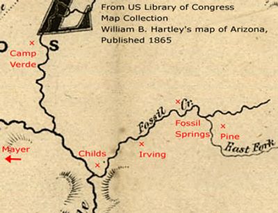
Childs-Irving Hydroelectric Facilities, Hydroelectric facility in Verde River Valley, Arizona, United States

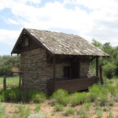
Childs-Irving Hydroelectric Facilities are two power plants built along Fossil Creek in the Verde River Valley, Arizona. The complex includes concrete aqueducts, diversion dams, and two separate generating stations connected into a single water-powered system.

Construction of the first plant began around 1908, when all equipment and supplies had to be carried in by mule across rough desert terrain. A second plant was added later to increase output, and together they powered towns and mining operations across the region for decades.

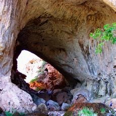
The site was built by a workforce that included men from many different backgrounds, which was notable for Arizona at the time. Walking among the remaining concrete structures today gives a tangible sense of the physical effort that went into shaping this remote canyon.

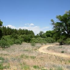
The area around the facilities is dry and exposed, so bring plenty of water and cover up against the sun before setting out. Some parts of the site require walking on uneven ground, and it helps to go early in the day when temperatures are lower.

A small reservoir was placed between the two generating stations specifically to store water during planned shutdowns, allowing operations to continue for several days without interruption. This buffer design was an early example of careful engineering on a remote site where outside help was slow to arrive.

The community of curious travelers

AroundUs brings together thousands of curated places, local tips, and hidden gems, enriched daily by 60,000 contributors worldwide.

Start exploring
Location
Inception
1909
GPS coordinates
34.34972,-111.69917
Latest update
March 3, 2026 08:11
Around this place
Cathedral Rock
United States of America

Cathedral Rock

53.1 km
Red Rock State Park
United States of America

Red Rock State Park

53.1 km
Tonto Natural Bridge
United States of America

Tonto Natural Bridge

22.5 km
Bell Rock
United States of America

Bell Rock

50.5 km
Mingus Mountain
United States of America

Mingus Mountain

54.9 km
Blue Ridge Reservoir
United States of America

Blue Ridge Reservoir

50 km
Dead Horse Ranch State Park
United States of America

Dead Horse Ranch State Park

53.2 km
Out of Africa Wildlife Park
United States of America

Out of Africa Wildlife Park

35.8 km
Discovery Channel Telescope
United States of America

Discovery Channel Telescope

50.8 km
Wet Beaver Wilderness
United States of America

Wet Beaver Wilderness

5.6 km
Fort Verde State Historic Park
United States of America

Fort Verde State Historic Park

27.8 km
Courthouse Butte
United States of America

Courthouse Butte

50.5 km
V-Bar-V Heritage Site
United States of America

V-Bar-V Heritage Site

34.7 km
Fossil Springs Wilderness
United States of America

Fossil Springs Wilderness

18.1 km
Mayer Red Brick Schoolhouse
United States of America

Mayer Red Brick Schoolhouse

50 km
Verde River Sheep Bridge
United States of America

Verde River Sheep Bridge

30.3 km
Tonto Natural Bridge State Park
United States of America

Tonto Natural Bridge State Park

22.5 km
Fossil Creek Bridge
United States of America

Fossil Creek Bridge

8.1 km
Beaver Creek Ranger Station
United States of America

Beaver Creek Ranger Station

36 km
Strawberry Schoolhouse
United States of America

Strawberry Schoolhouse

17.7 km
Clear Creek Church
United States of America

Clear Creek Church

22.8 km
Copper Creek Guard Station
United States of America

Copper Creek Guard Station

29.7 km
Master Mechanic's House
United States of America

Master Mechanic's House

52.2 km
Willard House
United States of America

Willard House

53.9 km
Verde Valley Archaeology Center and Museum
United States of America

Verde Valley Archaeology Center and Museum

28.4 km
Moqui Lookout
United States of America

Moqui Lookout

54.2 km
Apache Maid Lookout
United States of America

Apache Maid Lookout

44 km
Maggie Mine Bridge
United States of America

Maggie Mine Bridge

52.2 km
Show the full map
Reviews
Share your experience

No review yet

Discussions
Start a discussion...

No discussion yet

« Childs-Irving Hydroelectric Facilities - Hydroelectric facility in Verde River Valley, Arizona, United States » is provided by Around Us (aroundus.com). Images and texts are derived from Wikimedia project under a Creative Commons license. You are allowed to copy, distribute, and modify copies of this page, under the conditions set by the license, as long as this note is clearly visible.

Discover hidden gems everywhere you go!

From secret cafés to breathtaking viewpoints, skip the crowded tourist spots and find places that match your style. Our app makes it easy with voice search, smart filtering, route optimization, and insider tips from travelers worldwide. Download now for the complete mobile experience.

Around Us App Screenshot

A unique approach to discovering new places

Le Figaro

All the places worth exploring

France Info

A tailor-made excursion in just a few clicks

20 Minutes

Around Us
Travel Guide & Maps
Download

Send to your phone

QR Code
1

Open the camera app on your mobile.

2

Point at the QR code with your camera. A notification will appear.

3

Tap the notification to open the link.