Keyhole Sink

Log in to your account

AroundUs is a community-driven map of interesting places, built by curious explorers like you. It grows with every review, story, and photo you share.
Connect to save your favorite spots, contribute locations, and create personalized routes.
By continuing, you accept our Terms and Conditions and our Privacy Policy
Add to collection
Map
Suggest a change
Share

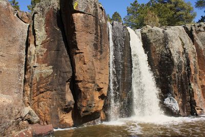
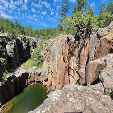
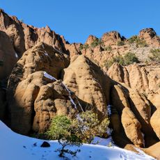
Keyhole Sink, Canyon with petroglyphs in Williams, Arizona.

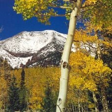
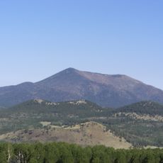
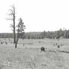
Keyhole Sink is a canyon in Williams, Arizona, where dark volcanic basalt walls contain ancient rock carvings left by the Cohonina people. The narrow gorge takes its name from its distinctive keyhole-shaped opening and fills with seasonal waterfalls that flow through the rocky passage.

Between 700 and 1100 CE, the Cohonina people carved depictions of snakes, lizards, and deer into the dark volcanic rock of this canyon. These petroglyphs record the artistic traditions and hunting practices that defined their long presence in this landscape.

Native Americans used this canyon as a sacred hunting ground where ritual initiations took place and natural rock formations helped with capturing game. The site held deep spiritual meaning for the communities who called these lands home.

Visitors can reach this canyon via a one-mile trail from the Oak Hill Snow Play parking area, located across from the trailhead on Route 66. The path is most accessible during drier months, and hikers should watch for slippery rock surfaces, especially after rainfall.

The petroglyphs were damaged in 2010 when vandals used aluminum roofing cement to deface them, but the site was later restored. Visitors can still observe the differences between original carvings and the areas that were repaired.

Location: Williams

Location: Arizona

GPS coordinates: 35.27000,-112.01400

Latest update: December 8, 2025 21:04

Photos
Around this place
Humphreys Peak
United States of America

Humphreys Peak

31.7 km
San Francisco Peaks
United States of America

San Francisco Peaks

33.7 km
Lowell Observatory
United States of America

Lowell Observatory

32.7 km
Lava River Cave
United States of America

Lava River Cave

18.1 km
Riordan Mansion State Historic Park
United States of America

Riordan Mansion State Historic Park

33.6 km
Museum of Northern Arizona
United States of America

Museum of Northern Arizona

31.9 km
Agassiz Peak
United States of America

Agassiz Peak

31.2 km
Kachina Peaks Wilderness
United States of America

Kachina Peaks Wilderness

32.9 km
Kendrick Peak
United States of America

Kendrick Peak

21.3 km
Fremont Peak
United States of America

Fremont Peak

32.6 km
Sycamore Canyon Wilderness
United States of America

Sycamore Canyon Wilderness

31.5 km
The Arboretum at Flagstaff
United States of America

The Arboretum at Flagstaff

28.5 km
Urban Route 66, Williams
United States of America

Urban Route 66, Williams

16.3 km
Canyon Coaster Adventure Park
United States of America

Canyon Coaster Adventure Park

15.2 km
Barney Flat Historic Railroad Logging Landscape
United States of America

Barney Flat Historic Railroad Logging Landscape

17.5 km
Camp Clover Ranger Station
United States of America

Camp Clover Ranger Station

19 km
First Methodist Episcopal Church and Parsonage
United States of America

First Methodist Episcopal Church and Parsonage

17.2 km
Riordan Mansion
United States of America

Riordan Mansion

33.5 km
Williams Residential Historic District
United States of America

Williams Residential Historic District

15.9 km
Sycamore Falls
United States of America

Sycamore Falls

14.6 km
Route 66 Museum And Gift Shop
United States of America

Route 66 Museum And Gift Shop

16.7 km
Flagstaff Armory
United States of America

Flagstaff Armory

33.6 km
Pioneer Museum--Arizona Historical Society
United States of America

Pioneer Museum--Arizona Historical Society

33 km
Woody Mountain Lookout Tower
United States of America

Woody Mountain Lookout Tower

27.8 km
Red Mountain Trail #159
United States of America

Red Mountain Trail #159

32.2 km
Volunteer Lookout Cabin
United States of America

Volunteer Lookout Cabin

12.2 km
Kendrick Mountain Fire Lookout Cabin
United States of America

Kendrick Mountain Fire Lookout Cabin

21.6 km
Bill Williams Lookout Tower
United States of America

Bill Williams Lookout Tower

19 km
Show the full map
Reviews

Visited this place? Tap the stars to rate it and share your experience / photos with the community! Try now! You can cancel it anytime.

« Keyhole Sink - Canyon with petroglyphs in Williams, Arizona » is provided by Around Us (aroundus.com). Images and texts are derived from Wikimedia project under a Creative Commons license. You are allowed to copy, distribute, and modify copies of this page, under the conditions set by the license, as long as this note is clearly visible.

Discover hidden gems everywhere you go!

From secret cafés to breathtaking viewpoints, skip the crowded tourist spots and find places that match your style. Our app makes it easy with voice search, smart filtering, route optimization, and insider tips from travelers worldwide. Download now for the complete mobile experience.

Around Us App Screenshot

A unique approach to discovering new places

Le Figaro

All the places worth exploring

France Info

A tailor-made excursion in just a few clicks

20 Minutes