Chest opened
+${chestReward.xp} XP
Explorer
NOUVEAU ×${chestReward.collectible.quantity}
tapez pour fermer
Chest locked

Open chests in the app

Around Us is built for your phone — chests unlock when you walk, explore and capture nearby places.

Enable Location

We need your location to show you interesting places around you

Discover nearby places

Find interesting locations and hidden gems around you

Precise directions

Get accurate directions and distances to places

Your location is never shared with other users. It's only used when you tap the location button.

Carson River

Log in to your account

Start exploring — it's free

Trusted by 72,880 travelers worldwide

Continue with Google
Continue with Apple
or

We will send you a code to connect

By continuing, you accept our Terms and Conditions and our Privacy Policy

Check your inbox

We've sent a pincode in your inbox. Please enter the code below.

Carson River
Discussion Reviews 1 Photos
14.2k Popularity

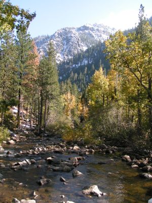
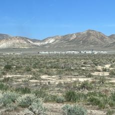
Carson River, River system in Nevada, United States

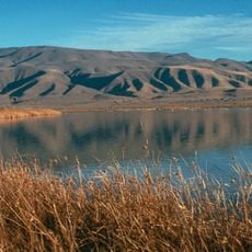
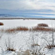
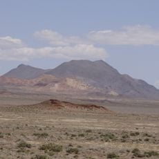
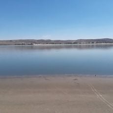
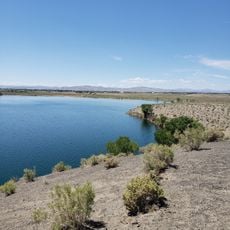
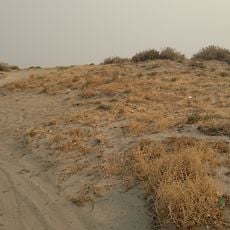
The Carson River is a river system that flows for about 131 miles across northwestern Nevada, passing through multiple counties including Carson City. The waterway connects the Sierra Nevada mountains to the region's valleys and plains, shaping the landscape with its wetlands and stream channels.

The river received its name during John C. Frémont's 1844 expedition, when scout Kit Carson guided the party through Carson Valley. This exploration marked a turning point for European settlement in the region.

Northern Paiute communities settled along the lower river and continue to value the fish and plants that grow in the region as important food sources.

Water access is easiest at Riverview Park and Carson River Park, where boat ramps and parking are available. These areas also serve as starting points for hiking and fishing, though visitors should check current water conditions before entering the water.

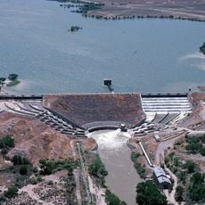
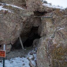
River sediments contain mercury residue from 1800s mining operations, leading to its designation as a Superfund site. This environmental history continues to shape protection measures and how the water is used today.

The community of curious travelers

AroundUs brings together thousands of curated places, local tips, and hidden gems, enriched daily by 60,000 contributors worldwide.

Start exploring
Location
Location
Location
Location
Location
GPS coordinates
39.71306,-118.65583
Latest update
December 7, 2025 20:23
Around this place
Lovelock Correctional Center
United States of America

Lovelock Correctional Center

61.2 km
Lovelock Cave
United States of America

Lovelock Cave

29 km
Sand Mountain
United States of America

Sand Mountain

50.2 km
Lahontan State Recreation Area
United States of America

Lahontan State Recreation Area

50.6 km
Lahontan Dam
United States of America

Lahontan Dam

44.8 km
Humboldt Cave
United States of America

Humboldt Cave

19.6 km
Stillwater National Wildlife Refuge
United States of America

Stillwater National Wildlife Refuge

23.1 km
Fallon National Wildlife Refuge
United States of America

Fallon National Wildlife Refuge

5.5 km
Salmon Creek Railroad
United States of America

Salmon Creek Railroad

25.2 km
Pershing County Courthouse
United States of America

Pershing County Courthouse

49.6 km
Marzen House
United States of America

Marzen House

53.1 km
Oats Park Grammar School
United States of America

Oats Park Grammar School

28.3 km
Harmon School
United States of America

Harmon School

24.9 km
Holy Trinity Episcopal Church
United States of America

Holy Trinity Episcopal Church

28.9 km
Churchill County Jail
United States of America

Churchill County Jail

28.5 km
Churchill County Courthouse
United States of America

Churchill County Courthouse

28.6 km
Fallon City Hall
United States of America

Fallon City Hall

28.5 km
Wadsworth Union Church
United States of America

Wadsworth Union Church

54.5 km
Robert L. Douglass House
United States of America

Robert L. Douglass House

28.5 km
The Cottage Schools
United States of America

The Cottage Schools

28.7 km
Topog Peak
United States of America

Topog Peak

19.4 km
Ragged Top Mountain
United States of America

Ragged Top Mountain

38.2 km
Vocational-Agriculture Building
United States of America

Vocational-Agriculture Building

60 km
U.S. Post Office-Lovelock Main
United States of America

U.S. Post Office-Lovelock Main

54.3 km
Maine Street Historic District
United States of America

Maine Street Historic District

28.7 km
Silver Springs Beach
United States of America

Silver Springs Beach

59.4 km
Soda Lake Beach
United States of America

Soda Lake Beach

29 km
Churchill Beach
United States of America

Churchill Beach

44.9 km
Show the full map
Reviews
Share your experience

No review yet

Discussions
Start a discussion...

No discussion yet

« Carson River - River system in Nevada, United States » is provided by Around Us (aroundus.com). Images and texts are derived from Wikimedia project under a Creative Commons license. You are allowed to copy, distribute, and modify copies of this page, under the conditions set by the license, as long as this note is clearly visible.

Discover hidden gems everywhere you go!

From secret cafés to breathtaking viewpoints, skip the crowded tourist spots and find places that match your style. Our app makes it easy with voice search, smart filtering, route optimization, and insider tips from travelers worldwide. Download now for the complete mobile experience.

Around Us App Screenshot

A unique approach to discovering new places

Le Figaro

All the places worth exploring

France Info

A tailor-made excursion in just a few clicks

20 Minutes

Around Us
Travel Guide & Maps
Download

Send to your phone

QR Code
1

Open the camera app on your mobile.

2

Point at the QR code with your camera. A notification will appear.

3

Tap the notification to open the link.