Chest opened
+${chestReward.xp} XP
Explorer
NOUVEAU ×${chestReward.collectible.quantity}
tapez pour fermer
Chest locked

Open chests in the app

Around Us is built for your phone — chests unlock when you walk, explore and capture nearby places.

Enable Location

We need your location to show you interesting places around you

Discover nearby places

Find interesting locations and hidden gems around you

Precise directions

Get accurate directions and distances to places

Your location is never shared with other users. It's only used when you tap the location button.

Empire

Log in to your account

Start exploring — it's free

Trusted by 72,881 travelers worldwide

Continue with Google
Continue with Apple
or

We will send you a code to connect

By continuing, you accept our Terms and Conditions and our Privacy Policy

Check your inbox

We've sent a pincode in your inbox. Please enter the code below.

Discussion Reviews 1 Photos
31.5k Popularity

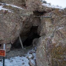
Empire, Mining ghost town in Nevada, United States

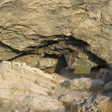
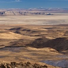
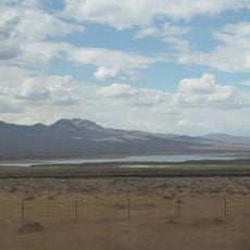
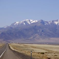
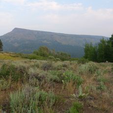
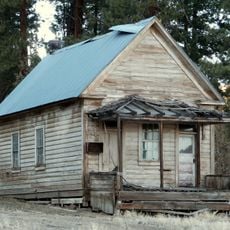
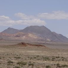
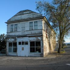
Empire is an abandoned settlement in Washoe County located at 4,036 feet (1,229 m) elevation across desert terrain featuring empty industrial structures and residential streets. The buildings show the layout and architecture of what was once a fully operating company-sponsored town.

A gypsum deposit was discovered at the site in 1907, and the U.S. Gypsum Corporation established it as a company town in 1948. The settlement operated successfully for decades before closure in the late 1900s.

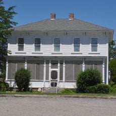
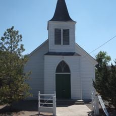
The settlement was named after the mining company and once served as a social hub with a golf course, swimming pool, and places of worship for its 750 residents. These amenities show how the employer tried to build a complete town rather than just a workplace.

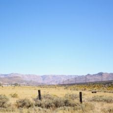
Visitors should prepare for a remote desert location without modern amenities or running services currently available. The cooler months are better for exploring because summer heat can be quite intense in this area.

For years after the town closed, two llamas named Tony Llama and Llama Bahama were the only residents living on the grounds. These unexpected inhabitants became a local symbol of the place's persistence during its long dormancy.

The community of curious travelers

AroundUs brings together thousands of curated places, local tips, and hidden gems, enriched daily by 60,000 contributors worldwide.

Start exploring
Location
GPS coordinates
40.57556,-119.34111
Latest update
December 20, 2025 01:19
Around this place
Fly Geyser
United States of America

Fly Geyser

31.6 km
Lovelock Cave
United States of America

Lovelock Cave

95.3 km
Beckwourth Pass
United States of America

Beckwourth Pass

108.9 km
Thunder Mountain Monument
United States of America

Thunder Mountain Monument

102.5 km
Black Rock Desert – High Rock Canyon Emigrant Trails National Conservation Area
United States of America

Black Rock Desert – High Rock Canyon Emigrant Trails National Conservation Area

44.4 km
Rye Patch Reservoir
United States of America

Rye Patch Reservoir

88.1 km
South Warner Wilderness
United States of America

South Warner Wilderness

110.3 km
United States of America

Black Rock Desert Wilderness

86.7 km
Rye Patch State Recreation Area
United States of America

Rye Patch State Recreation Area

88.1 km
Star Peak
United States of America

Star Peak

99.2 km
Reno Air Defense Sector
United States of America

Reno Air Defense Sector

112.8 km
Eagle Peak
United States of America

Eagle Peak

106.9 km
Humboldt Cave
United States of America

Humboldt Cave

93.5 km
High Rock Canyon Wilderness
United States of America

High Rock Canyon Wilderness

90.7 km
Anaho Island National Wildlife Refuge
United States of America

Anaho Island National Wildlife Refuge

70.7 km
Fallon National Wildlife Refuge
United States of America

Fallon National Wildlife Refuge

110.4 km
Dodge Reservoir
United States of America

Dodge Reservoir

80.1 km
Hat Mountain
United States of America

Hat Mountain

91.9 km
Pershing County Courthouse
United States of America

Pershing County Courthouse

85.9 km
Marzen House
United States of America

Marzen House

85.7 km
Roop's Fort
United States of America

Roop's Fort

112.6 km
Gerlach Water Tower
United States of America

Gerlach Water Tower

8.5 km
Wadsworth Union Church
United States of America

Wadsworth Union Church

104.8 km
Jess Valley Schoolhouse
United States of America

Jess Valley Schoolhouse

112.1 km
Topog Peak
United States of America

Topog Peak

96.2 km
Ragged Top Mountain
United States of America

Ragged Top Mountain

76.1 km
Standish Hall
United States of America

Standish Hall

94.4 km
Vocational-Agriculture Building
United States of America

Vocational-Agriculture Building

76.5 km
Show the full map
Reviews
Share your experience

No review yet

Discussions
Start a discussion...

No discussion yet

« Empire - Mining ghost town in Nevada, United States » is provided by Around Us (aroundus.com). Images and texts are derived from Wikimedia project under a Creative Commons license. You are allowed to copy, distribute, and modify copies of this page, under the conditions set by the license, as long as this note is clearly visible.

Discover hidden gems everywhere you go!

From secret cafés to breathtaking viewpoints, skip the crowded tourist spots and find places that match your style. Our app makes it easy with voice search, smart filtering, route optimization, and insider tips from travelers worldwide. Download now for the complete mobile experience.

Around Us App Screenshot

A unique approach to discovering new places

Le Figaro

All the places worth exploring

France Info

A tailor-made excursion in just a few clicks

20 Minutes

Around Us
Travel Guide & Maps
Download

Send to your phone

QR Code
1

Open the camera app on your mobile.

2

Point at the QR code with your camera. A notification will appear.

3

Tap the notification to open the link.