Enable Location

We need your location to show you interesting places around you

Discover nearby places

Find interesting locations and hidden gems around you

Precise directions

Get accurate directions and distances to places

Your location is never shared with other users. It's only used when you tap the location button.

South Warner Wilderness

Log in to your account

Start exploring — it's free

Trusted by 61,941 travelers worldwide

Continue with Google
Continue with Apple
or

We will send you a code to connect

By continuing, you accept our Terms and Conditions and our Privacy Policy

Check your inbox

We've sent a pincode in your inbox. Please enter the code below.

South Warner Wilderness

South Warner Wilderness, Nature reserve in Modoc County, US

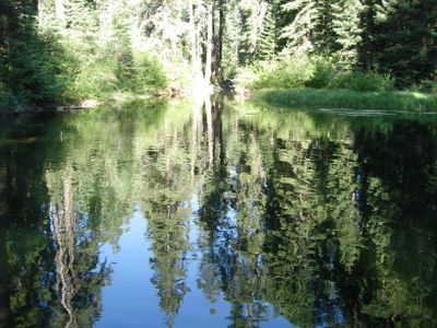
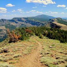
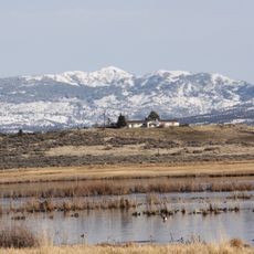
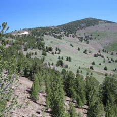
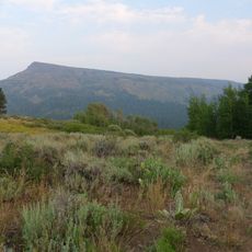
South Warner Wilderness is a large protected nature reserve in the Warner Mountains of northeastern California, featuring elevations between 4,800 and 9,900 feet. The landscape includes forested slopes, alpine meadows, and rocky peaks connected by well-maintained trail systems that wind through the terrain.

The U.S. Forest Service first recognized this area as a primitive region in 1931, and the Wilderness Act of 1964 gave it official protected status. This legal designation has kept the landscape largely undeveloped and unchanged since then.

Native American peoples lived in these mountains and used the land's resources for generations before European settlement changed the region. Walking through the area today, you can sense how these communities moved through the landscape and depended on its natural gifts.

Eight trailheads give you different entry points for exploring, and about 79 miles of paths are suitable for various skill levels. You can hike, ride horses, or fish in several lakes and streams, though weather and conditions can change quickly at higher elevations.

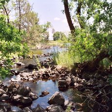
The crest of the Warner Mountains divides water flow between two completely different drainage systems that are worlds apart. On one side water flows toward the Sacramento River, while on the other side it feeds alkali lakes of the Great Basin - a geological boundary you can cross while hiking.

The community of curious travelers

AroundUs brings together thousands of curated places, local tips, and hidden gems, enriched daily by 60,000 contributors worldwide.

Start exploring
Location
Operator
US Forest Service
GPS coordinates
41.33376,-120.18629
Latest update
December 11, 2025 18:03
Around this place
Fly Geyser
United States of America

Fly Geyser

89 km
Modoc National Forest
United States of America

Modoc National Forest

87.9 km
Ahjumawi Lava Springs State Park
United States of America

Ahjumawi Lava Springs State Park

105.4 km
Sheldon National Wildlife Refuge
United States of America

Sheldon National Wildlife Refuge

92.9 km
Clear Lake National Wildlife Refuge
United States of America

Clear Lake National Wildlife Refuge

96.8 km
Modoc National Wildlife Refuge
United States of America

Modoc National Wildlife Refuge

31 km
Greaser Petroglyph Site
United States of America

Greaser Petroglyph Site

99.6 km
Eagle Peak
United States of America

Eagle Peak

5.7 km
Goose Lake State Recreation Area
United States of America

Goose Lake State Recreation Area

74.4 km
United States of America

Little High Rock Canyon Wilderness

66.8 km
United States of America

High Rock Lake Wilderness

81.8 km
High Rock Canyon Wilderness
United States of America

High Rock Canyon Wilderness

61.4 km
United States of America

North Black Rock Range Wilderness

96.5 km
Hunter's Hot Springs
United States of America

Hunter's Hot Springs

99.9 km
United States of America

Calico Mountains Wilderness

87.6 km
United States of America

East Fork High Rock Canyon Wilderness

70.2 km
Booth State Scenic Corridor
United States of America

Booth State Scenic Corridor

100.7 km
Goose Lake meteorite
United States of America

Goose Lake meteorite

77.8 km
United States of America

Pahute Peak Wilderness

98.2 km
Dodge Reservoir
United States of America

Dodge Reservoir

40.9 km
Hat Mountain
United States of America

Hat Mountain

21.2 km
Deep Creek Falls
United States of America

Deep Creek Falls

95.6 km
Lake County Round Sale Barn
United States of America

Lake County Round Sale Barn

97 km
John N. and Cornelia Watson House
United States of America

John N. and Cornelia Watson House

96.2 km
William P. Heryford House
United States of America

William P. Heryford House

96.1 km
Alger Theatre
United States of America

Alger Theatre

96.1 km
Niles Theater
United States of America

Niles Theater

34.1 km
Timber Mountain Lookout
United States of America

Timber Mountain Lookout

98.4 km
Show the full map
« South Warner Wilderness - Nature reserve in Modoc County, US » is provided by Around Us (aroundus.com). Images and texts are derived from Wikimedia project under a Creative Commons license. You are allowed to copy, distribute, and modify copies of this page, under the conditions set by the license, as long as this note is clearly visible.

Discover hidden gems everywhere you go!

From secret cafés to breathtaking viewpoints, skip the crowded tourist spots and find places that match your style. Our app makes it easy with voice search, smart filtering, route optimization, and insider tips from travelers worldwide. Download now for the complete mobile experience.

Around Us App Screenshot

A unique approach to discovering new places

Le Figaro

All the places worth exploring

France Info

A tailor-made excursion in just a few clicks

20 Minutes

Around Us
Travel Guide & Maps
Download

Send to your phone

QR Code
1

Open the camera app on your mobile.

2

Point at the QR code with your camera. A notification will appear.

3

Tap the notification to open the link.