Enable Location

We need your location to show you interesting places around you

Discover nearby places

Find interesting locations and hidden gems around you

Precise directions

Get accurate directions and distances to places

Your location is never shared with other users. It's only used when you tap the location button.

Ahjumawi Lava Springs State Park

Log in to your account

Start exploring — it's free

Trusted by 63,020 travelers worldwide

Continue with Google
Continue with Apple
or

We will send you a code to connect

By continuing, you accept our Terms and Conditions and our Privacy Policy

Check your inbox

We've sent a pincode in your inbox. Please enter the code below.

Discussion Reviews 1 Photos
7.1k Popularity

Ahjumawi Lava Springs State Park, State park in Shasta County, California, United States

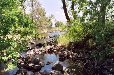
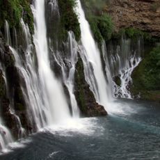
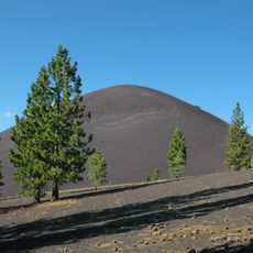
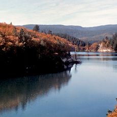
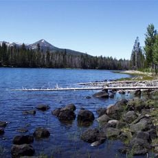
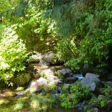
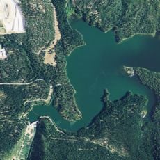
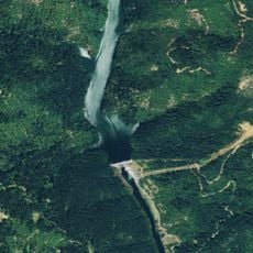
Ahjumawi Lava Springs State Park is a protected area in Shasta County featuring black basalt formations, freshwater springs, and about 13 miles of shoreline along interconnected waterways and lakes. The terrain spans roughly 5,930 acres of volcanic landscape with varied scenery.

The state of California acquired this land in 1975, transforming a former muskrat farm and utility company property into a protected natural area. This conversion preserved the volcanic landscape from further development.

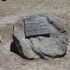
The name Ahjumawi comes from the Achomawi people, one of the Pit River Tribe bands, who constructed stone fish traps along the shoreline that remain visible today. These structures show how the original inhabitants worked with the waterways.

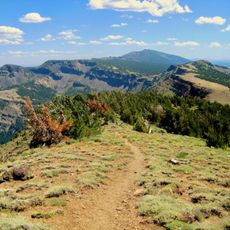
Access to the park requires using the boat launch at the Rat Farm site, which leads to three basic campsites and about 20 miles of hiking trails through volcanic terrain. The area is particularly accessible for visitors with their own boats.

The area contains one of North America's largest spring systems, discharging roughly 1.2 billion gallons of fresh water daily from Medicine Lake Volcano snowmelt. This high water output is a notable feature that shapes the ecosystem.

The community of curious travelers

AroundUs brings together thousands of curated places, local tips, and hidden gems, enriched daily by 60,000 contributors worldwide.

Start exploring
Location
Inception
1975
GPS coordinates
41.13610,-121.41800
Latest update
December 9, 2025 18:40
Around this place
Show the full map
Reviews
Share your experience

No review yet

Discussions
Start a discussion...

No discussion yet

« Ahjumawi Lava Springs State Park - State park in Shasta County, California, United States » is provided by Around Us (aroundus.com). Images and texts are derived from Wikimedia project under a Creative Commons license. You are allowed to copy, distribute, and modify copies of this page, under the conditions set by the license, as long as this note is clearly visible.

Discover hidden gems everywhere you go!

From secret cafés to breathtaking viewpoints, skip the crowded tourist spots and find places that match your style. Our app makes it easy with voice search, smart filtering, route optimization, and insider tips from travelers worldwide. Download now for the complete mobile experience.

Around Us App Screenshot

A unique approach to discovering new places

Le Figaro

All the places worth exploring

France Info

A tailor-made excursion in just a few clicks

20 Minutes

Around Us
Travel Guide & Maps
Download

Send to your phone

QR Code
1

Open the camera app on your mobile.

2

Point at the QR code with your camera. A notification will appear.

3

Tap the notification to open the link.