Enable Location

We need your location to show you interesting places around you

Discover nearby places

Find interesting locations and hidden gems around you

Precise directions

Get accurate directions and distances to places

Your location is never shared with other users. It's only used when you tap the location button.

Modoc National Forest

Log in to your account

Start exploring — it's free

Trusted by 61,940 travelers worldwide

Continue with Google
Continue with Apple
or

We will send you a code to connect

By continuing, you accept our Terms and Conditions and our Privacy Policy

Check your inbox

We've sent a pincode in your inbox. Please enter the code below.

Modoc National Forest

Modoc National Forest, National forest in northeastern California, United States.

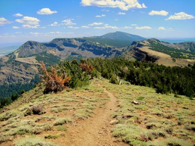
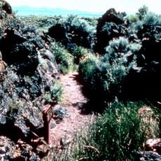
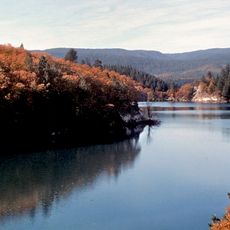
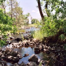
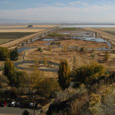
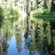
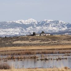
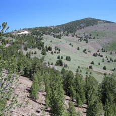
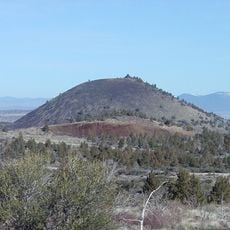
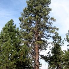
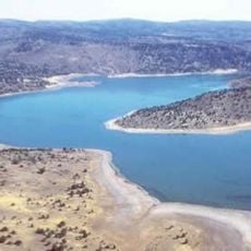
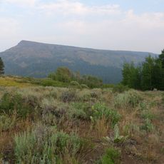
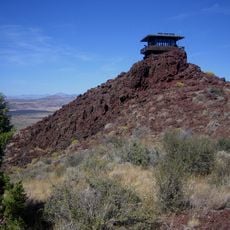
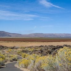
Modoc National Forest is a large protected area in northeastern California featuring forests and open landscapes shaped by geology. The terrain shows volcanic formations, pine stands, sagebrush grasslands, wetland areas, and mountain ranges with desert characteristics.

Protection of this land came in 1964 when the U.S. Forest Service formally established it as a national forest. The move followed decades of management efforts aimed at preserving the region's natural resources and landscapes.

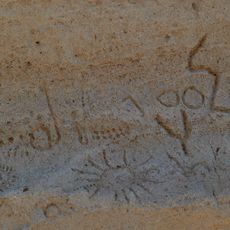
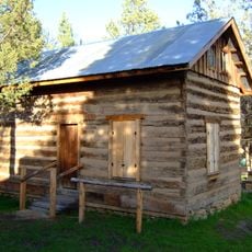
This land was home to the Modoc people for many generations, who lived and moved through it seasonally. You can find traces of their occupation scattered across the forest in the form of old camp sites and tool remains.

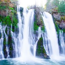
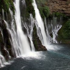
The forest is accessible via U.S. Highway 395 and connecting state roads, with several developed campgrounds available for overnight stays. Hiking trails and fishing spots are spread throughout the protected area for different skill levels and interests.

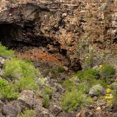
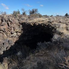
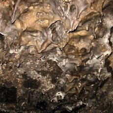
Hidden beneath the forest floor lies an extensive network of lava tubes that form natural caves. Visitors can descend into several of these underground passages and explore their volcanic structure firsthand.

The community of curious travelers

AroundUs brings together thousands of curated places, local tips, and hidden gems, enriched daily by 60,000 contributors worldwide.

Start exploring
Operator
United States Forest Service
GPS coordinates
41.45111,-121.22728
Latest update
December 8, 2025 19:53
Around this place
Burney Falls
United States of America

Burney Falls

60.4 km
Lava Beds National Monument
United States of America

Lava Beds National Monument

37.5 km
Medicine Lake Volcano
United States of America

Medicine Lake Volcano

34.3 km
McArthur-Burney Falls Memorial State Park
United States of America

McArthur-Burney Falls Memorial State Park

59.8 km
Captain Jack's Stronghold
United States of America

Captain Jack's Stronghold

47.3 km
Lake Britton
United States of America

Lake Britton

60.8 km
Ahjumawi Lava Springs State Park
United States of America

Ahjumawi Lava Springs State Park

38.5 km
Tule Lake National Wildlife Refuge
United States of America

Tule Lake National Wildlife Refuge

53.3 km
Clear Lake National Wildlife Refuge
United States of America

Clear Lake National Wildlife Refuge

46.6 km
South Warner Wilderness
United States of America

South Warner Wilderness

87.9 km
Modoc National Wildlife Refuge
United States of America

Modoc National Wildlife Refuge

59.1 km
Eagle Peak
United States of America

Eagle Peak

87.8 km
Petroglyph Point Archaeological Site
United States of America

Petroglyph Point Archaeological Site

45.9 km
Goose Lake State Recreation Area
United States of America

Goose Lake State Recreation Area

96.4 km
Schonchin Butte
United States of America

Schonchin Butte

40.6 km
Klamath Basin National Wildlife Refuge Complex
United States of America

Klamath Basin National Wildlife Refuge Complex

61.9 km
Canby's Cross
United States of America

Canby's Cross

48.7 km
Goose Lake meteorite
United States of America

Goose Lake meteorite

81.9 km
Pit 3 Dam
United States of America

Pit 3 Dam

60.8 km
Fort Crook
United States of America

Fort Crook

47 km
Dodge Reservoir
United States of America

Dodge Reservoir

105.9 km
Hat Mountain
United States of America

Hat Mountain

98 km
Tule Lake National Monument
United States of America

Tule Lake National Monument

50.3 km
Schonchin Butte Lookout
United States of America

Schonchin Butte Lookout

40.6 km
Skull Cave
United States of America

Skull Cave

39.1 km
Mushpot Cave
United States of America

Mushpot Cave

37.5 km
Hospital Rock Trail
United States of America

Hospital Rock Trail

47.1 km
Lava Beds Visitor Center
United States of America

Lava Beds Visitor Center

37.6 km
Show the full map
« Modoc National Forest - National forest in northeastern California, United States » is provided by Around Us (aroundus.com). Images and texts are derived from Wikimedia project under a Creative Commons license. You are allowed to copy, distribute, and modify copies of this page, under the conditions set by the license, as long as this note is clearly visible.

Discover hidden gems everywhere you go!

From secret cafés to breathtaking viewpoints, skip the crowded tourist spots and find places that match your style. Our app makes it easy with voice search, smart filtering, route optimization, and insider tips from travelers worldwide. Download now for the complete mobile experience.

Around Us App Screenshot

A unique approach to discovering new places

Le Figaro

All the places worth exploring

France Info

A tailor-made excursion in just a few clicks

20 Minutes

Around Us
Travel Guide & Maps
Download

Send to your phone

QR Code
1

Open the camera app on your mobile.

2

Point at the QR code with your camera. A notification will appear.

3

Tap the notification to open the link.