Enable Location

We need your location to show you interesting places around you

Discover nearby places

Find interesting locations and hidden gems around you

Precise directions

Get accurate directions and distances to places

Your location is never shared with other users. It's only used when you tap the location button.

Dodge Reservoir

Log in to your account

Start exploring — it's free

Trusted by 62,367 travelers worldwide

Continue with Google
Continue with Apple
or

We will send you a code to connect

By continuing, you accept our Terms and Conditions and our Privacy Policy

Check your inbox

We've sent a pincode in your inbox. Please enter the code below.

Dodge Reservoir

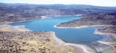
Dodge Reservoir, Lassen County, California

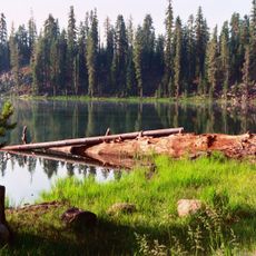
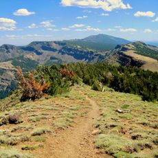
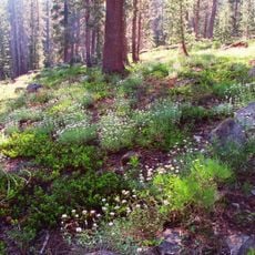
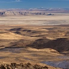
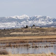
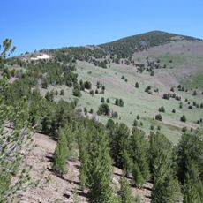
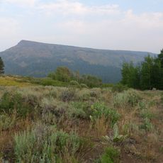
Dodge Reservoir is a large body of water set in California's high desert, covering about 480 acres and surrounded by gentle hills with sagebrush and scattered junipers. The water level changes seasonally, reaching its highest point in spring and early summer.

The reservoir was built in 1937 by the Dodge Brothers to supply irrigation water for nearby farmland. Over time it shifted from serving only agricultural needs to becoming a spot for outdoor recreation while the Dodge Ranch retained its water rights.

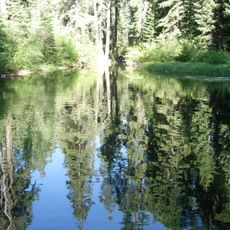
The reservoir reflects a rural way of life where farming and nature coexist in the high desert landscape. Visitors experience the quiet natural surroundings with their characteristic sounds - wind moving through junipers and water lapping gently at the shoreline.

Access is via the unpaved County Road 506, which can be rough or muddy after rain and suits vehicles with trailers but remains dusty and uneven. Check water and road conditions with the Eagle Lake Field Office before visiting, as these change significantly with the seasons.

The reservoir has no minimum water level requirement since the Dodge Ranch controls the water rights with no legal floor for water retention. This means the water level can vary dramatically from year to year, which may surprise visitors expecting more constant conditions.

The community of curious travelers

AroundUs brings together thousands of curated places, local tips, and hidden gems, enriched daily by 60,000 contributors worldwide.

Start exploring
Location
GPS coordinates
40.96820,-120.13800
Latest update
February 9, 2026 07:46
Around this place
Fly Geyser
United States of America

Fly Geyser

68.9 km
Allen Telescope Array
United States of America

Allen Telescope Array

113.6 km
Cinder Cone and the Fantastic Lava Beds
United States of America

Cinder Cone and the Fantastic Lava Beds

110 km
Lassen National Forest
United States of America

Lassen National Forest

97.9 km
Modoc National Forest
United States of America

Modoc National Forest

105.9 km
Ahjumawi Lava Springs State Park
United States of America

Ahjumawi Lava Springs State Park

109.1 km
Hat Creek Radio Observatory
United States of America

Hat Creek Radio Observatory

113.6 km
Caribou Wilderness
United States of America

Caribou Wilderness

104.9 km
Black Rock Desert – High Rock Canyon Emigrant Trails National Conservation Area
United States of America

Black Rock Desert – High Rock Canyon Emigrant Trails National Conservation Area

91.2 km
South Warner Wilderness
United States of America

South Warner Wilderness

40.9 km
Modoc National Wildlife Refuge
United States of America

Modoc National Wildlife Refuge

63.1 km
Eagle Peak
United States of America

Eagle Peak

35.5 km
United States of America

Little High Rock Canyon Wilderness

69.8 km
United States of America

High Rock Lake Wilderness

81.6 km
High Rock Canyon Wilderness
United States of America

High Rock Canyon Wilderness

73.7 km
United States of America

North Black Rock Range Wilderness

105.8 km
United States of America

Calico Mountains Wilderness

76.9 km
United States of America

East Fork High Rock Canyon Wilderness

83.4 km
United States of America

Pahute Peak Wilderness

97.9 km
Hosselkus Limestone
United States of America

Hosselkus Limestone

112.5 km
Hat Mountain
United States of America

Hat Mountain

20.2 km
Roop's Fort
United States of America

Roop's Fort

75.1 km
Gerlach Water Tower
United States of America

Gerlach Water Tower

74.8 km
Horseshoe Lake Ranger Station
United States of America

Horseshoe Lake Ranger Station

114.7 km
Standish Hall
United States of America

Standish Hall

71.3 km
Lassen County Court House
United States of America

Lassen County Court House

75.7 km
Fort Crook Museum
United States of America

Fort Crook Museum

109.9 km
Niles Theater
United States of America

Niles Theater

66.6 km
Show the full map
« Dodge Reservoir - Lassen County, California » is provided by Around Us (aroundus.com). Images and texts are derived from Wikimedia project under a Creative Commons license. You are allowed to copy, distribute, and modify copies of this page, under the conditions set by the license, as long as this note is clearly visible.

Discover hidden gems everywhere you go!

From secret cafés to breathtaking viewpoints, skip the crowded tourist spots and find places that match your style. Our app makes it easy with voice search, smart filtering, route optimization, and insider tips from travelers worldwide. Download now for the complete mobile experience.

Around Us App Screenshot

A unique approach to discovering new places

Le Figaro

All the places worth exploring

France Info

A tailor-made excursion in just a few clicks

20 Minutes

Around Us
Travel Guide & Maps
Download

Send to your phone

QR Code
1

Open the camera app on your mobile.

2

Point at the QR code with your camera. A notification will appear.

3

Tap the notification to open the link.