Chest opened
+${chestReward.xp} XP
Explorer
NOUVEAU ×${chestReward.collectible.quantity}
tapez pour fermer

See the monuments around you in AR Open chests in the app

Around Us is built for your phone — point your camera at the streets and discover the monuments and places around you in augmented reality. Around Us is built for your phone — chests unlock when you walk, explore and capture nearby places.

Enable Location

We need your location to show you interesting places around you

Discover nearby places

Find interesting locations and hidden gems around you

Precise directions

Get accurate directions and distances to places

Your location is never shared with other users. It's only used when you tap the location button.

Log in to your account

Start exploring — it's free

Trusted by 82,263 travelers worldwide

Continue with Google
Continue with Apple
or

We will send you a code to connect

By continuing, you accept our Terms and Conditions and our Privacy Policy

Check your inbox

We've sent a pincode in your inbox. Please enter the code below.

North Black Rock Range Wilderness
Discussion Reviews Photo
2.3k Popularity

North Black Rock Range Wilderness, Protected wilderness area in northwestern Nevada, United States

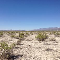
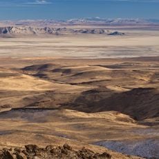
North Black Rock Range Wilderness is a protected natural area in northwestern Nevada with expansive sagebrush landscapes and multiple creek systems that wind through the terrain. The land varies between around 4,800 and 8,400 feet in elevation, offering a mix of open plateaus and rocky slopes.

The area was declared a protected wilderness in 2000 through federal legislation, establishing its permanent status as a conservation zone. This designation recognized the ecological importance of this high desert space for future generations.

Native American territories border the wilderness at Summit Lake Indian Reservation, representing ongoing connections between indigenous communities and the landscape.

The western side is accessible via a road from Soldier Meadows Ranch, and visitors should prepare for rough conditions and limited infrastructure. Navigation equipment and a vehicle suited for difficult terrain are strongly recommended.

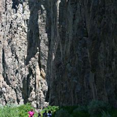
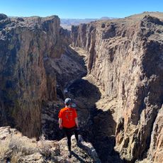
Battle and Colman Creeks harbor rare populations of Lahontan Cutthroat trout, fish that thrive in only a few western waters. The canyons of these streams form quiet sanctuaries amid the otherwise open sagebrush plains.

The community of curious travelers

AroundUs brings together thousands of curated places, local tips, and hidden gems, enriched daily by 60,000 contributors worldwide.

Start exploring
Location
GPS coordinates
41.43770,-119.03900
Latest update
August 2, 2026 17:30
Around this place
Sheldon National Wildlife Refuge
United States of America

Sheldon National Wildlife Refuge

44.5 km
Black Rock Desert – High Rock Canyon Emigrant Trails National Conservation Area
United States of America

Black Rock Desert – High Rock Canyon Emigrant Trails National Conservation Area

58.7 km
United States of America

Black Rock Desert Wilderness

34.1 km
United States of America

Little High Rock Canyon Wilderness

35.1 km
United States of America

High Rock Lake Wilderness

24.1 km
High Rock Canyon Wilderness
United States of America

High Rock Canyon Wilderness

35.2 km
United States of America

Calico Mountains Wilderness

52.4 km
United States of America

East Fork High Rock Canyon Wilderness

26.7 km
United States of America

South Jackson Mountains Wilderness

48.8 km
United States of America

North Jackson Mountains Wilderness

48.1 km
United States of America

Pahute Peak Wilderness

23.9 km
United States of America

Duffer Peak

35.4 km
United States of America

Catnip Reservoir

63.8 km
United States of America

Knott Creek Reservoir

32.9 km
United States of America

Little High Rock Reservoir

39.5 km
United States of America

Mud Meadow Reservoir

16.8 km
United States of America

Black Rock Point

51.9 km
United States of America

Captain Johnson Reservoir

59.9 km
United States of America

Alkali Reservoir

23.5 km
United States of America

Smith Lake

36.2 km
United States of America

Onion Valley Reservoir

37.8 km
United States of America

Swan Lake Reservoir

58.4 km
United States of America

Virgin Valley Reservoir

42.3 km
United States of America

Little Onion Reservoir

36 km
United States of America

Deer Creek Reservoir

43.2 km
Thousand Creek Gorge
United States of America

Thousand Creek Gorge

49.5 km
United States of America

Royal Peacock Opal Mine

39.1 km
United States of America

Thousand Creek Gorge Viewpoint

49.1 km
Show the full map
Reviews
Share your experience

No review yet

Discussions
Start a discussion...

No discussion yet

« North Black Rock Range Wilderness - Protected wilderness area in northwestern Nevada, United States » is provided by Around Us (aroundus.com). Images and texts are derived from Wikimedia project under a Creative Commons license. You are allowed to copy, distribute, and modify copies of this page, under the conditions set by the license, as long as this note is clearly visible.

Discover hidden gems everywhere you go!

From secret cafés to breathtaking viewpoints, skip the crowded tourist spots and find places that match your style. Our app makes it easy with voice search, smart filtering, route optimization, and insider tips from travelers worldwide. Download now for the complete mobile experience.

Around Us App Screenshot

A unique approach to discovering new places

Le Figaro

All the places worth exploring

France Info

A tailor-made excursion in just a few clicks

20 Minutes

Around Us
Travel Guide & Maps
Download

Send to your phone

QR Code
1

Open the camera app on your mobile.

2

Point at the QR code with your camera. A notification will appear.

3

Tap the notification to open the link.