Chest opened
+${chestReward.xp} XP
Explorer
NOUVEAU ×${chestReward.collectible.quantity}
tapez pour fermer

See the monuments around you in AR Open chests in the app

Around Us is built for your phone — point your camera at the streets and discover the monuments and places around you in augmented reality. Around Us is built for your phone — chests unlock when you walk, explore and capture nearby places.

Enable Location

We need your location to show you interesting places around you

Discover nearby places

Find interesting locations and hidden gems around you

Precise directions

Get accurate directions and distances to places

Your location is never shared with other users. It's only used when you tap the location button.

Log in to your account

Start exploring — it's free

Trusted by 83,247 travelers worldwide

Continue with Google
Continue with Apple
or

We will send you a code to connect

By continuing, you accept our Terms and Conditions and our Privacy Policy

Check your inbox

We've sent a pincode in your inbox. Please enter the code below.

South Jackson Mountains Wilderness
Discussion Reviews Photo
1.9k Popularity

South Jackson Mountains Wilderness, Protected wilderness area in Humboldt County, Nevada, United States.

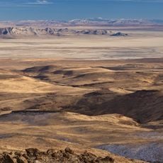
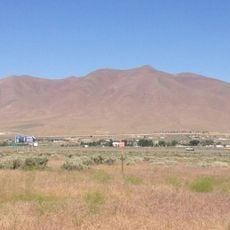
South Jackson Mountains Wilderness is a protected area in Nevada featuring granite cliffs, flowing streams, and juniper forests spread across thousands of acres. The terrain varies from lower valleys to higher ridges, creating different environments throughout the landscape.

This area experienced mining activities in the Red Butte district, where people searched for mineral deposits. Remnants like old cabins and structures from that era remain scattered throughout the wilderness today.

Indigenous communities utilized the natural resources of these mountains for generations, establishing sustainable practices for hunting and gathering.

The western side is accessible via Jackson Creek Road, while the eastern side can be reached through Trout Creek Road. Visitors should be prepared for rugged terrain and changing weather conditions in these mountains.

King Lear Peak stands at roughly 8,900 feet and attracts climbers seeking technical rock scrambling. This prominent summit offers challenging routes that draw mountaineers from across the region.

The community of curious travelers

AroundUs brings together thousands of curated places, local tips, and hidden gems, enriched daily by 60,000 contributors worldwide.

Start exploring
Location
GPS coordinates
41.20600,-118.54300
Latest update
August 12, 2026 11:38
Around this place
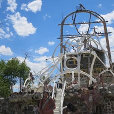
Thunder Mountain Monument
United States of America

Thunder Mountain Monument

69.9 km
Black Rock Desert – High Rock Canyon Emigrant Trails National Conservation Area
United States of America

Black Rock Desert – High Rock Canyon Emigrant Trails National Conservation Area

54.2 km
United States of America

Black Rock Desert Wilderness

17.9 km
United States of America

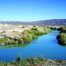
Trego Hot Springs

70.5 km
United States of America

Little High Rock Canyon Wilderness

69.2 km
United States of America

High Rock Lake Wilderness

58.5 km
United States of America

North Black Rock Range Wilderness

48.8 km
United States of America

Calico Mountains Wilderness

62.3 km
United States of America

East Fork High Rock Canyon Wilderness

71.8 km
Winnemucca Mountain
United States of America

Winnemucca Mountain

68.5 km
United States of America

North Jackson Mountains Wilderness

18.3 km
United States of America

Pahute Peak Wilderness

40.2 km
United States of America

Duffer Peak

52.7 km
United States of America

Adorno Station

68.1 km
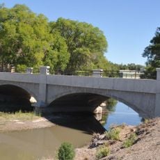
Humboldt River Bridge
United States of America

Humboldt River Bridge

72.2 km
United States of America

Alpha Butte

48.6 km
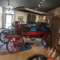
Humboldt Museum
United States of America

Humboldt Museum

71.8 km
United States of America

Upper Pitt-Taylor Reservoir

65.5 km
United States of America

Poker Brown Beach

69.8 km
United States of America

Koepato To

50 km
United States of America

Mud Meadow Reservoir

53.8 km
United States of America

Black Rock Point

46.4 km
United States of America

Alkali Reservoir

69.1 km
United States of America

Knott Creek Reservoir

55.6 km
United States of America

Little Onion Reservoir

55.9 km
United States of America

Onion Valley Reservoir

56.9 km
United States of America

Deer Creek Reservoir

20.1 km
United States of America

Onion Valley Campground

56.5 km
Show the full map
Reviews
Share your experience

No review yet

Discussions
Start a discussion...

No discussion yet

« South Jackson Mountains Wilderness - Protected wilderness area in Humboldt County, Nevada, United States » is provided by Around Us (aroundus.com). Images and texts are derived from Wikimedia project under a Creative Commons license. You are allowed to copy, distribute, and modify copies of this page, under the conditions set by the license, as long as this note is clearly visible.

Discover hidden gems everywhere you go!

From secret cafés to breathtaking viewpoints, skip the crowded tourist spots and find places that match your style. Our app makes it easy with voice search, smart filtering, route optimization, and insider tips from travelers worldwide. Download now for the complete mobile experience.

Around Us App Screenshot

A unique approach to discovering new places

Le Figaro

All the places worth exploring

France Info

A tailor-made excursion in just a few clicks

20 Minutes

Around Us
Travel Guide & Maps
Download

Send to your phone

QR Code
1

Open the camera app on your mobile.

2

Point at the QR code with your camera. A notification will appear.

3

Tap the notification to open the link.