Enable Location

We need your location to show you interesting places around you

Discover nearby places

Find interesting locations and hidden gems around you

Precise directions

Get accurate directions and distances to places

Your location is never shared with other users. It's only used when you tap the location button.

Caribou Wilderness

Log in to your account

Start exploring — it's free

Trusted by 62,370 travelers worldwide

Continue with Google
Continue with Apple
or

We will send you a code to connect

By continuing, you accept our Terms and Conditions and our Privacy Policy

Check your inbox

We've sent a pincode in your inbox. Please enter the code below.

Caribou Wilderness

Caribou Wilderness, Nature reserve in Plumas County, US

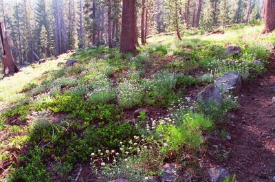
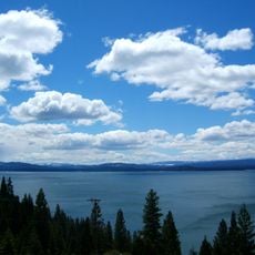
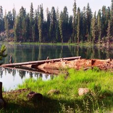
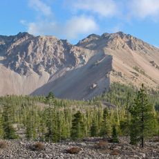
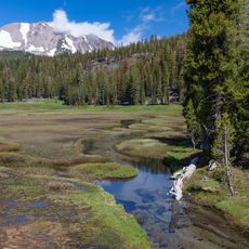
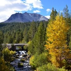
Caribou Wilderness is a nature reserve with volcanic plateaus, clear lakes, and dense conifer forests across rolling terrain. The landscape features open meadows interspersed with forested slopes and numerous water sources that create varied hiking opportunities for visitors.

The area was designated as a primitive zone by the US Forest Service in 1932 and gained status in the National Wilderness Preservation System in 1964. These protections secured the landscape against major development and maintained its natural character.

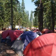
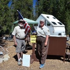
The wilderness area maintains strict preservation protocols, limiting human interference while allowing activities such as hiking, fishing, and nature photography within its boundaries.

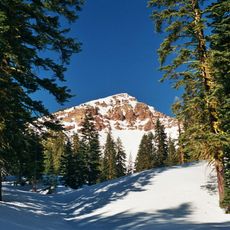
The reserve is accessible through multiple trailheads and offers the best conditions from late spring through early fall for safe outdoor activity. Visitors should prepare for changeable mountain weather and pack waterproof gear.

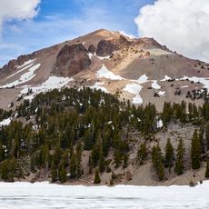
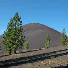
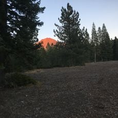
The area contains Red Cinder Peak and serves as the headwaters source for the Susan River and Bailey Creek, which flow into the Feather River watershed. These hidden water systems feed the valleys below and often go unnoticed by visitors.

The community of curious travelers

AroundUs brings together thousands of curated places, local tips, and hidden gems, enriched daily by 60,000 contributors worldwide.

Start exploring
Location
Operator
United States Forest Service
GPS coordinates
40.48874,-121.20878
Latest update
December 10, 2025 20:04
Around this place
Lassen Peak
United States of America

Lassen Peak

25.1 km
Lake Almanor
United States of America

Lake Almanor

26.6 km
Mount Tehama
United States of America

Mount Tehama

30.1 km
Cinder Cone and the Fantastic Lava Beds
United States of America

Cinder Cone and the Fantastic Lava Beds

11.5 km
Lassen National Forest
United States of America

Lassen National Forest

15.1 km
Geothermal areas in Lassen Volcanic National Park
United States of America

Geothermal areas in Lassen Volcanic National Park

25.1 km
Chaos Crags
United States of America

Chaos Crags

26.7 km
Nobles Emigrant Trail
United States of America

Nobles Emigrant Trail

19.4 km
Mount Harkness Fire Lookout
United States of America

Mount Harkness Fire Lookout

10.1 km
Lassen Volcanic National Park Highway Historic District
United States of America

Lassen Volcanic National Park Highway Historic District

25.6 km
Warner Valley Ranger Station
United States of America

Warner Valley Ranger Station

15.7 km
Horseshoe Lake Ranger Station
United States of America

Horseshoe Lake Ranger Station

10.4 km
Manzanita Lake Naturalist's Services Historic District
United States of America

Manzanita Lake Naturalist's Services Historic District

30.4 km
Summit Lake Ranger Station
United States of America

Summit Lake Ranger Station

18.5 km
Hot Rock
United States of America

Hot Rock

24.4 km
Discovery Center
United States of America

Discovery Center

30.4 km
Sulphur Works
United States of America

Sulphur Works

28.1 km
Loomis Ranger Station
United States of America

Loomis Ranger Station

30.4 km
Kohm Yah-mah-nee Visitor Center
United States of America

Kohm Yah-mah-nee Visitor Center

28.1 km
Bumpass Hell
United States of America

Bumpass Hell

25.2 km
Chaos Jumbles
United States of America

Chaos Jumbles

28.7 km
Lassen Peak Trailhead
United States of America

Lassen Peak Trailhead

25.1 km
Lassen Volcanic Center
United States of America

Lassen Volcanic Center

25.3 km
Kings Creek
United States of America

Kings Creek

13.6 km
Lost Creek Group Campground
United States of America

Lost Creek Group Campground

27.4 km
Hat Creek Culvert
United States of America

Hat Creek Culvert

21.9 km
Summit Lake North Campground
United States of America

Summit Lake North Campground

18.2 km
Manzanita Lake Campground
United States of America

Manzanita Lake Campground

30.4 km
Show the full map
« Caribou Wilderness - Nature reserve in Plumas County, US » is provided by Around Us (aroundus.com). Images and texts are derived from Wikimedia project under a Creative Commons license. You are allowed to copy, distribute, and modify copies of this page, under the conditions set by the license, as long as this note is clearly visible.

Discover hidden gems everywhere you go!

From secret cafés to breathtaking viewpoints, skip the crowded tourist spots and find places that match your style. Our app makes it easy with voice search, smart filtering, route optimization, and insider tips from travelers worldwide. Download now for the complete mobile experience.

Around Us App Screenshot

A unique approach to discovering new places

Le Figaro

All the places worth exploring

France Info

A tailor-made excursion in just a few clicks

20 Minutes

Around Us
Travel Guide & Maps
Download

Send to your phone

QR Code
1

Open the camera app on your mobile.

2

Point at the QR code with your camera. A notification will appear.

3

Tap the notification to open the link.