Enable Location

We need your location to show you interesting places around you

Discover nearby places

Find interesting locations and hidden gems around you

Precise directions

Get accurate directions and distances to places

Your location is never shared with other users. It's only used when you tap the location button.

Nobles Emigrant Trail

Log in to your account

Start exploring — it's free

Trusted by 62,371 travelers worldwide

Continue with Google
Continue with Apple
or

We will send you a code to connect

By continuing, you accept our Terms and Conditions and our Privacy Policy

Check your inbox

We've sent a pincode in your inbox. Please enter the code below.

Nobles Emigrant Trail, Historic emigrant trail in Shasta County, US.

The Nobles Emigrant Trail is a historic route that runs from the Applegate Trail in Nevada to Shasta City, California, passing through diverse landscapes and mountain passes. The path follows the journey that thousands of settlers took during the 1800s to reach northern California.

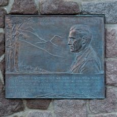
William Nobles established this alternative route in 1851 as a shorter path connecting Nevada and northern California for settlers seeking new opportunities. It quickly became an important alternative to longer existing trails and was heavily used by emigrants during the mid-1800s.

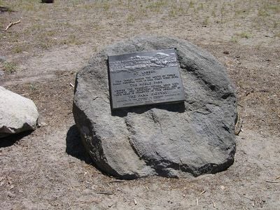
The trail displays 65 inscription plates featuring excerpts from emigrant diaries written between 1849 and 1865. These firsthand accounts reveal what daily life was like for people traveling this route to find new homes in California.

Access to the trail is available via Smoke Creek Road, which connects to Highway 395 North near Susanville, with guidance available from local BLM offices. Visitors are advised to check current conditions and signage before heading out to make the most of their experience.

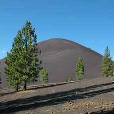
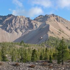
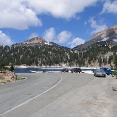
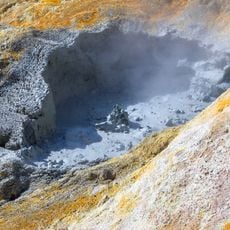
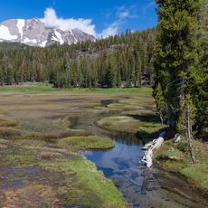
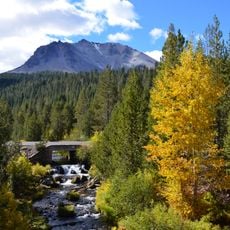
A 24-mile section within Lassen Volcanic National Park preserves wagon ruts and ground depressions that mark the original path of settlers. These physical traces offer a direct sense of the actual route that thousands of people traveled with their horses and wagons.

The community of curious travelers

AroundUs brings together thousands of curated places, local tips, and hidden gems, enriched daily by 60,000 contributors worldwide.

Start exploring
Location
Location
GPS coordinates
40.54722,-121.42472
Latest update
December 12, 2025 17:44
Around this place
Lassen Peak
United States of America

Lassen Peak

9.5 km
Cinder Cone and the Fantastic Lava Beds
United States of America

Cinder Cone and the Fantastic Lava Beds

8.9 km
Geothermal areas in Lassen Volcanic National Park
United States of America

Geothermal areas in Lassen Volcanic National Park

11.9 km
Chaos Crags
United States of America

Chaos Crags

8.5 km
Loomis Museum
United States of America

Loomis Museum

11.8 km
Lassen Volcanic National Park Highway Historic District
United States of America

Lassen Volcanic National Park Highway Historic District

8.9 km
Warner Valley Ranger Station
United States of America

Warner Valley Ranger Station

12.4 km
Horseshoe Lake Ranger Station
United States of America

Horseshoe Lake Ranger Station

11.5 km
Manzanita Lake Naturalist's Services Historic District
United States of America

Manzanita Lake Naturalist's Services Historic District

11.7 km
Summit Lake Ranger Station
United States of America

Summit Lake Ranger Station

5.4 km
Hot Rock
United States of America

Hot Rock

5.7 km
Discovery Center
United States of America

Discovery Center

11.7 km
Sulphur Works
United States of America

Sulphur Works

14.4 km
Loomis Ranger Station
United States of America

Loomis Ranger Station

11.7 km
Seismograph Building
United States of America

Seismograph Building

11.7 km
Bumpass Hell
United States of America

Bumpass Hell

12 km
Manzanita Ranger Residence
United States of America

Manzanita Ranger Residence

12.4 km
Lassen Peak Trailhead
United States of America

Lassen Peak Trailhead

10.6 km
Chaos Jumbles
United States of America

Chaos Jumbles

9.9 km
Kings Creek
United States of America

Kings Creek

14.9 km
Lassen Volcanic Center
United States of America

Lassen Volcanic Center

9.4 km
Mather Plaque in Lassen Volcanic National Park
United States of America

Mather Plaque in Lassen Volcanic National Park

11.8 km
Lost Creek Group Campground
United States of America

Lost Creek Group Campground

8 km
Hat Creek Culvert
United States of America

Hat Creek Culvert

5.5 km
Summit Lake North Campground
United States of America

Summit Lake North Campground

5.9 km
Manzanita Lake Campground
United States of America

Manzanita Lake Campground

11.9 km
Manzanita Kiosk
United States of America

Manzanita Kiosk

12.4 km
Northwest Entrance Checking Station and Ranger Residence
United States of America

Northwest Entrance Checking Station and Ranger Residence

12.4 km
Show the full map
« Nobles Emigrant Trail - Historic emigrant trail in Shasta County, US » is provided by Around Us (aroundus.com). Images and texts are derived from Wikimedia project under a Creative Commons license. You are allowed to copy, distribute, and modify copies of this page, under the conditions set by the license, as long as this note is clearly visible.

Discover hidden gems everywhere you go!

From secret cafés to breathtaking viewpoints, skip the crowded tourist spots and find places that match your style. Our app makes it easy with voice search, smart filtering, route optimization, and insider tips from travelers worldwide. Download now for the complete mobile experience.

Around Us App Screenshot

A unique approach to discovering new places

Le Figaro

All the places worth exploring

France Info

A tailor-made excursion in just a few clicks

20 Minutes

Around Us
Travel Guide & Maps
Download

Send to your phone

QR Code
1

Open the camera app on your mobile.

2

Point at the QR code with your camera. A notification will appear.

3

Tap the notification to open the link.