Summit Lake North Campground

Log in to your account

AroundUs is a community-driven map of interesting places, built by curious explorers like you. It grows with every review, story, and photo you share.
Connect to save your favorite spots, contribute locations, and create personalized routes.
Continue with Google
Continue with Apple
Continue with X
Continue with Facebook
Continue with email
By continuing, you accept our Terms and Conditions and our Privacy Policy
Create an account

Summit Lake North Campground

Add to collection
Map
Suggest a change
Share

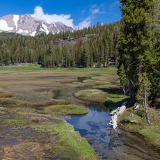
Summit Lake North Campground, Lakeside campground in Lassen Volcanic National Park, Shasta County, United States.

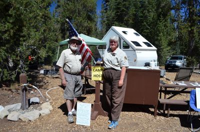
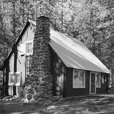
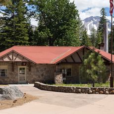
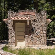
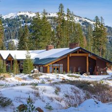
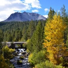
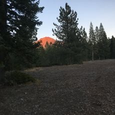
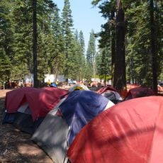
Summit Lake North Campground sits along the northern shore of the lake within the national park, with camping spots positioned under dense forest at 6,700 feet elevation. Flush toilets, drinking water, campfire rings, picnic tables, and bear-proof storage boxes are available at each site.

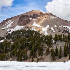
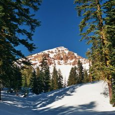
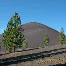
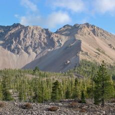
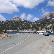
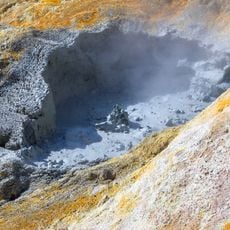
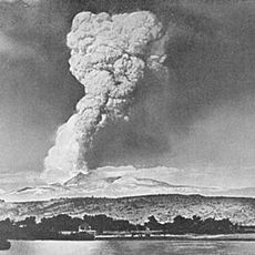
The campground was established after Lassen Volcanic National Park was created in 1916 to provide access to the park's volcanic features. Its location by the lake was chosen to connect visitors with the geothermal landscape and volcanic geology of the region.

Campfires and shared meals by the water create a social rhythm where visitors from different places naturally gather and connect with one another. This tradition of communal outdoor living remains central to how people experience and remember time spent here.

The elevation of 6,700 feet means nights can be cool, so bring warm bedding and layers even in summer. Store all food and scented items in the provided bear-proof boxes to avoid attracting wildlife to your site.

A native plant restoration effort has replanted thousands of species across the campground to restore the forest understory and increase privacy between sites. This long-term improvement work demonstrates how the park actively enhances the camping experience through habitat restoration.

Location: Shasta County

Website: https://nps.gov/lavo/planyourvisit/summit-lake-campground.htm

GPS coordinates: 40.49461,-121.42398

Latest update: December 15, 2025 13:24

Photos
Around this place
Lassen Peak
United States of America

Lassen Peak

6.9 km
Mount Tehama
United States of America

Mount Tehama

12.7 km
Cinder Cone and the Fantastic Lava Beds
United States of America

Cinder Cone and the Fantastic Lava Beds

10.7 km
Geothermal areas in Lassen Volcanic National Park
United States of America

Geothermal areas in Lassen Volcanic National Park

7.8 km
Chaos Crags
United States of America

Chaos Crags

8.9 km
Nobles Emigrant Trail
United States of America

Nobles Emigrant Trail

5.9 km
Loomis Museum
United States of America

Loomis Museum

12.6 km
Mount Harkness Fire Lookout
United States of America

Mount Harkness Fire Lookout

12.5 km
Lassen Volcanic National Park Highway Historic District
United States of America

Lassen Volcanic National Park Highway Historic District

7.4 km
Warner Valley Ranger Station
United States of America

Warner Valley Ranger Station

6.9 km
Horseshoe Lake Ranger Station
United States of America

Horseshoe Lake Ranger Station

8.3 km
Manzanita Lake Naturalist's Services Historic District
United States of America

Manzanita Lake Naturalist's Services Historic District

12.6 km
Summit Lake Ranger Station
United States of America

Summit Lake Ranger Station

485 m
Hot Rock
United States of America

Hot Rock

7.2 km
Discovery Center
United States of America

Discovery Center

12.6 km
Sulphur Works
United States of America

Sulphur Works

10.8 km
Loomis Ranger Station
United States of America

Loomis Ranger Station

12.6 km
Seismograph Building
United States of America

Seismograph Building

12.6 km
Kohm Yah-mah-nee Visitor Center
United States of America

Kohm Yah-mah-nee Visitor Center

11.3 km
Bumpass Hell
United States of America

Bumpass Hell

7.9 km
Chaos Jumbles
United States of America

Chaos Jumbles

11.1 km
Lassen Peak Trailhead
United States of America

Lassen Peak Trailhead

7.2 km
Kings Creek
United States of America

Kings Creek

9.9 km
Lassen Volcanic Center
United States of America

Lassen Volcanic Center

7.1 km
Mather Plaque in Lassen Volcanic National Park
United States of America

Mather Plaque in Lassen Volcanic National Park

12.6 km
Hat Creek Culvert
United States of America

Hat Creek Culvert

3.9 km
Manzanita Lake Campground
United States of America

Manzanita Lake Campground

12.5 km
Lost Creek Group Campground
United States of America

Lost Creek Group Campground

10.9 km
Show the full map
Reviews

Visited this place? Tap the stars to rate it and share your experience / photos with the community! Try now! You can cancel it anytime.

« Summit Lake North Campground - Lakeside campground in Lassen Volcanic National Park, Shasta County, United States » is provided by Around Us (aroundus.com). Images and texts are derived from Wikimedia project under a Creative Commons license. You are allowed to copy, distribute, and modify copies of this page, under the conditions set by the license, as long as this note is clearly visible.

Discover hidden gems everywhere you go!

From secret cafés to breathtaking viewpoints, skip the crowded tourist spots and find places that match your style. Our app makes it easy with voice search, smart filtering, route optimization, and insider tips from travelers worldwide. Download now for the complete mobile experience.

Around Us App Screenshot

A unique approach to discovering new places

Le Figaro

All the places worth exploring

France Info

A tailor-made excursion in just a few clicks

20 Minutes