Manzanita Lake Campground

Log in to your account

AroundUs is a community-driven map of interesting places, built by curious explorers like you. It grows with every review, story, and photo you share.
Connect to save your favorite spots, contribute locations, and create personalized routes.
Continue with Google
Continue with Apple
Continue with X
Continue with Facebook
Continue with email
By continuing, you accept our Terms and Conditions and our Privacy Policy
Create an account

Manzanita Lake Campground

Add to collection
Map
Suggest a change
Share

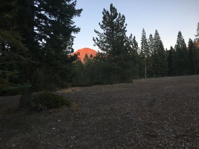
Manzanita Lake Campground, Camping destination at Manzanita Lake, Lassen Volcanic National Park, California.

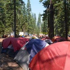
Manzanita Lake Campground is an established camping area with 179 sites situated among forest cover, providing tables, fire rings, and bear-proof storage for all campers. Facilities include flush toilets, hot showers, a small store, and laundry service, with sites designed to accommodate both tents and RVs up to 40 feet long.

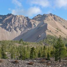
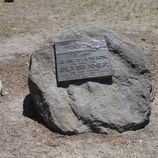
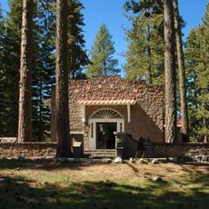
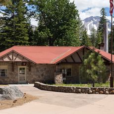
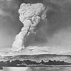
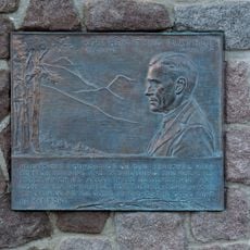
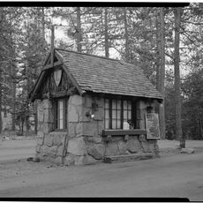
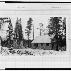
This campground was established during the early period of Lassen Volcanic National Park and sits near the historic Loomis Museum, which documents the area's natural history. The site was developed to provide visitor access to the park's volcanic features during an era when national parks were expanding across the country.

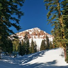
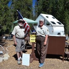
Evening gatherings around fire rings create a sense of community where visitors share meals and stories under the trees. Ranger-led talks during summer highlight the geological forces that shaped this landscape and the indigenous peoples who lived here.

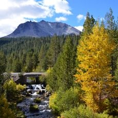
The campground offers sites in wooded areas and along the lake edge, allowing visitors to choose between shade and open views depending on preference. Access to the lake and nearby trails is straightforward, making it easy to plan activities throughout your stay.

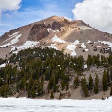
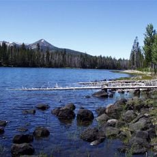
The campground sits at about 5,890 feet elevation, giving campers direct access to fishing for trout and paddling non-motorized boats on the lake from their sites. This setting combines lake recreation with high-altitude camping in one location.

Location: Shasta County

Website: https://nps.gov/lavo/planyourvisit/manzanita-lake-campground.htm

GPS coordinates: 40.52917,-121.56389

Latest update: December 15, 2025 13:24

Photos
Around this place
Lassen Peak
United States of America

Lassen Peak

6.8 km
Mount Tehama
United States of America

Mount Tehama

9.3 km
Geothermal areas in Lassen Volcanic National Park
United States of America

Geothermal areas in Lassen Volcanic National Park

9.5 km
Chaos Crags
United States of America

Chaos Crags

3.7 km
Thousand Lakes Wilderness
United States of America

Thousand Lakes Wilderness

19.1 km
Nobles Emigrant Trail
United States of America

Nobles Emigrant Trail

11.9 km
Loomis Museum
United States of America

Loomis Museum

782 m
Lassen Volcanic National Park Highway Historic District
United States of America

Lassen Volcanic National Park Highway Historic District

5.5 km
Warner Valley Ranger Station
United States of America

Warner Valley Ranger Station

18.2 km
Manzanita Lake Naturalist's Services Historic District
United States of America

Manzanita Lake Naturalist's Services Historic District

786 m
Summit Lake Ranger Station
United States of America

Summit Lake Ranger Station

12.1 km
Hot Rock
United States of America

Hot Rock

6.3 km
Discovery Center
United States of America

Discovery Center

906 m
Sulphur Works
United States of America

Sulphur Works

9.3 km
Loomis Ranger Station
United States of America

Loomis Ranger Station

782 m
Seismograph Building
United States of America

Seismograph Building

805 m
Kohm Yah-mah-nee Visitor Center
United States of America

Kohm Yah-mah-nee Visitor Center

10.5 km
Bumpass Hell
United States of America

Bumpass Hell

9.5 km
Manzanita Ranger Residence
United States of America

Manzanita Ranger Residence

1.1 km
Chaos Jumbles
United States of America

Chaos Jumbles

2.2 km
Lassen Peak Trailhead
United States of America

Lassen Peak Trailhead

7.9 km
Lassen Volcanic Center
United States of America

Lassen Volcanic Center

6.3 km
Mather Plaque in Lassen Volcanic National Park
United States of America

Mather Plaque in Lassen Volcanic National Park

794 m
Hat Creek Culvert
United States of America

Hat Creek Culvert

8.6 km
Summit Lake North Campground
United States of America

Summit Lake North Campground

12.5 km
Manzanita Kiosk
United States of America

Manzanita Kiosk

1.1 km
Lost Creek Group Campground
United States of America

Lost Creek Group Campground

5.3 km
Northwest Entrance Checking Station and Ranger Residence
United States of America

Northwest Entrance Checking Station and Ranger Residence

1.1 km
Show the full map
Reviews

Visited this place? Tap the stars to rate it and share your experience / photos with the community! Try now! You can cancel it anytime.

« Manzanita Lake Campground - Camping destination at Manzanita Lake, Lassen Volcanic National Park, California » is provided by Around Us (aroundus.com). Images and texts are derived from Wikimedia project under a Creative Commons license. You are allowed to copy, distribute, and modify copies of this page, under the conditions set by the license, as long as this note is clearly visible.

Discover hidden gems everywhere you go!

From secret cafés to breathtaking viewpoints, skip the crowded tourist spots and find places that match your style. Our app makes it easy with voice search, smart filtering, route optimization, and insider tips from travelers worldwide. Download now for the complete mobile experience.

Around Us App Screenshot

A unique approach to discovering new places

Le Figaro

All the places worth exploring

France Info

A tailor-made excursion in just a few clicks

20 Minutes