Enable Location

We need your location to show you interesting places around you

Discover nearby places

Find interesting locations and hidden gems around you

Precise directions

Get accurate directions and distances to places

Your location is never shared with other users. It's only used when you tap the location button.

Lake Almanor

Log in to your account

Start exploring — it's free

Trusted by 62,377 travelers worldwide

Continue with Google
Continue with Apple
or

We will send you a code to connect

By continuing, you accept our Terms and Conditions and our Privacy Policy

Check your inbox

We've sent a pincode in your inbox. Please enter the code below.

Lake Almanor

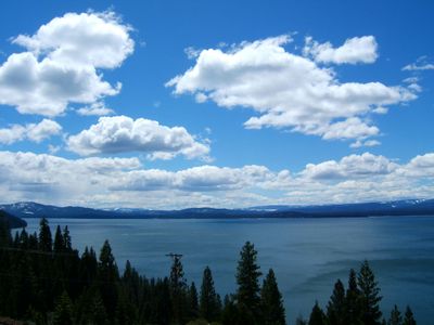
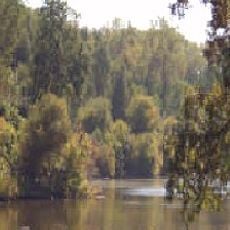
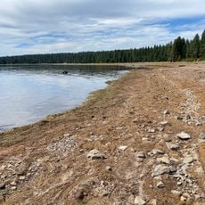
Lake Almanor, Reservoir in Plumas County, California.

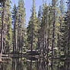
Lake Almanor is a reservoir in Plumas County in northeastern California with views of Lassen Peak and Dyer Mountain. The water surface extends across roughly 111 square kilometers with about 84 kilometers of shoreline.

Great Western Power completed the first dam in 1914 and flooded the North Fork Feather River valley. Yamani Maidu families lost their village and had to leave the area.

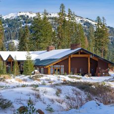
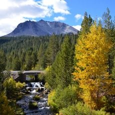
The name combines the first syllables of Alice, Martha, and Eleanor, three daughters of Vice President Guy C. Earl. Today families use the water for swimming and boating, while anglers seek out the shores and coves.

In summer the water warms to about 20 to 21 degrees Celsius (68 to 70 degrees Fahrenheit) and works well for swimming and water sports. The shore areas are easily accessible for swimmers and boaters.

The Almanor Fishing Association runs California's oldest fish-rearing program and releases about 50,000 Eagle Lake Trout into the water each year. The program has been operating for several decades and supports the population in the lake.

The community of curious travelers

AroundUs brings together thousands of curated places, local tips, and hidden gems, enriched daily by 60,000 contributors worldwide.

Start exploring
Location
Elevation above the sea
1,369 m
GPS coordinates
40.25278,-121.16028
Latest update
December 19, 2025 23:07
Around this place
Cinder Cone and the Fantastic Lava Beds
United States of America

Cinder Cone and the Fantastic Lava Beds

35.6 km
Lassen National Forest
United States of America

Lassen National Forest

21.4 km
Geothermal areas in Lassen Volcanic National Park
United States of America

Geothermal areas in Lassen Volcanic National Park

36.9 km
Caribou Wilderness
United States of America

Caribou Wilderness

26.6 km
Bucks Lake Wilderness
United States of America

Bucks Lake Wilderness

33.3 km
Drakesbad Guest Ranch
United States of America

Drakesbad Guest Ranch

29.7 km
Nobles Emigrant Trail
United States of America

Nobles Emigrant Trail

39.7 km
Canyon Dam
United States of America

Canyon Dam

10.7 km
Butte Creek Ecological Reserve
United States of America

Butte Creek Ecological Reserve

28.5 km
Mount Harkness Fire Lookout
United States of America

Mount Harkness Fire Lookout

23.2 km
Tobin Bridges
United States of America

Tobin Bridges

37.6 km
Park Headquarters, Lassen Volcanic National Park
United States of America

Park Headquarters, Lassen Volcanic National Park

39.5 km
Warner Valley Ranger Station
United States of America

Warner Valley Ranger Station

28.2 km
Horseshoe Lake Ranger Station
United States of America

Horseshoe Lake Ranger Station

28.4 km
Summit Lake Ranger Station
United States of America

Summit Lake Ranger Station

35.5 km
Devastated Area Interpretive Trail
United States of America

Devastated Area Interpretive Trail

39 km
Sulphur Works
United States of America

Sulphur Works

38.6 km
Kohm Yah-mah-nee Visitor Center
United States of America

Kohm Yah-mah-nee Visitor Center

37.8 km
Bumpass Hell
United States of America

Bumpass Hell

36.9 km
Lassen Peak Trailhead
United States of America

Lassen Peak Trailhead

38.2 km
Sulphur Works
United States of America

Sulphur Works

38.6 km
Hat Creek Trailhead
United States of America

Hat Creek Trailhead

38.6 km
Kings Creek
United States of America

Kings Creek

25.1 km
Bumpass Hell Trailhead
United States of America

Bumpass Hell Trailhead

38.3 km
Lassen Volcanic Center
United States of America

Lassen Volcanic Center

39.7 km
Catfish Beach
United States of America

Catfish Beach

6.7 km
Hat Creek Culvert
United States of America

Hat Creek Culvert

38.6 km
Devils Kitchen
United States of America

Devils Kitchen

31.4 km
Show the full map
« Lake Almanor - Reservoir in Plumas County, California » is provided by Around Us (aroundus.com). Images and texts are derived from Wikimedia project under a Creative Commons license. You are allowed to copy, distribute, and modify copies of this page, under the conditions set by the license, as long as this note is clearly visible.

Discover hidden gems everywhere you go!

From secret cafés to breathtaking viewpoints, skip the crowded tourist spots and find places that match your style. Our app makes it easy with voice search, smart filtering, route optimization, and insider tips from travelers worldwide. Download now for the complete mobile experience.

Around Us App Screenshot

A unique approach to discovering new places

Le Figaro

All the places worth exploring

France Info

A tailor-made excursion in just a few clicks

20 Minutes

Around Us
Travel Guide & Maps
Download

Send to your phone

QR Code
1

Open the camera app on your mobile.

2

Point at the QR code with your camera. A notification will appear.

3

Tap the notification to open the link.