Canyon Dam

Log in to your account

AroundUs is a community-driven map of interesting places, built by curious explorers like you. It grows with every review, story, and photo you share.
Connect to save your favorite spots, contribute locations, and create personalized routes.
Continue with Google
Continue with Apple
Continue with X
Continue with Facebook
Continue with email
By continuing, you accept our Terms and Conditions and our Privacy Policy
Create an account
Add to collection
Map
Suggest a change
Share

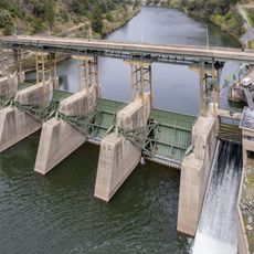
Canyon Dam, Embankment dam in Plumas County, California.

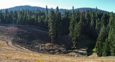
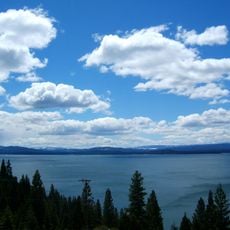
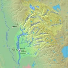
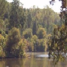
Canyon Dam is an earthen embankment dam that crosses the North Fork Feather River to create Lake Almanor. The structure holds back water that flows through a series of hydroelectric facilities downstream.

The Great Western Power Company built Canyon Dam in 1910 as part of a hydroelectric development project. The design was changed from a stone structure to an earthen embankment before construction began.

The dam represents California's commitment to water management infrastructure, contributing to both agricultural irrigation and power generation in the region.

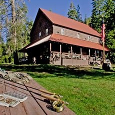
The dam is located in a forested area and accessible by regional roads in northern California. Visitors should be prepared for changing weather and variable conditions in the mountain terrain.

The reservoir feeds water into a cascade of power plants along the river corridor. This series of facilities demonstrates how one dam functions as part of a larger interconnected energy system.

Location: Plumas County

GPS coordinates: 40.17330,-121.09000

Latest update: December 14, 2025 09:46

Photos
Around this place
Lassen Peak
United States of America

Lassen Peak

49.7 km
Lake Almanor
United States of America

Lake Almanor

10.7 km
Mount Tehama
United States of America

Mount Tehama

50.1 km
Cinder Cone and the Fantastic Lava Beds
United States of America

Cinder Cone and the Fantastic Lava Beds

46.1 km
Lassen National Forest
United States of America

Lassen National Forest

28.3 km
Geothermal areas in Lassen Volcanic National Park
United States of America

Geothermal areas in Lassen Volcanic National Park

47.2 km
Caribou Wilderness
United States of America

Caribou Wilderness

36.5 km
Bucks Lake Wilderness
United States of America

Bucks Lake Wilderness

25.5 km
Drakesbad Guest Ranch
United States of America

Drakesbad Guest Ranch

40.2 km
Antelope Dam
United States of America

Antelope Dam

41.1 km
Bucks Lake
United States of America

Bucks Lake

32.7 km
Poe Dam
United States of America

Poe Dam

50 km
Hosselkus Limestone
United States of America

Hosselkus Limestone

33.9 km
Butte Creek Ecological Reserve
United States of America

Butte Creek Ecological Reserve

29.3 km
Mount Harkness Fire Lookout
United States of America

Mount Harkness Fire Lookout

33.9 km
Tobin Bridges
United States of America

Tobin Bridges

32.6 km
Roop's Fort
United States of America

Roop's Fort

45.9 km
Park Headquarters, Lassen Volcanic National Park
United States of America

Park Headquarters, Lassen Volcanic National Park

48.1 km
Warner Valley Ranger Station
United States of America

Warner Valley Ranger Station

38.8 km
Horseshoe Lake Ranger Station
United States of America

Horseshoe Lake Ranger Station

39.1 km
Summit Lake Ranger Station
United States of America

Summit Lake Ranger Station

46.1 km
Lassen County Court House
United States of America

Lassen County Court House

45.3 km
Sulphur Works
United States of America

Sulphur Works

48.7 km
Kohm Yah-mah-nee Visitor Center
United States of America

Kohm Yah-mah-nee Visitor Center

47.8 km
Bumpass Hell
United States of America

Bumpass Hell

47.2 km
Lassen Peak Trailhead
United States of America

Lassen Peak Trailhead

48.6 km
Kings Creek
United States of America

Kings Creek

35.7 km
Summit Lake North Campground
United States of America

Summit Lake North Campground

45.6 km
Show the full map
Reviews

Visited this place? Tap the stars to rate it and share your experience / photos with the community! Try now! You can cancel it anytime.

« Canyon Dam - Embankment dam in Plumas County, California » is provided by Around Us (aroundus.com). Images and texts are derived from Wikimedia project under a Creative Commons license. You are allowed to copy, distribute, and modify copies of this page, under the conditions set by the license, as long as this note is clearly visible.

Discover hidden gems everywhere you go!

From secret cafés to breathtaking viewpoints, skip the crowded tourist spots and find places that match your style. Our app makes it easy with voice search, smart filtering, route optimization, and insider tips from travelers worldwide. Download now for the complete mobile experience.

Around Us App Screenshot

A unique approach to discovering new places

Le Figaro

All the places worth exploring

France Info

A tailor-made excursion in just a few clicks

20 Minutes