Enable Location

We need your location to show you interesting places around you

Discover nearby places

Find interesting locations and hidden gems around you

Precise directions

Get accurate directions and distances to places

Your location is never shared with other users. It's only used when you tap the location button.

Log in to your account

Start exploring — it's free

Trusted by 62,374 travelers worldwide

Continue with Google
Continue with Apple
or

We will send you a code to connect

By continuing, you accept our Terms and Conditions and our Privacy Policy

Check your inbox

We've sent a pincode in your inbox. Please enter the code below.

Bucks Lake

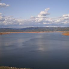
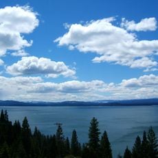
Bucks Lake, reservoir in California

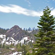
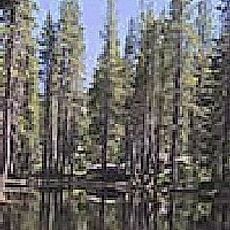
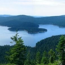
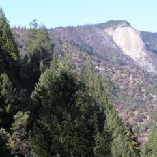
Bucks Lake is a mountain lake in Plumas National Forest in northern California, surrounded by dense forests of pine and cedar trees along rocky slopes. The clear water and green vegetation create a natural setting where bird calls echo and fish swim near the surface.

The area was named after an early settler and developed a long history as a fishing and boating destination. Over decades, it became a popular spot for outdoor adventure and relaxation, with each season bringing its own set of activities for visitors.

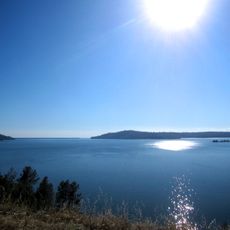
The lake is named after an early settler and serves as a traditional gathering place where people fish and boat throughout the year. Visitors of all kinds have made this area part of their seasonal routines, from summer water activities to winter snowmobile gatherings.

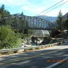
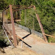
The lake sits about 17 miles from the town of Quincy and is easily reached by car during most of the year. Roads are generally clear from late spring through early fall, though winter snow can close some routes, so it is wise to check conditions before traveling.

The area offers more than 160 kilometers of groomed snowmobile trails in winter, making it a surprisingly popular winter destination. This extensive infrastructure for snow activities draws visitors who might not otherwise consider a mountain lake during colder months.

The community of curious travelers

AroundUs brings together thousands of curated places, local tips, and hidden gems, enriched daily by 60,000 contributors worldwide.

Start exploring
Location
GPS coordinates
39.88472,-121.16167
Latest update
February 9, 2026 08:23
Around this place
Lake Oroville
United States of America

Lake Oroville

43.7 km
Lake Almanor
United States of America

Lake Almanor

41 km
Bidwell Park
United States of America

Bidwell Park

54.3 km
Feather Falls
United States of America

Feather Falls

28.6 km
Phantom Falls
United States of America

Phantom Falls

45.8 km
Bidwell Bar Bridge
United States of America

Bidwell Bar Bridge

43.8 km
Plumas-Eureka State Park
United States of America

Plumas-Eureka State Park

41.3 km
North Table Mountain Ecological Reserve
United States of America

North Table Mountain Ecological Reserve

43.2 km
Bucks Lake Wilderness
United States of America

Bucks Lake Wilderness

7.8 km
Lake Oroville State Recreation Area
United States of America

Lake Oroville State Recreation Area

43.7 km
Oroville Chinese Temple
United States of America

Oroville Chinese Temple

53.6 km
Little Grass Valley Reservoir
United States of America

Little Grass Valley Reservoir

22.7 km
Bald Rock Dome
United States of America

Bald Rock Dome

28.6 km
Poe Dam
United States of America

Poe Dam

24.7 km
Pulga Bridges
United States of America

Pulga Bridges

26.8 km
Clio trestle
United States of America

Clio trestle

52.9 km
Old Bidwell Bar Bridge
United States of America

Old Bidwell Bar Bridge

46.1 km
Hosselkus Limestone
United States of America

Hosselkus Limestone

42.4 km
Chico Community Observatory
United States of America

Chico Community Observatory

54.6 km
Butte Creek Ecological Reserve
United States of America

Butte Creek Ecological Reserve

31.3 km
Tobin Bridges
United States of America

Tobin Bridges

14.4 km
Sierra County Sheriff's Gallows
United States of America

Sierra County Sheriff's Gallows

46.1 km
Oroville Carnegie Library
United States of America

Oroville Carnegie Library

53.6 km
Hospital Bridge
United States of America

Hospital Bridge

45.5 km
Oroville Chinese Temple
United States of America

Oroville Chinese Temple

53.7 km
Oroville State Theatre
United States of America

Oroville State Theatre

53.4 km
Castleberry Covered Bridge
United States of America

Castleberry Covered Bridge

45.2 km
Durgan Bridge
United States of America

Durgan Bridge

46 km
Show the full map
« Bucks Lake - reservoir in California » is provided by Around Us (aroundus.com). Images and texts are derived from Wikimedia project under a Creative Commons license. You are allowed to copy, distribute, and modify copies of this page, under the conditions set by the license, as long as this note is clearly visible.

Discover hidden gems everywhere you go!

From secret cafés to breathtaking viewpoints, skip the crowded tourist spots and find places that match your style. Our app makes it easy with voice search, smart filtering, route optimization, and insider tips from travelers worldwide. Download now for the complete mobile experience.

Around Us App Screenshot

A unique approach to discovering new places

Le Figaro

All the places worth exploring

France Info

A tailor-made excursion in just a few clicks

20 Minutes

Around Us
Travel Guide & Maps
Download

Send to your phone

QR Code
1

Open the camera app on your mobile.

2

Point at the QR code with your camera. A notification will appear.

3

Tap the notification to open the link.