Enable Location

We need your location to show you interesting places around you

Discover nearby places

Find interesting locations and hidden gems around you

Precise directions

Get accurate directions and distances to places

Your location is never shared with other users. It's only used when you tap the location button.

Feather Falls

Log in to your account

Start exploring — it's free

Trusted by 61,396 travelers worldwide

Continue with Google
Continue with Apple
or

We will send you a code to connect

By continuing, you accept our Terms and Conditions and our Privacy Policy

Check your inbox

We've sent a pincode in your inbox. Please enter the code below.

Feather Falls

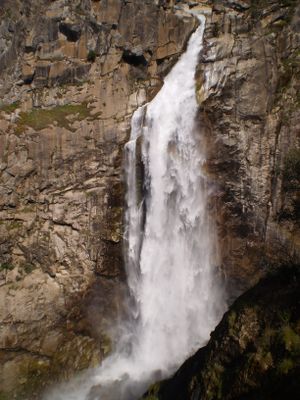
Feather Falls, Waterfall in Plumas National Forest, California, US

Description

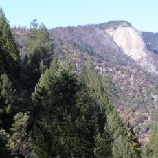
Feather Falls is a waterfall located in Plumas National Forest within the Sierra Nevada range. The water drops over 400 feet in a nearly vertical column, creating a powerful cascade that can be heard from some distance away.

History

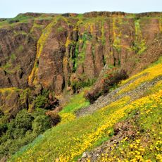
The area was long used by the Maidu Native Americans who lived in and traveled through these mountains. In the 1900s, trails and viewing platforms were developed to make the waterfall accessible to visitors.

Culture

The surrounding land holds significance for the Maidu Native American community, who maintained a connection to this territory for generations.

Practical

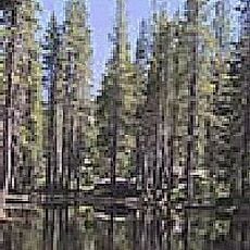
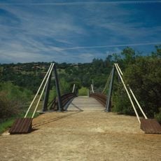
Two hiking routes reach the waterfall area: a steeper path and a more gradual one, each taking a few hours to complete. Sturdy hiking boots and plenty of water are important for either trail, as the terrain can be rocky and the sun exposure significant.

Did you know?

Nearby Frey Creek becomes a winter congregation spot for millions of ladybugs that migrate there from November through March. This unusual gathering is one of the largest ladybug aggregations found anywhere in North America.

GPS coordinates
39.64297,-121.27439
Latest update
December 9, 2025 18:43

AroundUs brings together thousands of curated places, local tips, and hidden gems, enriched daily by 60,000 contributors worldwide. Discover all places nearby (United States of America).

Around this place
Lake Oroville
United States of America

Lake Oroville

17.9 km
New Bullards Bar Reservoir
United States of America

New Bullards Bar Reservoir

30.1 km
New Bullards Bar Dam
United States of America

New Bullards Bar Dam

30 km
South Yuba River State Park
United States of America

South Yuba River State Park

39.6 km
Bridgeport Covered Bridge
United States of America

Bridgeport Covered Bridge

39.6 km
Phantom Falls
United States of America

Phantom Falls

24.8 km
Bidwell Bar Bridge
United States of America

Bidwell Bar Bridge

16.9 km
North Table Mountain Ecological Reserve
United States of America

North Table Mountain Ecological Reserve

23.6 km
Englebright Lake
United States of America

Englebright Lake

44.8 km
Bucks Lake Wilderness
United States of America

Bucks Lake Wilderness

35.7 km
Lake Oroville State Recreation Area
United States of America

Lake Oroville State Recreation Area

17.9 km
Oroville Chinese Temple
United States of America

Oroville Chinese Temple

28.5 km
Little Grass Valley Reservoir
United States of America

Little Grass Valley Reservoir

26.2 km
Bald Rock Dome
United States of America

Bald Rock Dome

3.4 km
Bucks Lake
United States of America

Bucks Lake

28.6 km
Poe Dam
United States of America

Poe Dam

23 km
Oregon Creek Covered Bridge
United States of America

Oregon Creek Covered Bridge

32 km
Pulga Bridges
United States of America

Pulga Bridges

22.7 km
Old Bidwell Bar Bridge
United States of America

Old Bidwell Bar Bridge

19.4 km
Tobin Bridges
United States of America

Tobin Bridges

32.9 km
Sierra County Sheriff's Gallows
United States of America

Sierra County Sheriff's Gallows

39.3 km
Oroville Carnegie Library
United States of America

Oroville Carnegie Library

28.4 km
Hospital Bridge
United States of America

Hospital Bridge

39.6 km
Oroville Chinese Temple
United States of America

Oroville Chinese Temple

28.6 km
Oroville State Theatre
United States of America

Oroville State Theatre

28.1 km
Purdon Crossing Bridge
United States of America

Purdon Crossing Bridge

40.2 km
Castleberry Covered Bridge
United States of America

Castleberry Covered Bridge

22.6 km
Freeman's Crossing Bridge
United States of America

Freeman's Crossing Bridge

32.1 km
Show the full map
Reviews

Real people, real opinions — but not verified.

Visited this place? Tap the stars to rate it and share your experience / photos with the community! Try now! You can cancel it anytime.

sochabrison
@sochabrison

Oct 18, 2025 07:23

So beautiful—breathtaking and captivating... a place to get to and want to stay.

« Feather Falls - Waterfall in Plumas National Forest, California, US » is provided by Around Us (aroundus.com). Images and texts are derived from Wikimedia project under a Creative Commons license. You are allowed to copy, distribute, and modify copies of this page, under the conditions set by the license, as long as this note is clearly visible.

Discover hidden gems everywhere you go!

From secret cafés to breathtaking viewpoints, skip the crowded tourist spots and find places that match your style. Our app makes it easy with voice search, smart filtering, route optimization, and insider tips from travelers worldwide. Download now for the complete mobile experience.

Around Us App Screenshot

A unique approach to discovering new places

Le Figaro

All the places worth exploring

France Info

A tailor-made excursion in just a few clicks

20 Minutes

Around Us
Travel Guide & Maps
Download

Send to your phone

QR Code
1

Open the camera app on your mobile.

2

Point at the QR code with your camera. A notification will appear.

3

Tap the notification to open the link.