Enable Location

We need your location to show you interesting places around you

Discover nearby places

Find interesting locations and hidden gems around you

Precise directions

Get accurate directions and distances to places

Your location is never shared with other users. It's only used when you tap the location button.

Lake Oroville State Recreation Area

Log in to your account

Start exploring — it's free

Trusted by 62,625 travelers worldwide

Continue with Google
Continue with Apple
or

We will send you a code to connect

By continuing, you accept our Terms and Conditions and our Privacy Policy

Check your inbox

We've sent a pincode in your inbox. Please enter the code below.

Lake Oroville State Recreation Area

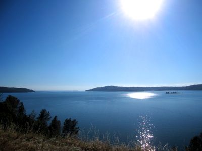
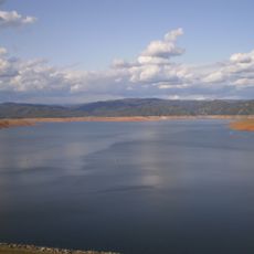
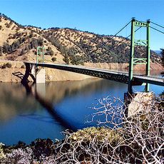
Lake Oroville State Recreation Area, State recreation area in Butte County, United States

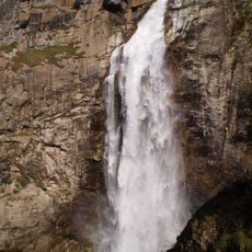
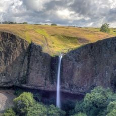
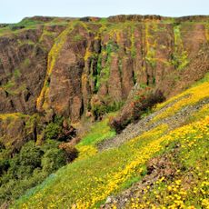
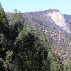
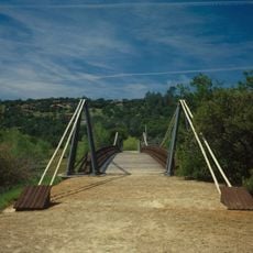
Lake Oroville State Recreation Area is a large reservoir surrounded by rolling hills and protected land in northern California. The shoreline features multiple access points, sandy coves, and natural areas suitable for different kinds of outdoor visits.

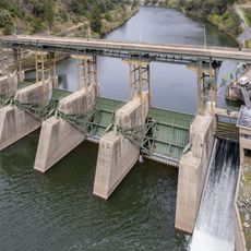
The Oroville Dam was completed in the 1960s to create a major water storage and power generation facility. The area was subsequently developed as a public recreation area with various amenities for visitors.

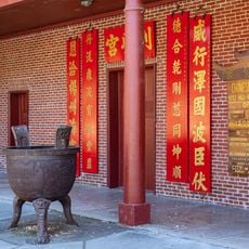
The Lake Oroville Visitor Center exhibits information about regional hydropower facilities and displays the heritage of native populations through educational presentations.

The area has multiple marinas with boat launches, camping, and picnic facilities at different shoreline points. Most visitor areas are accessible with clear signage for independent exploration.

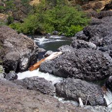
Lake Oroville maintains both warm-water and cold-water fish populations, including Chinook salmon, spotted bass, sturgeon, and rainbow trout.

The community of curious travelers

AroundUs brings together thousands of curated places, local tips, and hidden gems, enriched daily by 60,000 contributors worldwide.

Start exploring
Location
GPS coordinates
39.56360,-121.45600
Latest update
December 11, 2025 11:08
Around this place
Lake Oroville
United States of America

Lake Oroville

0 m
Bidwell Park
United States of America

Bidwell Park

36 km
New Bullards Bar Reservoir
United States of America

New Bullards Bar Reservoir

33.1 km
Bidwell Mansion State Historic Park
United States of America

Bidwell Mansion State Historic Park

39 km
New Bullards Bar Dam
United States of America

New Bullards Bar Dam

32.9 km
South Yuba River State Park
United States of America

South Yuba River State Park

37.6 km
Bridgeport Covered Bridge
United States of America

Bridgeport Covered Bridge

37.6 km
Feather Falls
United States of America

Feather Falls

17.9 km
Phantom Falls
United States of America

Phantom Falls

10.4 km
Bidwell Bar Bridge
United States of America

Bidwell Bar Bridge

2.7 km
North Table Mountain Ecological Reserve
United States of America

North Table Mountain Ecological Reserve

11.4 km
Oroville Chinese Temple
United States of America

Oroville Chinese Temple

10.6 km
Bald Rock Dome
United States of America

Bald Rock Dome

16 km
Poe Dam
United States of America

Poe Dam

27.4 km
Oregon Creek Covered Bridge
United States of America

Oregon Creek Covered Bridge

37.1 km
Pulga Bridges
United States of America

Pulga Bridges

25.7 km
Old Bidwell Bar Bridge
United States of America

Old Bidwell Bar Bridge

2.9 km
Chico Community Observatory
United States of America

Chico Community Observatory

36.3 km
Live Oak Historic Commercial District
United States of America

Live Oak Historic Commercial District

36.6 km
A. H. Chapman House
United States of America

A. H. Chapman House

36.8 km
Silberstein Park Building
United States of America

Silberstein Park Building

37.6 km
Museum of Northern California Art
United States of America

Museum of Northern California Art

38.5 km
Oroville Carnegie Library
United States of America

Oroville Carnegie Library

10.5 km
Oroville Chinese Temple
United States of America

Oroville Chinese Temple

10.7 km
Oroville State Theatre
United States of America

Oroville State Theatre

10.2 km
Senator Theatre
United States of America

Senator Theatre

37.5 km
Castleberry Covered Bridge
United States of America

Castleberry Covered Bridge

7.2 km
Freeman's Crossing Bridge
United States of America

Freeman's Crossing Bridge

37.1 km
Show the full map
« Lake Oroville State Recreation Area - State recreation area in Butte County, United States » is provided by Around Us (aroundus.com). Images and texts are derived from Wikimedia project under a Creative Commons license. You are allowed to copy, distribute, and modify copies of this page, under the conditions set by the license, as long as this note is clearly visible.

Discover hidden gems everywhere you go!

From secret cafés to breathtaking viewpoints, skip the crowded tourist spots and find places that match your style. Our app makes it easy with voice search, smart filtering, route optimization, and insider tips from travelers worldwide. Download now for the complete mobile experience.

Around Us App Screenshot

A unique approach to discovering new places

Le Figaro

All the places worth exploring

France Info

A tailor-made excursion in just a few clicks

20 Minutes

Around Us
Travel Guide & Maps
Download

Send to your phone

QR Code
1

Open the camera app on your mobile.

2

Point at the QR code with your camera. A notification will appear.

3

Tap the notification to open the link.