Enable Location

We need your location to show you interesting places around you

Discover nearby places

Find interesting locations and hidden gems around you

Precise directions

Get accurate directions and distances to places

Your location is never shared with other users. It's only used when you tap the location button.

Butte County

Log in to your account

Start exploring — it's free

Trusted by travelers worldwide

Continue with Google
Continue with Apple
or

We will send you a code to connect

By continuing, you accept our Terms and Conditions and our Privacy Policy

Check your inbox

We've sent a pincode in your inbox. Please enter the code below.

Butte County, Administrative county in Northern California, United States

Description

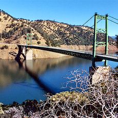
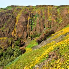
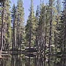
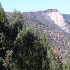
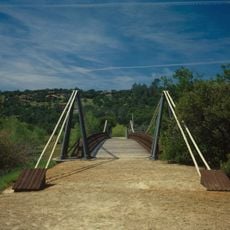
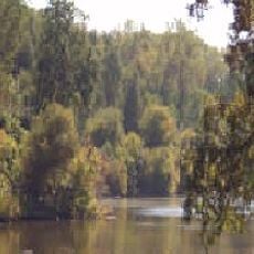
Butte County is an administrative district in north-central California, stretching from the foothills of the Sierra Nevada to the broad valleys along the Sacramento River. The area includes forested zones in the higher elevations, agricultural plains and several small communities alongside the larger towns of Chico and Oroville.

History

The district was created in February 1850 in the first months after California became a US state. In the following years many settlers arrived because of gold deposits and later for farming opportunities in the region.

Culture

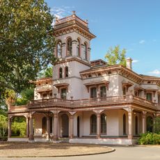
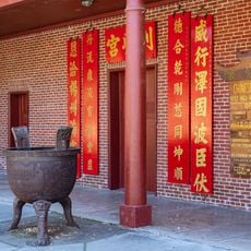
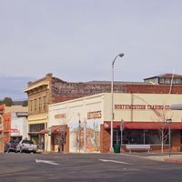
The name comes from the Sutter Buttes in the neighboring district, while the landscape itself is shaped by orchards and rice fields. In the smaller towns you can still see architecture from the California Gold Rush era, with low wooden houses and wide streets.

Practical

The public bus network connects the different communities in the district, with Chico serving as the largest hub. Visitors heading to the higher mountain areas should check road conditions in winter, as some routes close during snow.

Did you know?

The local libraries lend camping gear, telescopes and other equipment alongside books through a special program called Library of Things. The rural branches in particular offer access to tools and leisure items that not everyone can afford to buy.

Location
Inception
1850
Capital city
Oroville
Shares border with
Tehama County, Sutter County, Yuba County, Colusa County, Glenn County, Plumas County
GPS coordinates
39.66000,-121.60000
Latest update
December 13, 2025 15:42

AroundUs brings together thousands of curated places, local tips, and hidden gems, enriched daily by 60,000 contributors worldwide. Discover all places nearby (California).

Around this place
Oroville Dam
United States of America

Oroville Dam

16.7 km
Lake Oroville
United States of America

Lake Oroville

16.4 km
Bidwell Park
United States of America

Bidwell Park

19.6 km
New Bullards Bar Reservoir
United States of America

New Bullards Bar Reservoir

49.4 km
Bidwell Mansion State Historic Park
United States of America

Bidwell Mansion State Historic Park

23.1 km
Abbey of New Clairvaux
United States of America

Abbey of New Clairvaux

49.9 km
New Bullards Bar Dam
United States of America

New Bullards Bar Dam

49.2 km
Ishi Wilderness
United States of America

Ishi Wilderness

54.5 km
Feather Falls
United States of America

Feather Falls

28 km
Phantom Falls
United States of America

Phantom Falls

6.5 km
Bidwell Bar Bridge
United States of America

Bidwell Bar Bridge

19 km
North Table Mountain Ecological Reserve
United States of America

North Table Mountain Ecological Reserve

5 km
Bucks Lake Wilderness
United States of America

Bucks Lake Wilderness

48.9 km
Lake Oroville State Recreation Area
United States of America

Lake Oroville State Recreation Area

16.4 km
Oroville Chinese Temple
United States of America

Oroville Chinese Temple

16.6 km
Sacramento River National Wildlife Refuge
United States of America

Sacramento River National Wildlife Refuge

30.8 km
United States of America

Bidwell-Sacramento River State Park

35.8 km
Bald Rock Dome
United States of America

Bald Rock Dome

24.8 km
Bucks Lake
United States of America

Bucks Lake

45.1 km
Poe Dam
United States of America

Poe Dam

21.9 km
Chico Air Museum
United States of America

Chico Air Museum

27.3 km
Oregon Creek Covered Bridge
United States of America

Oregon Creek Covered Bridge

53.3 km
Pulga Bridges
United States of America

Pulga Bridges

19.6 km
Old Bidwell Bar Bridge
United States of America

Old Bidwell Bar Bridge

18.5 km
Gianella Bridge
United States of America

Gianella Bridge

35.4 km
Chico Community Observatory
United States of America

Chico Community Observatory

20 km
Butte Creek Ecological Reserve
United States of America

Butte Creek Ecological Reserve

50.2 km
United States of America

North Fork Bridge

12.8 km
Show the full map
Administrative divisions
« Butte County - Administrative county in Northern California, United States » is provided by Around Us (aroundus.com). Images and texts are derived from Wikimedia project under a Creative Commons license. You are allowed to copy, distribute, and modify copies of this page, under the conditions set by the license, as long as this note is clearly visible.

Discover hidden gems everywhere you go!

From secret cafés to breathtaking viewpoints, skip the crowded tourist spots and find places that match your style. Our app makes it easy with voice search, smart filtering, route optimization, and insider tips from travelers worldwide. Download now for the complete mobile experience.

Around Us App Screenshot

A unique approach to discovering new places

Le Figaro

All the places worth exploring

France Info

A tailor-made excursion in just a few clicks

20 Minutes

Around Us
Travel Guide & Maps
Download

Send to your phone

QR Code
1

Open the camera app on your mobile.

2

Point at the QR code with your camera. A notification will appear.

3

Tap the notification to open the link.