Oroville Dam

Log in to your account

AroundUs is a community-driven map of interesting places, built by curious explorers like you. It grows with every review, story, and photo you share.
Connect to save your favorite spots, contribute locations, and create personalized routes.
By continuing, you accept our Terms and Conditions and our Privacy Policy
Add to collection
Map
Suggest a change
Share

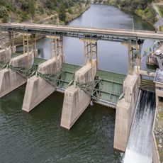
Oroville Dam, Embankment dam in Butte County, United States.

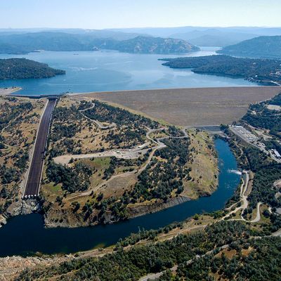
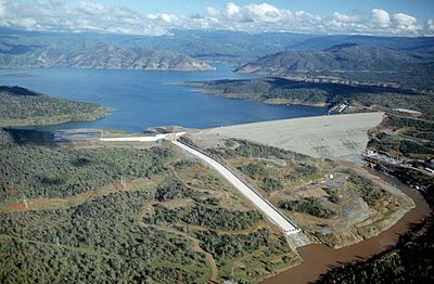
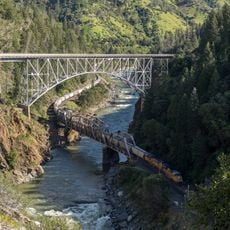
Oroville Dam stretches 2109 meters (about 6900 feet) across the canyon of the Feather River, forming Lake Oroville in Northern California. The structure consists of a tall earthfill embankment, spillways and an underground powerhouse at the base.

Construction began in 1961 under the California Department of Water Resources and finished in 1968 as part of a statewide water project. The facility underwent extensive repairs in 2017 after heavy rainfall damaged the main spillway.

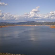
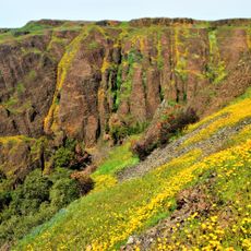
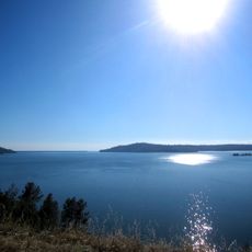
The name Oroville references the Spanish word for gold, pointing to the mid-19th-century rush that brought thousands of prospectors to this region. Today visitors and residents use the reservoir for fishing and boating throughout the warm months.

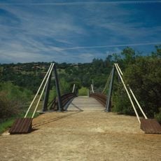
Viewing areas along the roadway offer views of the structure, while the reservoir itself has multiple access points for recreation. Parking and information stations are available at several locations around the water.

The spillway damage in February 2017 prompted the evacuation of about 188000 people from downstream communities, the largest such action in California history. Repairs continued into 2019 and involved completely rebuilding both spillway channels.

Location: Butte County

Inception: 1961

Official opening: 1968

Length: 2,109 m

Website: http://water.ca.gov/Programs/State-Water-Project/SWP-Facilities/Oroville

GPS coordinates: 39.53890,-121.48600

Latest update: December 4, 2025 23:03

Around this place
Show the full map
Lake Oroville
United States of America

Lake Oroville

3.8 km
Bidwell Park
United States of America

Bidwell Park

35.9 km
New Bullards Bar Reservoir
United States of America

New Bullards Bar Reservoir

33.9 km
New Bullards Bar Dam
United States of America

New Bullards Bar Dam

33.6 km
South Yuba River State Park
United States of America

South Yuba River State Park

37.1 km
Bridgeport Covered Bridge
United States of America

Bridgeport Covered Bridge

37.1 km
Feather Falls
United States of America

Feather Falls

21.5 km
Phantom Falls
United States of America

Phantom Falls

10.2 km
Bidwell Bar Bridge
United States of America

Bidwell Bar Bridge

5 km
North Table Mountain Ecological Reserve
United States of America

North Table Mountain Ecological Reserve

12.1 km
Lake Oroville State Recreation Area
United States of America

Lake Oroville State Recreation Area

3.8 km
Oroville Chinese Temple
United States of America

Oroville Chinese Temple

7 km
Bald Rock Dome
United States of America

Bald Rock Dome

19.8 km
Poe Dam
United States of America

Poe Dam

30.5 km
Pulga Bridges
United States of America

Pulga Bridges

28.6 km
Old Bidwell Bar Bridge
United States of America

Old Bidwell Bar Bridge

2.7 km
Chico Community Observatory
United States of America

Chico Community Observatory

36.3 km
Live Oak Historic Commercial District
United States of America

Live Oak Historic Commercial District

33 km
A. H. Chapman House
United States of America

A. H. Chapman House

36.1 km
Silberstein Park Building
United States of America

Silberstein Park Building

36.9 km
Collins Lake Beach
United States of America

Collins Lake Beach

26.8 km
Museum of Northern California Art
United States of America

Museum of Northern California Art

37.8 km
Oroville Carnegie Library
United States of America

Oroville Carnegie Library

6.9 km
Arboreto de la Universidad de California Campus de Chico
United States of America

Arboreto de la Universidad de California Campus de Chico

37.8 km
Oroville Chinese Temple
United States of America

Oroville Chinese Temple

7.1 km
Oroville State Theatre
United States of America

Oroville State Theatre

6.6 km
Beatson Falls
United States of America

Beatson Falls

10 km
Senator Theatre
United States of America

Senator Theatre

36.8 km
Show the full map

Reviews

Real people, real opinions — but not verified.

Visited this place? Tap the stars to rate it and share your experience / photos with the community! Try now! You can cancel it anytime.

sochabrison
@sochabrison

Oct 18, 2025 07:16

A beautiful place to explore and take your walks and regress. My children loved the experience of walking the dam for the first time.

« Oroville Dam - Embankment dam in Butte County, United States » is provided by Around Us (aroundus.com). Images and texts are derived from Wikimedia project under a Creative Commons license. You are allowed to copy, distribute, and modify copies of this page, under the conditions set by the license, as long as this note is clearly visible.

Discover hidden gems everywhere you go!

From secret cafés to breathtaking viewpoints, skip the crowded tourist spots and find places that match your style. Our app makes it easy with voice search, smart filtering, route optimization, and insider tips from travelers worldwide. Download now for the complete mobile experience.

Around Us App Screenshot

A unique approach to discovering new places

Le Figaro

All the places worth exploring

France Info

A tailor-made excursion in just a few clicks

20 Minutes