Enable Location

We need your location to show you interesting places around you

Discover nearby places

Find interesting locations and hidden gems around you

Precise directions

Get accurate directions and distances to places

Your location is never shared with other users. It's only used when you tap the location button.

Bald Rock Dome

Log in to your account

Start exploring — it's free

Trusted by 61,397 travelers worldwide

Continue with Google
Continue with Apple
or

We will send you a code to connect

By continuing, you accept our Terms and Conditions and our Privacy Policy

Check your inbox

We've sent a pincode in your inbox. Please enter the code below.

Bald Rock Dome

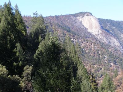
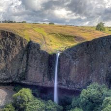
Bald Rock Dome, Granite summit in Plumas National Forest, California.

Description

Bald Rock Dome is a granite summit in Plumas National Forest, rising nearly 3,500 feet above sea level with an 800-foot vertical rock face. Multiple climbing routes of varying difficulty cover the main wall and surrounding sections.

History

Indigenous Maidu people used this location long before modern settlement and left marks of their presence. Grinding holes and mortar depressions carved into the rock show where they processed food from local plants.

Culture

The rock draws climbers from across the region who practice different skill levels on its faces. Local climbing traditions developed over decades as the site became known among the community.

Practical

The approach requires navigation via Forest Service roads from nearby Oroville, so having a current map helps. Nearby camping areas exist, though visitors should follow national forest regulations for any overnight stays.

Did you know?

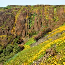
Several natural crevasses and rock pockets break up the surface and create unexpected obstacles while climbing. From the summit, the view stretches across the Sacramento Valley toward California's coastal mountain chains.

Location
GPS coordinates
39.65433,-121.31080
Latest update
December 12, 2025 12:02

AroundUs brings together thousands of curated places, local tips, and hidden gems, enriched daily by 60,000 contributors worldwide. Discover all places nearby (California).

Around this place
Lake Oroville
United States of America

Lake Oroville

16 km
Bidwell Park
United States of America

Bidwell Park

42.1 km
New Bullards Bar Reservoir
United States of America

New Bullards Bar Reservoir

32.6 km
New Bullards Bar Dam
United States of America

New Bullards Bar Dam

32.4 km
South Yuba River State Park
United States of America

South Yuba River State Park

41.5 km
Bridgeport Covered Bridge
United States of America

Bridgeport Covered Bridge

41.5 km
Feather Falls
United States of America

Feather Falls

3.4 km
Phantom Falls
United States of America

Phantom Falls

22 km
Bidwell Bar Bridge
United States of America

Bidwell Bar Bridge

15.5 km
North Table Mountain Ecological Reserve
United States of America

North Table Mountain Ecological Reserve

20.6 km
Bucks Lake Wilderness
United States of America

Bucks Lake Wilderness

35.3 km
Lake Oroville State Recreation Area
United States of America

Lake Oroville State Recreation Area

16 km
Oroville Chinese Temple
United States of America

Oroville Chinese Temple

26.6 km
Little Grass Valley Reservoir
United States of America

Little Grass Valley Reservoir

28.7 km
Bucks Lake
United States of America

Bucks Lake

28.6 km
Poe Dam
United States of America

Poe Dam

20.2 km
Oregon Creek Covered Bridge
United States of America

Oregon Creek Covered Bridge

34.7 km
Pulga Bridges
United States of America

Pulga Bridges

19.7 km
Old Bidwell Bar Bridge
United States of America

Old Bidwell Bar Bridge

17.9 km
Chico Community Observatory
United States of America

Chico Community Observatory

42.5 km
Tobin Bridges
United States of America

Tobin Bridges

31.4 km
Collins Lake Beach
United States of America

Collins Lake Beach

35.7 km
Oroville Carnegie Library
United States of America

Oroville Carnegie Library

26.5 km
Oroville Chinese Temple
United States of America

Oroville Chinese Temple

26.6 km
Oroville State Theatre
United States of America

Oroville State Theatre

26.2 km
Beatson Falls
United States of America

Beatson Falls

24.2 km
Castleberry Covered Bridge
United States of America

Castleberry Covered Bridge

19.9 km
Freeman's Crossing Bridge
United States of America

Freeman's Crossing Bridge

34.9 km
Show the full map
« Bald Rock Dome - Granite summit in Plumas National Forest, California » is provided by Around Us (aroundus.com). Images and texts are derived from Wikimedia project under a Creative Commons license. You are allowed to copy, distribute, and modify copies of this page, under the conditions set by the license, as long as this note is clearly visible.

Discover hidden gems everywhere you go!

From secret cafés to breathtaking viewpoints, skip the crowded tourist spots and find places that match your style. Our app makes it easy with voice search, smart filtering, route optimization, and insider tips from travelers worldwide. Download now for the complete mobile experience.

Around Us App Screenshot

A unique approach to discovering new places

Le Figaro

All the places worth exploring

France Info

A tailor-made excursion in just a few clicks

20 Minutes

Around Us
Travel Guide & Maps
Download

Send to your phone

QR Code
1

Open the camera app on your mobile.

2

Point at the QR code with your camera. A notification will appear.

3

Tap the notification to open the link.