Enable Location

We need your location to show you interesting places around you

Discover nearby places

Find interesting locations and hidden gems around you

Precise directions

Get accurate directions and distances to places

Your location is never shared with other users. It's only used when you tap the location button.

Antelope Dam

Log in to your account

Start exploring — it's free

Trusted by 62,371 travelers worldwide

Continue with Google
Continue with Apple
or

We will send you a code to connect

By continuing, you accept our Terms and Conditions and our Privacy Policy

Check your inbox

We've sent a pincode in your inbox. Please enter the code below.

Antelope Dam

Antelope Dam, Embankment dam in Plumas County, California, United States.

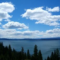
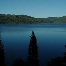
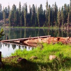
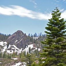
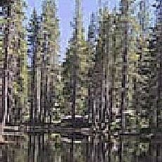
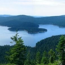
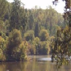
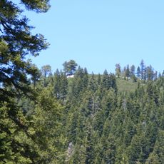
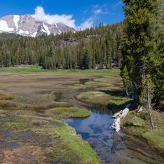
Antelope Dam is an embankment dam that crosses Indian Creek, creating a reservoir surrounded by forest in the Sierra Nevada foothills. The water body stretches across a wide valley with rocky slopes and tree-covered ridges.

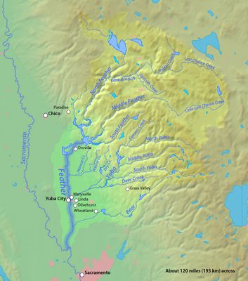
The dam was completed in 1964 to manage water flow in the Feather River watershed. Its construction was part of a larger effort to control water supplies across the region.

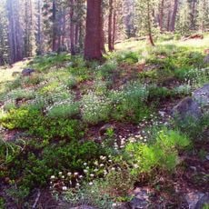
Native American tribes of the region maintained connections to the land surrounding Antelope Dam through traditional practices of resource gathering and subsistence.

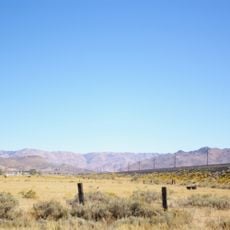
The reservoir is accessed by driving through Plumas National Forest via local roads that require some travel time from the nearest town. Visit during warmer months for more comfortable conditions in this higher elevation area.

The lake is a destination for anglers seeking rainbow and brook trout that thrive in its cool waters. Few visitors realize how consistent the fishing quality remains throughout the year at this location.

The community of curious travelers

AroundUs brings together thousands of curated places, local tips, and hidden gems, enriched daily by 60,000 contributors worldwide.

Start exploring
Location
GPS coordinates
40.18130,-120.60700
Latest update
December 12, 2025 14:27
Around this place
Lake Almanor
United States of America

Lake Almanor

47.7 km
Plumas National Forest
United States of America

Plumas National Forest

36 km
Cinder Cone and the Fantastic Lava Beds
United States of America

Cinder Cone and the Fantastic Lava Beds

73 km
Lassen National Forest
United States of America

Lassen National Forest

46.5 km
Western Pacific Railroad Museum
United States of America

Western Pacific Railroad Museum

43.5 km
Beckwourth Pass
United States of America

Beckwourth Pass

60.8 km
Plumas-Eureka State Park
United States of America

Plumas-Eureka State Park

47.5 km
Caribou Wilderness
United States of America

Caribou Wilderness

61.5 km
Bucks Lake Wilderness
United States of America

Bucks Lake Wilderness

54.7 km
Drakesbad Guest Ranch
United States of America

Drakesbad Guest Ranch

73.7 km
Little Grass Valley Reservoir
United States of America

Little Grass Valley Reservoir

60 km
United States of America

Bucks Lake

57.7 km
Canyon Dam
United States of America

Canyon Dam

41.1 km
Clio trestle
United States of America

Clio trestle

47.7 km
Hosselkus Limestone
United States of America

Hosselkus Limestone

16.6 km
Butte Creek Ecological Reserve
United States of America

Butte Creek Ecological Reserve

69.6 km
Mount Harkness Fire Lookout
United States of America

Mount Harkness Fire Lookout

65.2 km
Tobin Bridges
United States of America

Tobin Bridges

66.3 km
Roop's Fort
United States of America

Roop's Fort

26.8 km
Sierra County Sheriff's Gallows
United States of America

Sierra County Sheriff's Gallows

71.9 km
Warner Valley Ranger Station
United States of America

Warner Valley Ranger Station

71.9 km
Schroeder Mountain
United States of America

Schroeder Mountain

62 km
Horseshoe Lake Ranger Station
United States of America

Horseshoe Lake Ranger Station

69.4 km
Hospital Bridge
United States of America

Hospital Bridge

70.5 km
Standish Hall
United States of America

Standish Hall

25.8 km
Lassen County Court House
United States of America

Lassen County Court House

26.6 km
Kings Creek
United States of America

Kings Creek

68.6 km
Durgan Bridge
United States of America

Durgan Bridge

71.8 km
Show the full map
« Antelope Dam - Embankment dam in Plumas County, California, United States » is provided by Around Us (aroundus.com). Images and texts are derived from Wikimedia project under a Creative Commons license. You are allowed to copy, distribute, and modify copies of this page, under the conditions set by the license, as long as this note is clearly visible.

Discover hidden gems everywhere you go!

From secret cafés to breathtaking viewpoints, skip the crowded tourist spots and find places that match your style. Our app makes it easy with voice search, smart filtering, route optimization, and insider tips from travelers worldwide. Download now for the complete mobile experience.

Around Us App Screenshot

A unique approach to discovering new places

Le Figaro

All the places worth exploring

France Info

A tailor-made excursion in just a few clicks

20 Minutes

Around Us
Travel Guide & Maps
Download

Send to your phone

QR Code
1

Open the camera app on your mobile.

2

Point at the QR code with your camera. A notification will appear.

3

Tap the notification to open the link.