Enable Location

We need your location to show you interesting places around you

Discover nearby places

Find interesting locations and hidden gems around you

Precise directions

Get accurate directions and distances to places

Your location is never shared with other users. It's only used when you tap the location button.

Plumas National Forest

Log in to your account

Start exploring — it's free

Trusted by 62,372 travelers worldwide

Continue with Google
Continue with Apple
or

We will send you a code to connect

By continuing, you accept our Terms and Conditions and our Privacy Policy

Check your inbox

We've sent a pincode in your inbox. Please enter the code below.

Plumas National Forest

Plumas National Forest, National forest in northeastern California, United States

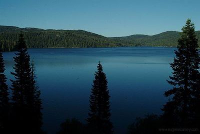
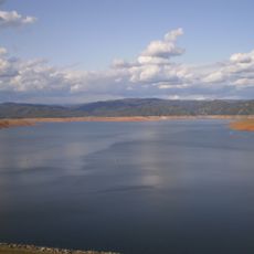
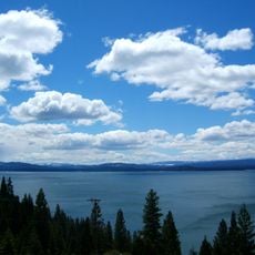
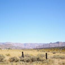
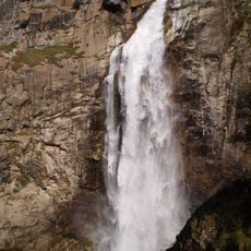
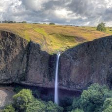
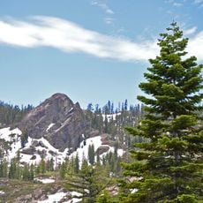
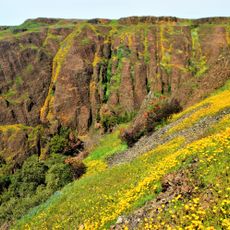
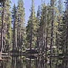
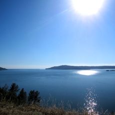
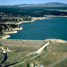
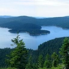
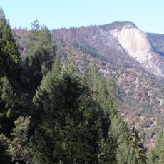
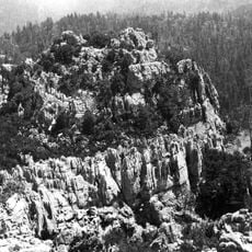
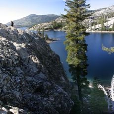
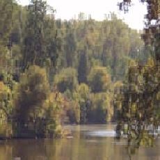
Plumas National Forest spreads across mountains, meadows, and lakes throughout the Sierra Nevada range, featuring multiple forest types and natural habitats. The landscape includes alpine lakes, clear streams, and dense conifer forests that roll across gentle and steep slopes.

The United States government created the Plumas Forest Reserve in 1905 and transferred it to the Forest Service two years later. This shift marked part of a broader effort to protect forests across the country.

The forest land held deep meaning for the Maidu and Washoe peoples, who hunted, gathered, and carried out their traditional ways of life across these grounds. These connections remain visible today in place names and in how people move through and use the forest.

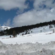
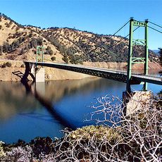
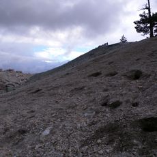
The area offers a large network of trails with different difficulty levels, from short walks to multi-day backpacking routes. Visitor centers provide maps and information to help plan your visit, and the best time to go is from June to September when higher elevation paths are free of snow.

Foresters have found that this region holds older mixed-conifer forests with Douglas-fir and Sierra White Fir trees that have stood for many generations. These older forests create a different feel than younger stands and influence how water, wildlife, and fungi interact across the landscape.

The community of curious travelers

AroundUs brings together thousands of curated places, local tips, and hidden gems, enriched daily by 60,000 contributors worldwide.

Start exploring
Operator
United States Forest Service
GPS coordinates
39.89729,-120.40546
Latest update
December 7, 2025 20:20
Around this place
Lake Oroville
United States of America

Lake Oroville

97.3 km
Lake Almanor
United States of America

Lake Almanor

75.5 km
Tahoe National Forest
United States of America

Tahoe National Forest

50.2 km
New Bullards Bar Reservoir
United States of America

New Bullards Bar Reservoir

84.4 km
Western Pacific Railroad Museum
United States of America

Western Pacific Railroad Museum

12 km
New Bullards Bar Dam
United States of America

New Bullards Bar Dam

84.5 km
Beckwourth Pass
United States of America

Beckwourth Pass

28 km
Feather Falls
United States of America

Feather Falls

79.6 km
Phantom Falls
United States of America

Phantom Falls

103.9 km
Bidwell Bar Bridge
United States of America

Bidwell Bar Bridge

95.9 km
Plumas-Eureka State Park
United States of America

Plumas-Eureka State Park

29.9 km
North Table Mountain Ecological Reserve
United States of America

North Table Mountain Ecological Reserve

102.2 km
Bucks Lake Wilderness
United States of America

Bucks Lake Wilderness

66.1 km
Lake Oroville State Recreation Area
United States of America

Lake Oroville State Recreation Area

97.3 km
Boca Reservoir
United States of America

Boca Reservoir

62.4 km
Crystal Peak
United States of America

Crystal Peak

46.5 km
Oroville Chinese Temple
United States of America

Oroville Chinese Temple

107.8 km
Little Grass Valley Reservoir
United States of America

Little Grass Valley Reservoir

53.4 km
Bald Rock Dome
United States of America

Bald Rock Dome

82 km
United States of America

Bucks Lake

64.6 km
Poe Dam
United States of America

Poe Dam

88.4 km
Oregon Creek Covered Bridge
United States of America

Oregon Creek Covered Bridge

80.4 km
Pulga Bridges
United States of America

Pulga Bridges

90.2 km
Clio trestle
United States of America

Clio trestle

21.1 km
Old Bidwell Bar Bridge
United States of America

Old Bidwell Bar Bridge

98.3 km
Hosselkus Limestone
United States of America

Hosselkus Limestone

32.4 km
French Lake Reservoir
United States of America

French Lake Reservoir

54.3 km
Butte Creek Ecological Reserve
United States of America

Butte Creek Ecological Reserve

88.8 km
Show the full map
« Plumas National Forest - National forest in northeastern California, United States » is provided by Around Us (aroundus.com). Images and texts are derived from Wikimedia project under a Creative Commons license. You are allowed to copy, distribute, and modify copies of this page, under the conditions set by the license, as long as this note is clearly visible.

Discover hidden gems everywhere you go!

From secret cafés to breathtaking viewpoints, skip the crowded tourist spots and find places that match your style. Our app makes it easy with voice search, smart filtering, route optimization, and insider tips from travelers worldwide. Download now for the complete mobile experience.

Around Us App Screenshot

A unique approach to discovering new places

Le Figaro

All the places worth exploring

France Info

A tailor-made excursion in just a few clicks

20 Minutes

Around Us
Travel Guide & Maps
Download

Send to your phone

QR Code
1

Open the camera app on your mobile.

2

Point at the QR code with your camera. A notification will appear.

3

Tap the notification to open the link.