Seismograph

Log in to your account

AroundUs is a community-driven map of interesting places, built by curious explorers like you. It grows with every review, story, and photo you share.
Connect to save your favorite spots, contribute locations, and create personalized routes.
By continuing, you accept our Terms and Conditions and our Privacy Policy
Add to collection
Map
Suggest a change
Share

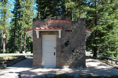
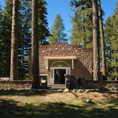
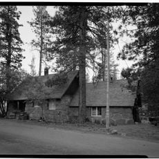
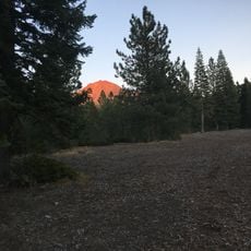
Seismograph, Seismic monitoring station in Shasta County, United States.

The Seismograph in Shasta County is a monitoring facility that continuously measures and records ground movements across the region. The station uses specialized instruments to detect vibrations and detect shifts in the earth beneath the area.

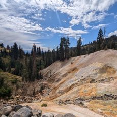
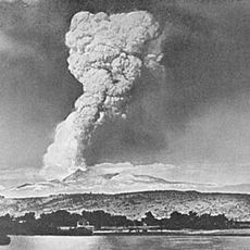
The station was established to systematically monitor the frequent seismic activity in Northern California. It has contributed to a regional network that tracks ground movements related to the movement of tectonic plates.

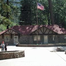
The station serves as an educational center where visitors learn about tectonic plate movements and their effects on California's geological formations.

The site is accessible during daylight hours, allowing visitors to observe the monitoring equipment and how it functions up close. The best time to visit is in the morning when the air is clear and the instruments are easy to see.

The station transmits its measurement data in real time to authorities, helping experts respond quickly to earthquakes. This immediate data sharing makes the facility a vital hub in the statewide monitoring network.

Location: Shasta County

GPS coordinates: 40.53638,-121.56276

Latest update: December 9, 2025 20:29

Photos
Around this place
Show the full map
Lassen Peak
United States of America

Lassen Peak

7.3 km
Mount Tehama
United States of America

Mount Tehama

10.1 km
Geothermal areas in Lassen Volcanic National Park
United States of America

Geothermal areas in Lassen Volcanic National Park

10.1 km
Chaos Crags
United States of America

Chaos Crags

3.8 km
Nobles Emigrant Trail
United States of America

Nobles Emigrant Trail

11.7 km
Loomis Museum
United States of America

Loomis Museum

36 m
Lassen Volcanic National Park Highway Historic District
United States of America

Lassen Volcanic National Park Highway Historic District

6 km
Manzanita Lake Naturalist's Services Historic District
United States of America

Manzanita Lake Naturalist's Services Historic District

54 m
Summit Lake Ranger Station
United States of America

Summit Lake Ranger Station

12.2 km
Hot Rock
United States of America

Hot Rock

6.1 km
Devastated Area Interpretive Trail
United States of America

Devastated Area Interpretive Trail

8.6 km
Discovery Center
United States of America

Discovery Center

100 m
Sulphur Works
United States of America

Sulphur Works

10 km
Loomis Ranger Station
United States of America

Loomis Ranger Station

51 m
Seismograph Building
United States of America

Seismograph Building

3 m
Kohm Yah-mah-nee Visitor Center
United States of America

Kohm Yah-mah-nee Visitor Center

11.2 km
Bumpass Hell
United States of America

Bumpass Hell

10.1 km
Manzanita Ranger Residence
United States of America

Manzanita Ranger Residence

708 m
Lassen Peak Trailhead
United States of America

Lassen Peak Trailhead

8.5 km
Chaos Jumbles
United States of America

Chaos Jumbles

1.8 km
Sulphur Works
United States of America

Sulphur Works

10 km
Lassen Volcanic Center
United States of America

Lassen Volcanic Center

6.8 km
Mather Plaque in Lassen Volcanic National Park
United States of America

Mather Plaque in Lassen Volcanic National Park

24 m
Manzanita Kiosk
United States of America

Manzanita Kiosk

698 m
Lost Creek Group Campground
United States of America

Lost Creek Group Campground

4.8 km
Hat Creek Culvert
United States of America

Hat Creek Culvert

8.7 km
Summit Lake North Campground
United States of America

Summit Lake North Campground

12.6 km
Manzanita Lake Campground
United States of America

Manzanita Lake Campground

808 m
Show the full map
Reviews

Visited this place? Tap the stars to rate it and share your experience / photos with the community! Try now! You can cancel it anytime.

« Seismograph - Seismic monitoring station in Shasta County, United States » is provided by Around Us (aroundus.com). Images and texts are derived from Wikimedia project under a Creative Commons license. You are allowed to copy, distribute, and modify copies of this page, under the conditions set by the license, as long as this note is clearly visible.

Discover hidden gems everywhere you go!

From secret cafés to breathtaking viewpoints, skip the crowded tourist spots and find places that match your style. Our app makes it easy with voice search, smart filtering, route optimization, and insider tips from travelers worldwide. Download now for the complete mobile experience.

Around Us App Screenshot

A unique approach to discovering new places

Le Figaro

All the places worth exploring

France Info

A tailor-made excursion in just a few clicks

20 Minutes